The National Geologic Map Database is migrating to a new infrastructure. We apologize for any service disruptions during this process.
|
|---|


- Usage in publication:
-
- Warley Hill marl, phase
- Modifications:
-
- Named
- Dominant lithology:
-
- Marl
- AAPG geologic province:
-
- Atlantic Coast basin
Summary:
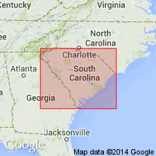
Warley Hill marl (new name) [part of Warley Hill phase] occurs as a fine-grained argillaceous yellow-green marl at base of Shell Bluff, at Kennedy's scarp on Tinkers Creek, and along South Fork of the Edisto. Unit is exposed in its more typical form at Caw Caw Swamp, and at the type locality at Warley Hill. Also observed slightly north of Weeks Landing, and at Cave Hill and Poplar Creek. It is occurs approximately at water level of Edisto River from Tuckers Bridge (near Branchville) to Sullivan's Bridge (about 14 mi north of Jacksonboro). Its seeming equivalent is also observed underlying Santee marl in bed of Lower Three Runs, at Usserys Bluff (Barnwell Co.). Typically consists of highly glauconitic harsh marls.
Source: GNU records (USGS DDS-6; Reston GNULEX).
- Usage in publication:
-
- Warley Hill marl
- Modifications:
-
- Named
- AAPG geologic province:
-
- Atlantic Coast basin
Summary:
Warley Hill phase of earlier reports is here divided into Upper or Warley Hill marl and Lower or Caw Caw shales and marls. The Lower Warley Hill formation lithologically represents a transition from Congaree shales [below] to later marls and comprises both shales and marls, often intergrading. Faunally they are distinctly characterized by first appearance of OSTREA SELLAEFORMIS in South Carolina and by abundant association of PTEROPSIS LAPIDOSA. Succeeding a coarse glauconitic sand, a pea-green clay, now in the form of a slightly laminated shale, occupied the shoal areas, while pale yellow-green and gray marls formed in the deeper waters, and intergraded with the shale along their dividing zone. In some areas an irregular deposit of yellow to gray marls extended over the basal pea-green shales, but along the shoal areas renewed silting covered this broken bed of marl with a very fossiliferous pale yellow-green shale, in which casts of a large VENERICARDIA PLANICOSTA, PTEROPSIS LAPIDOSA, OSTREA SELLAEFORMIS are found. At Kennedy's Scarp on Tinkers Creek this pea-green shale encloses a matted mass of soft shells at base of the scarp. Some erosion, solution, or other degradation of the top shales of Lower Warley Hill phase occurred preliminary to deposition of Upper Warley Hill series. At some localities the Upper Warley Hill is represented by a bed of dark-gray, slightly glauconitic, fine-grained laminated shale. It is coarser grained near its base and includes rounded gravel. Its greatest thickness is approximately 24 feet. The most extensive area of Upper Warley Hill phase exposes the characteristic Warley Hill glauconitic marl, which at Warley Hill may be seen resting on the slightly irregular surface of Lower Warley Hill series. It is exposed along Santee Valley as far down as Pinckney's Landing, and along Edisto River from Branchville to Sullivan's Bridge. Its greatest observed thickness does not exceed 25 feet. The Warley Hill marl is of a dirty gray-green color, compact, hard, and very harsh to the touch. The latter feature is accentuated by the large angular grains of glauconite. At one locality small semispherical crystals of wavellite appear to have been derived from the weathered glauconitic mass.
Source: GNU records (USGS DDS-6; Reston GNULEX).

- Usage in publication:
-
- Warley Hill Formation
- Modifications:
-
- Geochronologic dating
- AAPG geologic province:
-
- Atlantic Coast basin
Summary:
The Warley Hill Formation is middle middle Eocene based on Rb-Sr isochron date of 41.6+/-1.5 Ma from glauconitic micas at the stratotype. This agrees with assignment to calcareous nannofossil zone NP15. An average conventional K-Ar date of 45.1+/-1.7 Ma is considered to approximate the time of sediment deposition.
Source: GNU records (USGS DDS-6; Reston GNULEX).

- Usage in publication:
-
- Warley Hill Formation
- Modifications:
-
- Overview
- AAPG geologic province:
-
- Atlantic Coast basin
Summary:
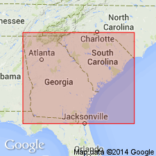
Authors include the Huber, Congaree, Warley Hill and McBean Formations in the Orangeburg Group. The middle middle Eocene Warley Hill Formation correlates with the lower part of the Lisbon Formation in AL. Unit is composed of quartzose and glauconitic sand, glauconite silt, with minor muscovite, traces of heavy minerals, and minor to moderate interstitial clay. Where present, is a distinctive green marker bed separating the Congaree and McBean Formation. Unit crops out in northeastern, north-central, and western Calhoun and northwestern Orangeburg Cos. and crops out below the Orangeburg Scarp at the type section. Unit is very thin (0.7 m) along the western edge of the St. Matthews 15-min. quad and is up to 6 m thick in eastern Calhoun Co.
Source: GNU records (USGS DDS-6; Reston GNULEX).
- Usage in publication:
-
- Warley Hill Formation
- Modifications:
-
- Overview
- AAPG geologic province:
-
- Atlantic Coast basin
Summary:
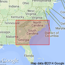
Warley Hill Formation at the Savannah River site in Barnwell Co., SC, is a fine to medium, poorly to well-sorted quartz sand and muddy quartz sand, glauconitic in places and a few inches to about 15 ft thick. Absent in the northwestern part of the study area. Unconformably(?) overlies Congaree Formation in many cores in the central part of the site and underlies the Santee Limestone. Assigned to zone NP 15 based on dinoflagellate assemblages. Correlates with the middle Eocene (middle Claibornian) Lisbon Formation of the Gulf Coast. Shallow marine environments suggested by dinoflagellates and glauconite.
Source: GNU records (USGS DDS-6; Reston GNULEX).
- Usage in publication:
-
- Warley Hill Formation*
- Modifications:
-
- Overview
- AAPG geologic province:
-
- Atlantic Coast basin
Summary:
The Warley Hill of the study area is correlated with sequence 1 of the Castle Hayne Limestone in North Carolina and the lower Lisbon Formation of Alabama. Age-diagnostic barnacles in the sequence at the Savannah River Site establish this correlation with upper middle Eocene units.
Source: GNU records (USGS DDS-6; Reston GNULEX).
- Usage in publication:
-
- Warley Hill Formation
- Modifications:
-
- Overview
- AAPG geologic province:
-
- Atlantic Coast basin
Summary:
Warley Hill underlies the Tinker Formation (new name), originally named the Tinker Creek Formation by Fallaw and Price, 1992b. The Tinker is gradational with the Santee Limestone and the Blue Bluff unit in the Savannah River Site area. Warley Hill is correlated with the base of the Lisbon Formation of the Gulf Coast.
Source: GNU records (USGS DDS-6; Reston GNULEX).
For more information, please contact Nancy Stamm, Geologic Names Committee Secretary.
Asterisk (*) indicates published by U.S. Geological Survey authors.
"No current usage" (†) implies that a name has been abandoned or has fallen into disuse. Former usage and, if known, replacement name given in parentheses ( ).
Slash (/) indicates name conflicts with nomenclatural guidelines (CSN, 1933; ACSN, 1961, 1970; NACSN, 1983, 2005, 2021). May be explained within brackets ([ ]).