- Usage in publication:
-
- Wando clays and sands
- Modifications:
-
- Named
- Dominant lithology:
-
- Clay
- Sand
- AAPG geologic province:
-
- Atlantic Coast basin
Summary:
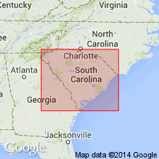
Wando clays and sands of southern SC, here named, described as white sands and a layer of drab clay (frequently stained red). Successively overlie Accabee gravels. This sequence is established at Corn Hill, above Accabee Flats, on the Ashley, and elsewhere. It occurs most extensively developed along Foster's Creek and Wando River. The base of the drab clay, along its upper limits on the Cooper, attains elevation of 50 ft (MLT), which declines to low-tide level at Dean Hall, and is exhibited near tide level along Foster's Creek and Goose Creek, from which area it probably sweeps around by Accabee Flats, on the Ashley, and proceeds irregularly to the southwest, while from the Cooper exposures it extends northeasterly. The clay formation is generally missing, but the Wando sands are widely distributed. They are characterized by abundant enclosure of fine black particles, as may be observed at Simmons' Bluff and at base of the bluff along southerly side of Wappoo Cut. Wando is a marine Pleistocene formation. . [C.W. Cooke, in a 1935 communication to the Geologic Names Committee, described the Wando clays and sands as facies of the Pamlico formation, and so the name was abandoned.]
Source: GNU records (USGS DDS-6; Reston GNULEX).

- Usage in publication:
-
- Wando Formation*
- Modifications:
-
- Reinstated
- Principal reference
- Revised
- Reference
- AAPG geologic province:
-
- Atlantic Coast basin
Summary:
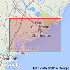
Wando Clays and Sands of Sloan (1908) are here adopted and redefined as Wando Formation. Composite type section designated in sand pit east of Charleston. The best natural exposures are the reference sections at Simmons Bluff, Yonges Island (Wadmalaw Island 7.5-min quad, 32 deg 41'40" N., 80 deg 13'40" W., 30 km southwest of Charleston, and the Bailey Creek cliff on the south end of Scanawah Island (Edisto Island 7.5-min quad., 32 deg 33'30" N, 80 deg 21'45" W, about 45 km southwest of Charleston). The type section and reference sections consist of several meters of shelly sands and muds overlain by several meters of unfossiliferous well-sorted sand. Unit consists elsewhere of a variety of sediment types that represent several depositional environments that may be grouped into barrier, back barrier, and fluvial facies. The "red-weathering gray clay and overlying sand along the Ashley River and Foster Creek" referred to by Sloan as Wando are probably older than the age proposed in this paper for the Wando. The name "Wando Bar" has been used by Kaldor (1971 and 1969) for a sand ridge that predates the Wando Formation as described in this report. Term has not been used elsewhere in the literature and its use should be formally abandoned. Wando Formation unconformably overlies Cooper Formation or Santee Limestone; underlies Holocene eolian deposits. Includes deposits formerly included in Pamlico, "Princess Anne," and "Silver Bluff." Age is latest Pleistocene.
Source: GNU records (USGS DDS-6; Reston GNULEX).

- Usage in publication:
-
- Wando Formation
- Modifications:
-
- Overview
- AAPG geologic province:
-
- Atlantic Coast basin
Summary:
Wando Formation divided into upper and lower units equivalent to (respectively) Princess Anne and Pamlico terraces of Colquhoun.
Source: GNU records (USGS DDS-6; Reston GNULEX).

- Usage in publication:
-
- Wando Formation
- Modifications:
-
- Areal extent
- AAPG geologic province:
-
- Atlantic Coast basin
Summary:
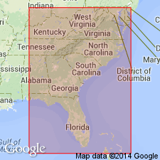
Wando Formation is the youngest Pleistocene unit of the SC coastal region. Isotopic ages average 100 ka. Includes deposits cropping out at maximum elevations between 6 and 9 m above sea level. Barrier and backbarrier facies form most of the unit. South of Charleston, SC, unit has a complex outcrop pattern. Over a width of 40 km, it occurs in low-lying areas of Socastee outcrop and as "islands" surrounded by Holocene deposits. Outcrop belt narrows northward and is absent north of Winyah Bay where the Socastee Formation is the coastal unit. Near Cape Fear, unit is restricted to a narrow barrier deposit. May correlate with Core Creek sand of Mixon and Pilkey (1976) in northeastern NC. Also tentatively correlated with the Lynnhaven Member of the Tabb Formation of Johnson and Peebles (1986).
Source: GNU records (USGS DDS-6; Reston GNULEX).
For more information, please contact Nancy Stamm, Geologic Names Committee Secretary.
Asterisk (*) indicates published by U.S. Geological Survey authors.
"No current usage" (†) implies that a name has been abandoned or has fallen into disuse. Former usage and, if known, replacement name given in parentheses ( ).
Slash (/) indicates name conflicts with nomenclatural guidelines (CSN, 1933; ACSN, 1961, 1970; NACSN, 1983, 2005, 2021). May be explained within brackets ([ ]).

