- Usage in publication:
-
- Walworth Formation
- Modifications:
-
- Principal reference
- Dominant lithology:
-
- Till
- Sand
- Gravel
- AAPG geologic province:
-
- Wisconsin arch
Summary:
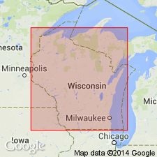
Pg. 4 (table 1); App., p. A1-3 to A1-4. Walworth Formation. Occurs in southern Wisconsin and northern Illinois. Consists of gray to brown sandy till, and associated sand and gravel deposits. Thickness ranges from a few meters to 80 m. Subdivided into the lower, clayey Foxhollow Member (new), the middle, sandy Allens Grove Member (new) [=Argyle Till Member of Winnebago Formation in Illinois], and the upper, sandier Clinton Member (new). Unconformably overlies pre-Pleistocene rocks. Is the surface unit in western Walworth and eastern Rock Counties, Wisconsin. Underlies Capron Member of Zenda Formation (new) in eastern Walworth County [=Capron Till Member of Winnebago Formation in Illinois], contact is sharp. To north underlies Horicon Formation (new). Age is Pleistocene (early Wisconsinan or older).
Type section (outcrop and subsurface; =Clinton Member type section): roadcut and test hole along Highway 15 (Beloit-Milwaukee Road), 2 mi (3.2 km) northeast of Clinton, in NE/4 SW/4 sec. 3, T. 1 N., R. 14 E., [approx. Lat. 42 deg. 34 min. 20 sec. N., Long. 88 deg. 49 min. 37 sec. W.], Clinton 7.5-min quadrangle, Rock Co., southern WI.
Named from Walworth Co., southeastern WI; name credited to David M. Mickelson.
Reference sections = type and reference sections of constituent members, Foxhollow, Allens Grove, and Clinton.
[Additional locality information from Syverson and others, 2011, Wisconsin lexicon of Pleistocene units, Wisconsin Geol. Nat. Hist. Survey Tech. Rpt., no. 1; supplemented from USGS historical topographic map collection TopoView, accessed on June 9, 2018.]
Source: Publication; US geologic names lexicon (USGS Bull. 1565, p. 342-343).
For more information, please contact Nancy Stamm, Geologic Names Committee Secretary.
Asterisk (*) indicates published by U.S. Geological Survey authors.
"No current usage" (†) implies that a name has been abandoned or has fallen into disuse. Former usage and, if known, replacement name given in parentheses ( ).
Slash (/) indicates name conflicts with nomenclatural guidelines (CSN, 1933; ACSN, 1961, 1970; NACSN, 1983, 2005, 2021). May be explained within brackets ([ ]).

