

- Usage in publication:
-
- Walnut clay
- Modifications:
-
- Overview
- AAPG geologic province:
-
- South Oklahoma folded belt
Summary:
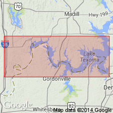
Is basal formation in Fredericksburg group in South Oklahoma folded belt province. Overlies Antlers formation; underlies Goodland formation. Measured section in SE1/4 sec 31, T6S, R2E, Love Co, OK with 1.4 ft of Walnut noted to have been included in upper part of Paluxy formation by Vanderpool (1933); and 2.2 ft considered transitional to typical Goodland lithology and termed the Walnut Shaly member of the Goodland by Stephenson (1919). Second measured section near Denison, Grayson Co, TX. Described and illustrated are Early Cretaceous Fredericksburgian (Albian) foraminifers from outcrops. Brief historical review of nomenclature. On basis of large number of species of foraminifers common to this horizon and Goodland formation, Walnut is included in Fredericksburg division, rather than Trinity. Material considered here represents only the marginal sandy clay facies of the Walnut at its northern area of outcrop; to the south in the more marly facies the faunules are noted to be richer in variety. Depositional environment interpreted to represent Scott's (1940, p. 1167-1168) littoral or epineritic zones indicating deposition in less than 20 fathoms.
Source: GNU records (USGS DDS-6; Denver GNULEX).
- Usage in publication:
-
- Walnut Clay*
- Modifications:
-
- Mapped 1:62.5k
- Dominant lithology:
-
- Clay
- AAPG geologic province:
-
- Permian basin
Summary:
Is formation mapped in eastern Brewster County, Texas, along Rio Grande, in Permian basin. Mapped undivided with Comanche Peak Limestone. Map unit described as medium-gray, poorly bedded limestone and clayey limestone, very finely crystalline, in upper part medium- to coarse-grained clastic limestone; very fossiliferous; weathers nodular, light-gray with light yellowish-gray mottling. Exposed along Rio Grande. About 60 feet thick. Overlies Maxon Limestone; underlies Edwards Limestone. Age is Early Cretaceous.
Source: GNU records (USGS DDS-6; Denver GNULEX).

- Usage in publication:
-
- Walnut Formation
- Modifications:
-
- Mapped 1:250k
- AAPG geologic province:
-
- Bend arch
- Permian basin
- Strawn basin
Summary:
Pamphlet [p. 2]. Walnut Formation. Limestone and claystone interbedded. Limestone, in upper part argillaceous, nodular, thin to medium bedded, iron stained, burrowed; in lower part fine to coarse grained, hard, in part nodular, ripple marked on bedding surfaces in eastern Erath County, light brown, gray, white. Claystone, calcareous, limestone nodules in upper part, sandy in lower part, light brown to gray. Megafossils include EXOGYRA, GRYPHAEA, other pelecypods, echinoids, mods of gastropods, OXYTROPIDOCERAS abundant near middle in Erath and Callahan Counties. Thickness 100 to 140 feet, thickens eastward, cannot be distinguished from Comanche Peak Limestone west of Callahan County. Age is Early Cretaceous.
Source: Publication.
- Usage in publication:
-
- Walnut Clay
- Modifications:
-
- Mapped 1:250k
- Dominant lithology:
-
- Clay
- Limestone
- AAPG geologic province:
-
- Fort Worth syncline
- Ouachita folded belt
- Strawn basin
Summary:
Walnut Clay. Clay and limestone about equally abundant. Limestone, aphanitic; in part bioclastic, GRYPHAEA-bearing, beds 0.1 to 1 foot thick; in part nodular, grades laterally into either resistant, bench-forming, GRYPHAEA-bearing limestone or calcareous clay; medium- to dark-gray, weathers yellowish brown. Clay, fossiliferous, calcareous, olive brown, weathers yellowish brown. Thickness 30+/- feet. Lies above Paluxy Formation. South of Hood-Parker County line, lies below Comanche Peak Limestone; north of Hood-Parker County line, lies below Goodland Limestone. Age is Early Cretaceous.
[Mapped in Bosque, Erath, Hill, Hood, Johnson, Parker, Somervell, Tarrant, and Wise Cos., eastern TX.]
Source: Publication.

- Usage in publication:
-
- Walnut Clay
- Modifications:
-
- Areal extent
- Dominant lithology:
-
- Shale
- AAPG geologic province:
-
- Fort Worth syncline
- South Oklahoma folded belt
Summary:
Pamphlet [p. 6]. Goodland Limestone and Walnut Clay, [undifferentiated]. Map unit is mostly Goodland Limestone, fine-grained, well-indurated, massive, nodular toward base, grades downward to Walnut Clay, interbedded coquinite and dark-gray, marly shale. Thickness of Goodland Limestone and Walnut Clay, [undifferentiated] in Texas 13 to 20 feet, 20 to 25 feet thick in Oklahoma. Lies above Paluxy Sand and below Kiamichi Formation. Age is Early Cretaceous.
[Mapped in mostly continuous exposures in northern part and in western half of map sheet; in Cooke, Denton, Grayson, Montague, and Wise Cos., central northern TX, and Love and Marshall Cos., southeastern OK.]
Source: Publication.

- Usage in publication:
-
- Walnut Formation
- Modifications:
-
- Mapped 1:250k
- Dominant lithology:
-
- Shale
- Limestone
- Sandstone
- AAPG geologic province:
-
- Permian basin
Summary:
Is Lower Cretaceous formation mapped undivided with other Lower Cretaceous formations in several small scattered areas in this map sheet (northeastern Permian basin). Mapped with Edwards Limestone and Comanche Peak Limestone (above), and Antlers Sand (below) on east peak of Double Mountain, in southwest Stonewall County, Texas, and on hill about 11.5 miles south-southwest of Clairemont, Kent County, Texas. Mapped with overlying Comanche Peak Limestone and underlying Antlers Sand in Yellow House Canyon about 3.5 miles northeast of Posey, Lubbock County, Texas; along upper reaches of Double Mountain Fork Brazos River, southwest of Post, Texas; and on west peak of Double Mountain. Described as interbedded shale, limestone, and sandstone. Shale, sandy in part, thin-bedded, light- to dark-gray, grayish-yellow. Limestone, sandy, argillaceous, nodular, light-gray, yellowish-gray, grayish-yellow. Sandstone, fine- to medium-grained, indistinctly bedded, moderately indurated, grayish-yellow to yellowish-brown, orange. Marine megafossils. Maximum thickness 25+/- feet.
Source: GNU records (USGS DDS-6; Denver GNULEX).
For more information, please contact Nancy Stamm, Geologic Names Committee Secretary.
Asterisk (*) indicates published by U.S. Geological Survey authors.
"No current usage" (†) implies that a name has been abandoned or has fallen into disuse. Former usage and, if known, replacement name given in parentheses ( ).
Slash (/) indicates name conflicts with nomenclatural guidelines (CSN, 1933; ACSN, 1961, 1970; NACSN, 1983, 2005, 2021). May be explained within brackets ([ ]).