- Usage in publication:
-
- Wallpack Center Member*
- Modifications:
-
- Named
- Dominant lithology:
-
- Sandstone
- Conglomerate
- Limestone
- Shale
- Dolomite
- AAPG geologic province:
-
- Appalachian basin
Summary:
Pg. 2 (fig. 1), 10-11, 51-55, pl. 1. Herein proposed that (1) name Decker Formation (=Decker Ferry Formation of Weller, 1900, New Jersey Geol. Survey Ann. Rpt. State Geol. 1899, p. 7; [also Weller, 1903, New Jersey Geol. Survey Rpt. on Paleo., v. 3]) be applied to strata lying between Bossardville Limestone and Rondout Formation in northeastern Pennsylvania and New Jersey, (2) the calcareous facies northeast of Hainesville area, New Jersey, be designated Clove Brook Member, and (3) the arenaceous facies southwest of Hainesville area be designated Wallpack Center Member. The Wallpack Center consists of medium-dark- to medium-light-gray generally fine-grained calcareous sandstone that weathers yellowish-gray to grayish-orange, lenses of calcareous quartz-pebble conglomerate, fine- to coarse-grained calcareous sandstone, calcareous siltstone, fine- to coarse-grained arenaceous limestone, medium-dark-gray calcareous shale, and dark-gray to medium-dark-gray very fine-grained dolomite. Thickness 81.8 feet at type section, 80 feet near Haney's Mill, New Jersey, 54 feet near Tocks Island, New Jersey, and 85 feet south of Croasdale quarry, about 0.8 mile southwest of Minisink Hills, Pennsylvania. Underlies Duttonville Member (new) of Rondout Formation; contact is abrupt and is placed at top of first arenaceous limestone or calcareous sandstone found downward in the section. Overlies Bossardville Limestone; contact is gradational through an interval as much as 18 feet thick. Northeast of type section, grades into and is replaced by Clove Brook Member. Brachiopods, corals, and ostracodes present in the limestone beds (Weller, 1903); the conglomerate and sandstone beds contain poorly preserved fossils. Age is Late Silurian. Report includes measured sections. (Wallpack Center Member of Decker Formation adopted by the USGS.)
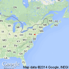
Type section: 1 mi northeast of Wallpack Center, NJ, on southeast slope of Wallpack Ridge, along western edge of Culvers Gap 7.5-min quadrangle, in Sussex Co., NJ. Named from the village of Wallpack Center.
Source: Publication; US geologic names lexicon (USGS Bull. 1350, p. 805); GNU records (USGS DDS-6; Reston GNULEX); Changes in stratigraphic nomenclature, 1967 (USGS Bull. 1274-A, p. A20).
For more information, please contact Nancy Stamm, Geologic Names Committee Secretary.
Asterisk (*) indicates published by U.S. Geological Survey authors.
"No current usage" (†) implies that a name has been abandoned or has fallen into disuse. Former usage and, if known, replacement name given in parentheses ( ).
Slash (/) indicates name conflicts with nomenclatural guidelines (CSN, 1933; ACSN, 1961, 1970; NACSN, 1983, 2005, 2021). May be explained within brackets ([ ]).

