- Usage in publication:
-
- Walker formation
- Modifications:
-
- Original reference
- Dominant lithology:
-
- Sandstone
- Shale
- AAPG geologic province:
-
- San Joaquin basin
Summary:
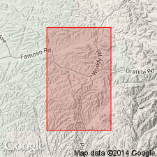
Pg. 9, pl. 1. Walker formation. A series of land-laid beds, consisting of sands and shales of characteristic greenish color. The formation changes rapidly in type from bed to bed and may be considered to be formed from variable proportions of 2 types of constituents: (1) granitic, including widespread unsorted angular quartz grains and white decomposed feldspar grains, large biotite flakes, and dark-green and red opaque clays; (2) volcanic, including white clays and ashy materials, and shales, also green soapy clays which form the matrix for fragmentary granitic debris. The formation has widespread distribution in area and is characteristically continental in origin. Its deposition represents first stage of erosion of old granitic land mass to east. Only 3 wells have penetrated this formation, the thicknesses encountered being 370, 555, and 594 feet. Unconformably underlies Temblor formation (middle Miocene) and rests unconformably on granitic basement.
[Origin of name not stated; no indication of age or whether or not exposed. Present in Kern Co., southern CA.]
Source: US geologic names lexicon (USGS Bull. 896, p. 2266).
- Usage in publication:
-
- Walker formation
- Modifications:
-
- Revised
- AAPG geologic province:
-
- San Joaquin basin
Summary:
Pg. 5-10. Walker formation. Is lower member of Temblor group; is probably lower Miocene and may be = Vaqueros formation. Thickness 0 to 1,200 feet; average 700+/- feet. Unconformably underlies Temblor formation and rests unconformably on granite.
[Derivation of name not stated. Appears not to be exposed on surface.]
Source: US geologic names lexicon (USGS Bull. 896, p. 2266).
- Usage in publication:
-
- Walker formation
- Modifications:
-
- Overview
- AAPG geologic province:
-
- San Joaquin basin
Summary:
Pg. 19. Walker formation. There is little evidence as to age of Walker formation, other than that Vedder sands grade into it. Basinward the formation decreases in thickness, and it is possible it is a facies of Vedder sand. Rests on granite.
Source: US geologic names lexicon (USGS Bull. 896, p. 2266).
- Usage in publication:
-
- Walker formation
- Modifications:
-
- Principal reference
- Dominant lithology:
-
- Sandstone
- Conglomerate
- Siltstone
- Breccia
- AAPG geologic province:
-
- San Joaquin basin
Summary:
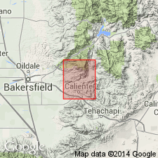
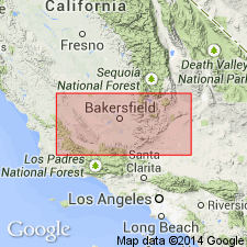
Pg. 12 (fig. 2), 33-35, pls. 1, 2, 3. Walker formation. Described in surface section. Consists of granitic sandstone, conglomerate, siltstone, and tuff breccia. Thickness at type section herein designated, 2,000 feet; thickens southwestward along strike to 2,950 feet and grades into Bealville fanglomerate (new) facies; thins northwestward, and in Cottonwood Canyon consists of about 200 feet of sand and gravel. At type section, overlies (Jurassic) quartz diorite and conformably underlies Ilmon basalt (new); in Cottonwood Canyon (outside mapped area), conformably underlies Freeman-Jewett shale. Age is Oligocene.
Type section: along southeast bank of Walker Basin Creek, 1 to 2 mi northeast of Bena, Breckenridge Mountain quadrangle, Kern Co., southern CA.
Source: US geologic names lexicon (USGS Bull. 1200, p. 4111).
- Usage in publication:
-
- Walker formation
- Modifications:
-
- Age modified
- AAPG geologic province:
-
- San Joaquin basin
Summary:
Pg. 10. Walker formation. Overlies basement complex in outcrop. To the west, subsurface Eocene rocks rest on basement, and it is apparent that Walker is land-laid equivalent of marine rocks of lower Miocene through upper Eocene.
Source: US geologic names lexicon (USGS Bull. 1200, p. 4111).
- Usage in publication:
-
- Walker Formation*
- Modifications:
-
- Geochronologic dating
- AAPG geologic province:
-
- San Joaquin basin
Summary:
Pg. 9, geologic time scale (inside front cover). Walker Formation. Sample from pumice tuff, about 160 m above base of continental Walker Formation at type section, in bluff on south side of Walker Basin Creek, Lat. 35 deg. 20 min. 19 sec. N., Long. 118 deg. 43 min. 02 sec. W., Bena quadrangle, Kern County, California, yielded a K-Ar age of 21.3 +/-0.6 Ma (plagioclase). Ages calculated using decay constants of Steiger and Jager, 1977 (Earth Planet. Sci. Letters, v. 36, p. 359-362). [Miocene, based on time scale of Berggren, 1972, Lethaia, v. 5, no. 2, p. 195-215.]
Source: Publication.
For more information, please contact Nancy Stamm, Geologic Names Committee Secretary.
Asterisk (*) indicates published by U.S. Geological Survey authors.
"No current usage" (†) implies that a name has been abandoned or has fallen into disuse. Former usage and, if known, replacement name given in parentheses ( ).
Slash (/) indicates name conflicts with nomenclatural guidelines (CSN, 1933; ACSN, 1961, 1970; NACSN, 1983, 2005, 2021). May be explained within brackets ([ ]).

