

- Usage in publication:
-
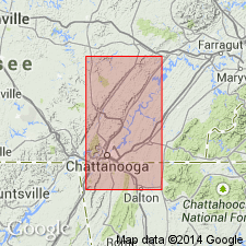
- Walden sandstone
- Modifications:
-
- Named
- Dominant lithology:
-
- Sandstone
- Shale
- Coal
- Clay
- AAPG geologic province:
-
- Appalachian basin
Summary:
Named as a formation in Pottsville Group. Named for Walden Ridge, Chattanooga, Pikeville, and Kingston quads, southeastern TN. Consists of sandstones, shales, and beds of coal and fire clay. Thickness is 500 ft or more. Overlies heavy conglomerate constituting top member of Lookout sandstone, and also forms top part of Coal Measures in northeastern AL and adjacent parts of GA, and TN. More homogenous than underlying Lookout sandstone. Equivalent to Upper Coal Measures of Smith [no date]. Age is Pennsylvanian.
Source: GNU records (USGS DDS-6; Reston GNULEX).

- Usage in publication:
-
- Walden Sandstone†
- Modifications:
-
- Abandoned
- AAPG geologic province:
-
- Appalachian basin
Summary:
Walden Sandstone of TN and GA abandoned herein. Was assigned to strata above Lookout Sandstone. In TN, strata are now assigned to Rockcastle Conglomerate, Vandever Formation, Newton Sandstone, and Whitwell Shale of Crab Orchard Mountains Group. [No reassignment to other strata in GA known at this time.]
Source: GNU records (USGS DDS-6; Reston GNULEX).
For more information, please contact Nancy Stamm, Geologic Names Committee Secretary.
Asterisk (*) indicates published by U.S. Geological Survey authors.
"No current usage" (†) implies that a name has been abandoned or has fallen into disuse. Former usage and, if known, replacement name given in parentheses ( ).
Slash (/) indicates name conflicts with nomenclatural guidelines (CSN, 1933; ACSN, 1961, 1970; NACSN, 1983, 2005, 2021). May be explained within brackets ([ ]).