The National Geologic Map Database is migrating to a new infrastructure. We apologize for any service disruptions during this process.
|
|---|


- Usage in publication:
-
- Wakarusa limestone
- Modifications:
-
- Original reference
- AAPG geologic province:
-
- Forest City basin
Summary:
Pg. 30. Wakarusa limestone. Very fossiliferous limestone, 2 to 4 feet thick, included in Upper Coal Measures of Shawnee County, northeastern Kansas. [From statement on p. 28 it appears to underlie Auburn shale and overlie Soldier Creek shale.]
Named for fine exposure on Wakarusa Creek [now Wakarusa River] immediately south of Auburn, [in secs. 25 and 26, T. 13 S., R. 14 E., Auburn 7.5-min quadrangle, Shawnee Co., northeastern KS].
Source: US geologic names lexicon (USGS Bull. 896, p. 2263).

- Usage in publication:
-
- Wakarusa limestone
- Modifications:
-
- Revised
- AAPG geologic province:
-
- Forest City basin
- Nemaha anticline
Summary:
Wakarusa limestone [of Wabaunsee group]. Underlies Auburn shale and overlies Soldier Creek shale. Was named by Beede in 1898. Is same as "Fargo" limestone of Condra and Bengston. In places it is one solid limestone 6+/- feet thick; in other places it is 2 dense blocky bluish limestones separated by 1 to 4 feet of argillaceous shale. [Age is Pennsylvanian. Recognized in northeastern Kansas and southeastern Nebraska.]
Source: US geologic names lexicon (USGS Bull. 896, p. 2262-2263).

- Usage in publication:
-
- Wakarusa limestone
- Modifications:
-
- Overview
- AAPG geologic province:
-
- Forest City basin
- Nemaha anticline
Summary:
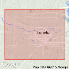
Pg. 218-225. Wakarusa limestone [of Wabaunsee group]. Underlies Auburn shale and overlies Soldier Creek shale [p. 49]. Beede's original Wakarusa limestone, however, is identified as Reading limestone; and Wakarusa limestone as now defined by usage, mainly by Condra, was included in upper part of Beede's "Stanton" (=Burlingame) limestone [p. 219]. Condra's 1927 usage of Wakarusa limestone seems to agree with Beede's original definition, but when the limestone called Wakarusa by Condra is traced to southern Shawnee County, Kansas, it is found to comprise upper member of Beede's "Stanton" limestone. It is desirable to separate this unit from Burlingame limestone, and because Condra's use of Wakarusa is the only one since original publication, and because this name has been extensively employed recently with application given it by Condra, it is here retained with Condra's definition. This is case where usage desirably takes precedence over priority. The beds called Wakarusa limestone by Condra and here designated by that name are present along Wakarusa Creek south of Auburn, but much better exposures are on Kansas Highway 10 west of Topeka, in sec. 35, T. 11 S., R. 13 E., and along the creek north of the highway near this place [p. 220]. [Age is Pennsylvanian. Recognized in northeastern Kansas and southeastern Nebraska.]
Source: US geologic names lexicon (USGS Bull. 896, p. 2262-2263).

- Usage in publication:
-
- Wakarusa limestone
- Modifications:
-
- Revised
- AAPG geologic province:
-
- Forest City basin
Summary:
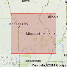
Chart 6 (column 32). Wakarusa limestone of Shawnee group. Pennsylvanian correlation chart shows Wakarusa limestone in Shawnee group in Missouri. [Age is Late Pennsylvanian (Virgil).]
Source: US geologic names lexicon (USGS Bull. 1200, p. 4106).
- Usage in publication:
-
- Wakarusa limestone
- Modifications:
-
- Revised
- AAPG geologic province:
-
- Forest City basin
Summary:
Pg. 20. Wakarusa limestone of Wabaunsee group. Assigned to Wabaunsee group when that group was redefined for Missouri. [Age is Late Pennsylvanian (Virgil).]
Source: US geologic names lexicon (USGS Bull. 1200, p. 4106).

- Usage in publication:
-
- Wakarusa limestone member*
- Modifications:
-
- Revised
- AAPG geologic province:
-
- Nemaha anticline
Summary:
Pg. 2273 (fig. 1), 2277. Wakarusa limestone member of Bern limestone. Rank reduced to member status in Bern limestone (new). Overlies Soldier Creek shale member; underlies Auburn shale. Age is Late Pennsylvanian (Virgilian).
Source: US geologic names lexicon (USGS Bull. 1200, p. 4106).
- Usage in publication:
-
- Wakarusa limestone
- Modifications:
-
- Areal extent
- AAPG geologic province:
-
- Chautauqua platform
Summary:
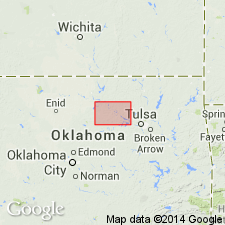
Pg. 53-54. Wakarusa limestone of Wabaunsee group. As now defined, name Wakarusa is applied to first resistant limestone unit above Burlingame limestone in Kansas section. Fusulinid-bearing phase of Wakarusa extends into Oklahoma, where, in earlier reports, it was referred to as CRYPTOZOON limestone. Thickness in Pawnee County 2 to 9.5 feet. Overlies Hallett shale; underlies Auburn shale. [Age is Late Pennsylvanian (Virgil).]
Source: US geologic names lexicon (USGS Bull. 1200, p. 4106).

- Usage in publication:
-
- Wakarusa limestone
- Modifications:
-
- Areal extent
- AAPG geologic province:
-
- Forest City basin
Summary:
Pg. 13, fig. 5. Wakarusa limestone of Wabaunsee group. Consists of two blocky bluish-gray fine-grained limestone beds separated by thin gray crinoidal shale. Underlies Auburn shale;
overlies Soldier Creek shale. [Age is Late Pennsylvanian (Virgil).]
Source: US geologic names lexicon (USGS Bull. 1200, p. 4106).
For more information, please contact Nancy Stamm, Geologic Names Committee Secretary.
Asterisk (*) indicates published by U.S. Geological Survey authors.
"No current usage" (†) implies that a name has been abandoned or has fallen into disuse. Former usage and, if known, replacement name given in parentheses ( ).
Slash (/) indicates name conflicts with nomenclatural guidelines (CSN, 1933; ACSN, 1961, 1970; NACSN, 1983, 2005, 2021). May be explained within brackets ([ ]).