- Usage in publication:
-
- Wagon Bed Formation*
- Modifications:
-
- Named
- Dominant lithology:
-
- Sandstone
- Siltstone
- Mudstone
- AAPG geologic province:
-
- Wind River basin
Summary:
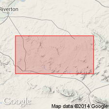
Named for Wagon Bed Spring, SE1/4 sec 33, SW1/4 sec 34, T32N, R95W. Type section measured in sec 24, T32N, R95W, Fremont Co, WY in Wind River basin. Rocks assigned to Wagon Bed were called Green Cove Beds or Formation, Continental Peak, and Tepee Trail Formation in earlier reports. Is exposed along most of Beaver Rim, between Big Sand Draw and Conant Creek anticlines, and east of Canyon Creek. Wedges out against Sweetwater uplift, the Conant Creek and Sweetwater anticlines. Thickens from 130 ft to 700 ft. Local variations in thickness due to erosion of Wagon Bed prior to deposition of overlying White River Formation. Is characterized by persistent well-sorted sandstone, siltstone and mudstone which commonly contain volcanic debris and bentonitic clay. Volcanic debris common at east and west ends of Beaver Rim. Volcanic-rich layers are yellowish green, olive, and dark green gray. Green- to yellow-gray, poorly sorted arkose and pebble conglomerate occurs in lower and upper parts. Nodules and beds of chert, and beds of silicified mudstone and sandstone are common. Overlies Wind River Formation. Is of middle and late Eocene age. Contains fossil plants, titanotheres, artiodactyls, creodonts, oreodonts, camels, etc. Deposited on warm, humid, poorly drained lowlands, floodplains, and lakes. Correlates with Tepee Trail, part of Tatman, part of Pitchfork, and Continental Peak Formations.
Source: GNU records (USGS DDS-6; Denver GNULEX).
For more information, please contact Nancy Stamm, Geologic Names Committee Secretary.
Asterisk (*) indicates published by U.S. Geological Survey authors.
"No current usage" (†) implies that a name has been abandoned or has fallen into disuse. Former usage and, if known, replacement name given in parentheses ( ).
Slash (/) indicates name conflicts with nomenclatural guidelines (CSN, 1933; ACSN, 1961, 1970; NACSN, 1983, 2005, 2021). May be explained within brackets ([ ]).

