

- Usage in publication:
-
- Wagnon member*
- Modifications:
-
- Named
- Dominant lithology:
-
- Limestone
- Shale
- AAPG geologic province:
-
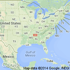
- Black Warrior basin
Summary:
Pride Mountain formation named and subdivided into seven members (ascending): Alsobrook, Tanyard Branch (new), Wagnon (new), Southward Spring sandstone, Sandfall (new), Mynot sandstone (new), and Green Hill (new). Wagnon member consists of a series of limestones and shales. Includes lower part of strata referred to by Butts (1926) as Gasper formation. Thickness ranges from 70 ft at south Tuscumbia to 30 ft near Pride and averages about 50 ft. Both upper and lower contacts are sharp and conformable. At type locality of the Pride Mountain, where Southward Spring sandstone member is absent, unit underlies Sandfall member. Age is Late Mississippian.
Source: GNU records (USGS DDS-6; Reston GNULEX).
- Usage in publication:
-
- Wagnon Member
- Modifications:
-
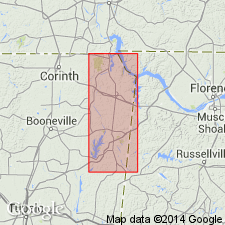
- Overview
- Areal extent
- AAPG geologic province:
-
- Black Warrior basin
Summary:
The Wagnon Member (Southward Pond formation of Morse, 1928) is composed primarily of three thin intervals of fossiliferous limestones, which are separated by varying thicknesses of shale. The lower limestone (Pond limestone A of Morse, 1928) is very fossiliferous, oolitic, and locally asphaltic. Fossils are well preserved in an exposure on the north side of Pennywinkle Creek valley near the confluence with Bear Creek, in Colbert Co., AL. The lower limestones are thinly interbedded and interlaminated with calcareous shale. Limestone intervals in the upper portions are not continuous in outcrop and rarely exceed 1 ft in thickness. The Wagnon reaches a maximum exposed thickness of about 70 ft in Tishomingo Co., MS. Age is Late Mississippian (Chesterian).
Source: GNU records (USGS DDS-6; Reston GNULEX).
For more information, please contact Nancy Stamm, Geologic Names Committee Secretary.
Asterisk (*) indicates published by U.S. Geological Survey authors.
"No current usage" (†) implies that a name has been abandoned or has fallen into disuse. Former usage and, if known, replacement name given in parentheses ( ).
Slash (/) indicates name conflicts with nomenclatural guidelines (CSN, 1933; ACSN, 1961, 1970; NACSN, 1983, 2005, 2021). May be explained within brackets ([ ]).