


- Usage in publication:
-
- Waggoner Ranch Formation
- Modifications:
-
- First used
- Dominant lithology:
-
- Mudstone
- Limestone
- Siltstone
- Sandstone
- Conglomerate
- AAPG geologic province:
-
- Bend arch
- Palo Duro basin
Summary:
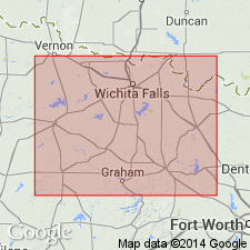
First used as formation in upper part, Wichita Group. Mapped in Baylor and Archer Cos, TX (Bend arch) and in Wichita and Wilbarger Cos, TX, (Palo Duro basin) north of "Mabelle" to Red River and east of Lueders Formation exposures. West limit arbitrary. Equivalent to Bead Mountain (base), Grape Creek, Talpa, and Lueders Formations of Albany Group mapped south of and a short distance west of Waggoner Ranch exposures. Neither location of Waggoner Ranch nor designation of a type locality stated. Consists of 380-420 ft of: red-brown mudstone with calcareous nodules (predominant lithology); gray, variegated shale and claystone with selenite gypsum lenses 5-15 ft thick and fossils (plants, vertebrates, pelecypods, conchostracans); gray to brown, locally sandy, fossiliferous (algae, serpulid tubes) limestone in beds 6 inches-2 ft thick; red-brown, laminated siltstone in beds 1-3 ft thick scattered throughout; very fine to fine grained, locally calcareous, laminated, desiccation-cracked, cross-bedded, cross-laminated sandstone in channel-fill bodies with sparse marine invertebrates; conglomerate of granule- to pebble-size clasts of calcareous limestone and desiccated mudstone in poorly indurated lenses 1-3 ft thick. Four limestones, all unranked, mapped: Beaverburk (base), Rendham (first used) and Maybelle (middle), and Lake Kemp (top). Overlies Petrolia Formation (first used) of Wichita; underlies Lytle Limestone of Clear Fork Group. Leonard age.
Source: GNU records (USGS DDS-6; Denver GNULEX).
- Usage in publication:
-
- Waggoner Ranch Formation
- Modifications:
-
- Named
- Dominant lithology:
-
- Mudstone
- Shale
- Claystone
- Limestone
- AAPG geologic province:
-
- Bend arch
- Palo Duro basin
Summary:
Named as topmost of three new formations of Wichita Group (revised) for the W.T. Waggoner Estate in Baylor Co, TX. Stratotype measured from base of west-facing cutbank of the Wichita River about 4.8 mi east-northeast of Lake Kemp dam, northern Baylor Co. Overlies Petrolia Formation (named) of Wichita; underlies Clear Fork Group (undivided). Present in northeastern Baylor and southeastern Wilbarger Cos, and western and northern Wichita Co, TX on Bend arch and Palo Duro basin. Consists of continental, paralic, and minor marine strata that are approximately equivalent to the Bead Mountain, Grape Creek, Talpa, and Lueders Formations [Brown and Goodson, 1972] of the Albany Group. Ranges in thickness from 380-420 ft. As reflected in the stratotype, mudrock is the dominant lithology; reddish-brown mudstone and gray shale and claystone constitute 80-95 percent of exposed rocks. Crudely stratified calcareous nodules abundant in the red mudstones. Lenticular light-gray and variegated claystone and shale are also typical but not as common as the reddish hues. Locally developed, dark-gray, very carbonaceous shale is rare and associated as interbeds with limestone. Limestones are volumetrically minor but provide the only means of stratigraphic correlation with equivalent Albany formations [author discusses limestone correlations in detail.] Forms badland terrain. Age is Early Permian (Leonardian). Geologic map.
Source: GNU records (USGS DDS-6; Denver GNULEX).
For more information, please contact Nancy Stamm, Geologic Names Committee Secretary.
Asterisk (*) indicates published by U.S. Geological Survey authors.
"No current usage" (†) implies that a name has been abandoned or has fallen into disuse. Former usage and, if known, replacement name given in parentheses ( ).
Slash (/) indicates name conflicts with nomenclatural guidelines (CSN, 1933; ACSN, 1961, 1970; NACSN, 1983, 2005, 2021). May be explained within brackets ([ ]).