- Usage in publication:
-
- Village Bend Limestone [unranked]
- Modifications:
-
- Mapped 1:250k
- Dominant lithology:
-
- Limestone
- AAPG geologic province:
-
- Fort Worth syncline
Summary:
Village Bend Limestone [unranked] in Mineral Wells Formation of Strawn Group. Fine-grained, locally sandy, thick-bedded, yellow gray, weathers to small blocks, marine megafossils, forms laterally discontinuous lentils. Thickness up to 3 feet. Lies above Hog Mountain Sandstone [unranked] and below Lake Pinto Sandstone [unranked], in middle part of Mineral Wells Formation. [Age is considered latest Middle Pennsylvanian (latest Desmoinesian). Early-Middle Pennsylvanian boundary tentatively placed between Village Bend and Lake Pinto. Boardman and others, 1994, Kansas Geol. Survey Bull., no. 232, p. 8, 14 (fig. 8) state boundary is 15 to 25 feet above Village Bend, based on fusulinids, conodonts, and ammonoids.]
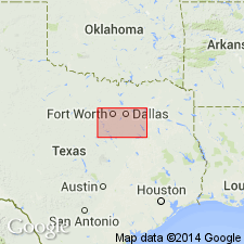
[Mapped along western edge of map sheet, west of Weatherford, in Parker Co., eastern TX. See also adjacent Geol. Atlas Texas, Abilene sheet, 1972.]
Source: Publication.
For more information, please contact Nancy Stamm, Geologic Names Committee Secretary.
Asterisk (*) indicates published by U.S. Geological Survey authors.
"No current usage" (†) implies that a name has been abandoned or has fallen into disuse. Former usage and, if known, replacement name given in parentheses ( ).
Slash (/) indicates name conflicts with nomenclatural guidelines (CSN, 1933; ACSN, 1961, 1970; NACSN, 1983, 2005, 2021). May be explained within brackets ([ ]).

