

- Usage in publication:
-
- Ventioner beds
- Modifications:
-
- Original reference
- Dominant lithology:
-
- Sandstone
- Shale
- Limestone
- AAPG geologic province:
-
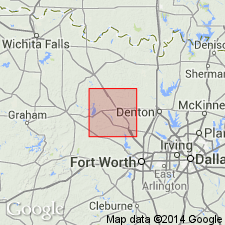
- Fort Worth syncline
Summary:
Pg. 35. Ventioner beds of Brad formation. In Wise County, the Adams Branch limestone is absent, and the beds below Ranger limestone member of Brad formation and above Devils Den limestone member of Graford formation are here named Ventioner beds. The beds are at least 300 feet thick, and consist of sands and shales with 2 limestone lentils, the lower of which lies about 40 feet above Devils Den limestone on west side of Trinity River upstream from mouth of Ventioner Creek, and the higher of which lies about 40 feet higher and is exposed 1 mile west of Ventioner Creek bridge. For convenience of mapping these beds are included in Brad formation, although lower part is of Graford age. Age is Pennsylvanian.
Source: US geologic names lexicon (USGS Bull. 896, p. 2238).

- Usage in publication:
-
- Ventioner Formation
- Modifications:
-
- Revised
- AAPG geologic province:
-
- Fort Worth syncline
Summary:
Ventioner revised--mapped as a formation of Canyon Group in the southeastern part of mapped area, north-central TX (ascending): Palo Pinto Formation, Wolf Mountain Shale, Winchell Limestone, Placid Shale, Ranger Limestone, Colony Creek Shale, and Home Creek Limestone. Farther east, Canyon is divided into (ascending): Willow Point Formation, Jasper Creek Formation and its Chico Ridge Limestone [unranked], Ventioner Formation, Ranger Limestone, and Colony Creek Shale. Ventioner is partly equivalent to Placid Shale and Winchell Limestone; stratigraphic cutoff of Placid and Winchell is in southern Jack Co, Fort Worth syncline. Ventioner is present from this point eastward to edge of sheet, and on adjacent Sherman sheet. Consists of shale, sandstone, siltstone, and limestone. Shale is gray, black, maroon, weathers to tan and reddish brown, silty, sandy, locally laminated, thick bedded, ferruginous nodules locally common; numerous sandy and silty lenses and flaggy, thin beds with horizontal lamination, local load and flute casts; some small, sandy channel-fill bodies to 6 ft thick with coarse woody debris; fossiliferous beds with marine invertebrates uncommon, fine-grained plant debris abundant. Separately mapped are several unnamed sandstone and shale units, and a limestone. Thickness of Ventioner is 200-270 ft. Age is Missouri (Late Pennsylvanian). Geologic map.
Source: GNU records (USGS DDS-6; Denver GNULEX).

- Usage in publication:
-
- Ventioner Formation
- Modifications:
-
- Mapped 1:250k
- Dominant lithology:
-
- Shale
- Mudstone
- Sandstone
- AAPG geologic province:
-
- Fort Worth syncline
Summary:
Pamphlet [p. 13]. Ventioner Formation of Canyon Group. [Shales and mudstones, up to 60 feet thick, with sandstones and siltstones, and in places limestone. Total thickness 280 to 300 feet. Includes separately mapped units, descending: (1) in upper part, ls, tan, gray, yellowish-white, fossiliferous limestone, 10 to 15 feet thick, restricted to east-central Jack County, merges with Ranger Limestone in subsurface; (2) in middle part, ss3, brown, reddish-brown, fossiliferous (CALAMITES) sandstone, 5 to 100 feet thick; (3) in lower part, ss2, discontinuous zones of channel-fill bodies and evenly bedded sandstone locally interbedded with shale, 5 to 50 feet thick, locally = base of Ventioner; and (4) in basal part, ss1, sheet-like bodies of tan to dark-brown sandstone interbedded with gray, tan, pale-reddish-brown, silty shale, 15 to 40 feet thick.] Ventioner = Placid Shale, Winchell Limestone, and upper part of Wolf Mountain Shale that are exposed in adjacent Wichita Falls-Lawton sheet. Lies above Jasper Creek Formation and below Ranger Limestone; both of Canyon Group. Age is Late Pennsylvanian (Missourian).
[Mapped in Bear Knob area, Jack and Wise Cos., central northern TX; western edge of map sheet. Rocks previously (1967 ed. of map) included in "Brad Formation." See also adjacent Wichita Falls-Lawton sheet, Texas Geol. Atlas, 1987.]
Source: Publication.
For more information, please contact Nancy Stamm, Geologic Names Committee Secretary.
Asterisk (*) indicates published by U.S. Geological Survey authors.
"No current usage" (†) implies that a name has been abandoned or has fallen into disuse. Former usage and, if known, replacement name given in parentheses ( ).
Slash (/) indicates name conflicts with nomenclatural guidelines (CSN, 1933; ACSN, 1961, 1970; NACSN, 1983, 2005, 2021). May be explained within brackets ([ ]).