- Usage in publication:
-
- Vekol Formation*
- Modifications:
-
- Named
- Reference
- Dominant lithology:
-
- Conglomerate
- Arkose
- Graywacke
- Mudstone
- Quartzite
- AAPG geologic province:
-
- Basin-and-Range province
Summary:
Pg. G1-G9. Vekol Formation. A series of green-gray sedimentary rocks. Includes thick lenses of conglomerate, green-gray pebbly arkose and graywacke, green and maroon mudstone, and beds of quartzite, arkosic quartzite, or aphanitic claystone. Includes a local basal member, 50 to 200 feet thick, of purplish-green volcanic conglomerate. At type locality lowest part of formation consists of alternating beds of conglomerate and mudstone. This sequence is about 300 feet thick and grades upward through a transition zone into main part of formation. At Copperosity Mine (reference section), formation is conglomerate made up almost entirely of deeply weathered, intensely sheared pebbles and cobbles. The Vekol in this area is about 1,000 feet thick. At second reference section, formation is predominantly limestone conglomerate. At third reference section, Vekol is a series of pebble conglomerate beds that overlie Phonodoree Formation (new) or older rocks. Thickness commonly between 2,000 and 3,000 feet. Overlaps Phonodoree Formation and lies unconformably on older rocks. West of Reward Mine, is overlain unconformably by Chiapuk Rhyolite (new). Elsewhere is exposed below cover of Tertiary volcanic rocks and Tertiary and Quaternary alluvium. Age is Mesozoic.
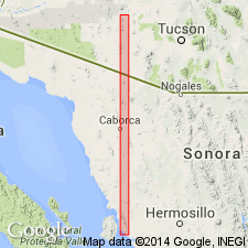
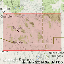
Type locality: exposures immediately west of Reward Mine, Vekol Mountains, Papago Indian Reservation, southwestern Pinal Co., AZ (Basin-and-Range province). Named for exposures in Vekol Mountains.
Reference localities: (1) southeast of Copperosity Mine; (2) between the Copperosity and Vekol Mines; and (3) in vicinity of village of Sif Vaya.
Source: US geologic names lexicon (USGS Bull. 1350, p. 796-797).

- Usage in publication:
-
- Vekol Formation*
- Modifications:
-
- Overview
- Age modified
- AAPG geologic province:
-
- Basin-and-Range province
Summary:
Is oldest Cretaceous formation in Vekol Mountains (Pinal Co, AZ) in Basin-and-Range province. Overlies Phonodoree Formation (Triassic). Underlies Chiapuk Rhyolite (Campanian and Maestrichtian). Is 2,000-3,000 ft thick; includes lenses of conglomerate, gray-green pebbly arkose and graywacke, green and maroon mudstone, and beds of quartzite, arkosic quartzite, aphanitic claystone, and minor interlayered andesite. Is considered possible, if not probable, that both Vekol and Chiapuk are general equivalents to Salero Formation in Santa Rita Mountains. Age is shown to be Campanian (Late Cretaceous) on correlation chart (fig. 5); refined from late? Mesozoic.
Source: GNU records (USGS DDS-6; Denver GNULEX).
For more information, please contact Nancy Stamm, Geologic Names Committee Secretary.
Asterisk (*) indicates published by U.S. Geological Survey authors.
"No current usage" (†) implies that a name has been abandoned or has fallen into disuse. Former usage and, if known, replacement name given in parentheses ( ).
Slash (/) indicates name conflicts with nomenclatural guidelines (CSN, 1933; ACSN, 1961, 1970; NACSN, 1983, 2005, 2021). May be explained within brackets ([ ]).

