The National Geologic Map Database is migrating to a new infrastructure. We apologize for any service disruptions during this process.
|
|---|


- Usage in publication:
-
- Vaquero sandstone*
- Modifications:
-
- Named
- Dominant lithology:
-
- Sandstone
- AAPG geologic province:
-
- California Coast Ranges province
Summary:
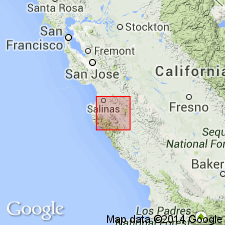
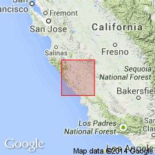
Named for occurrence in Los Vaqueros Valley [Monterey Co, CA]. Is well defined in Salinas Valley, along eastern slope of Santa Lucia Range and may be on summit of Mount Diablo Range, around headwaters of Stone Canyon. Is rather coarse, uniformly gray, white or light-yellow quartzose sandstone, with occasional stratum of granitic pebbles. Is of great thickness along eastern slope of Santa Lucia Range. Unconformably overlies Basement complex and stratified terranes older than Neocene. List of megafossils included in report. Age given as Neocene.
Source: GNU records (USGS DDS-6; Menlo GNULEX).
- Usage in publication:
-
- Vaqueros sandstone*
- Modifications:
-
- Areal extent
- Biostratigraphic dating
- AAPG geologic province:
-
- Transverse Ranges province
- San Joaquin basin
- California Coast Ranges province
Summary:
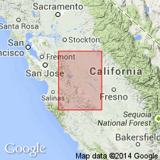
[Note that spelling changed from "Vaquero" to 'Vaqueros"]. Type locality designated as Los Vaqueros Valley, Monterey Co, CA. Distribution of unit also includes Mount Diablo Range, Martinez, Santa Cruz Mountains, and parts of: San Luis Obispo Co, Kern Co, Santa Barbara Co, Ventura Co, Santa Monica Mountains in Los Angeles Co, Santa Ana Mountains in Orange Co, and questionably, San Diego Co(?). Thickness varies, its maximum being between 2000 and 3000 ft. Conformably overlies San Lorenzo formation; unconformably overlies Eocene or older formations. Conformably underlies Monterey shale. Extensive list of megafauna especially pectens, pelecypods, and gastropods included. J.C. Merriam gave name AGASOMA zone (early Miocene age) for fossils in unit.
Source: GNU records (USGS DDS-6; Menlo GNULEX).
- Usage in publication:
-
- Vaqueros formation*
- Modifications:
-
- Redescribed
- Revised
- AAPG geologic province:
-
- San Joaquin basin
Summary:
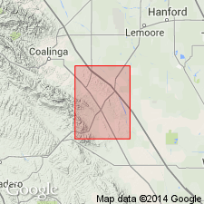
[Vaqueros sandstone of earlier publications] is here referred to as Vaqueros formation assigned to Monterey group in area between Coalinga and Panoche Creek. Divided into lower unnamed member and upper member named Big Blue serpentinous member. Big Blue was formerly mapped as part of Santa Margarita(?) formation by Arnold and Anderson (1908, 1910). Big Blue is considered part of Vaqueros formation because it interfingers sandy beds containing typical Vaqueros fossils. [Big Blue serpentinous member later reassigned to Temblor formation by Clark (1935), raised in rank to Big Blue Formation by Adegoke (1960) and adopted by the USGS as formation by Lockwood (1971)]. Vaqueros formation unconformably overlies Kreyenhagen shale and unconformably underlies Santa Margarita(?) formation. Age of Vaqueros given as early Miocene.
Source: GNU records (USGS DDS-6; Menlo GNULEX).
- Usage in publication:
-
- Vaqueros sandstone*
- Modifications:
-
- Revised
- AAPG geologic province:
-
- California Coast Ranges province
Summary:
Monterey group is no longer recognized as group; now considered Monterey shale of formational rank. Vaqueros sandstone therefore removed from Monterey group.
Source: GNU records (USGS DDS-6; Menlo GNULEX).
- Usage in publication:
-
- Vaqueros formation
- Modifications:
-
- Overview
- AAPG geologic province:
-
- California Coast Ranges province
Summary:
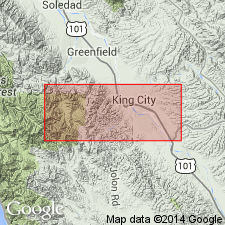
Type area/locality designated, 10 mi west of King City in Los Vaqueros Valley and upper part of adjoining Reliz Canyon in T20S R6E, Junipero Serra 15' quad, Monterey Co, CA. Historical overview, sketch map of type area, composite columnar section, cross section, and lithologic description with listed fossils of informal members A through F included in report. Vaqueros formation conformably overlies Berry conglomerate; gradationally underlies Sandholdt formation. Is about 2000 ft thick in type area. Lower members are in Zemorrian Stage of Kleinpell; upper member is considered early Saucesian Stage.
Source: GNU records (USGS DDS-6; Menlo GNULEX).
- Usage in publication:
-
- Vaqueros Formation*
- Modifications:
-
- Revised
- AAPG geologic province:
-
- California Coast Ranges province
Summary:
Vaqueros Formation in area of its type locality, Reliz Canyon quad, is expanded to include probable nonmarine rocks previously termed Berry Formation as basal unnamed member here. Overlies Reliz Canyon Formation (new). Vaqueros as described by Hamlin (1904) included some strata herein placed in Reliz Canyon Formation. In central Monterey Co, unfossiliferous lower member of Vaqueros may represent part, if not all, of Oligocene time. Upper member contains fossils of early Miocene age (Loel and Corey, 1932).
Source: GNU records (USGS DDS-6; Menlo GNULEX).
- Usage in publication:
-
- Vaqueros Sandstone*
- Modifications:
-
- Revised
- AAPG geologic province:
-
- California Coast Ranges province
Summary:
The lower part of Vaqueros Sandstone along Zayante Creek, Santa Cruz Mountains, as mapped by Branner and others (1909, USGS Folio 163) was renamed Zayante Sandstone by Clark (1966, PhD thesis). Zayante Sandstone is here adopted. The age of locally restricted Vaqueros Sandstone is Oligocene and early Miocene.
Source: GNU records (USGS DDS-6; Menlo GNULEX).
- Usage in publication:
-
- Vaqueros Formation*
- Modifications:
-
- Revised
- Age modified
- AAPG geologic province:
-
- California Coast Ranges province
Summary:
In Caliente Range, southern California Coast Range southwest of San Andreas fault, Vaqueros Formation is composed of (ascending); Quail Canyon Sandstone Member (late Oligocene age), Soda Lake Shale member (late Oligocene and early Miocene age), and Painted Rock Sandstone Member (new) (early or middle Miocene age). Age of Vaqueros is late Oligocene to middle(?) Miocene in this area. It is proposed that Vaqueros Formation be used southwest of San Andreas fault and Temblor Formation be applied northeast of this fault.
Source: GNU records (USGS DDS-6; Menlo GNULEX).
- Usage in publication:
-
- Vaqueros Formation*
- Modifications:
-
- Revised
- AAPG geologic province:
-
- California Coast Ranges province
Summary:
Rocks included as basal unnamed member in type Vaqueros Formation (Durham, 1963) are now considered distinct formation named Berry Formation. As so defined Vaqueros Formation overlies Berry Formation; underlies Monterey Formation or intervening Tierra Redonda Formation. Fossils from unit in Reliz Canyon, Bear Canyon, Bryson, and Tierra Redonda Mountain 7.5' quads and stratigraphic position indicate Vaqueros in southern Salinas Valley area is early Miocene age.
Source: GNU records (USGS DDS-6; Menlo GNULEX).
- Usage in publication:
-
- Vaqueros Sandstone*
- Modifications:
-
- Age modified
- Biostratigraphic dating
- AAPG geologic province:
-
- California Coast Ranges province
Summary:
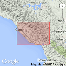
Mapped northeast of Coast Union High School and near Green Valley (Cambria 7.5' quad, San Luis Obispo Co, CA) where basal part of Vaqueros Sandstone interfingers with Lospe Formation. Fossils (listed) indicate Oligocene (Zemorrian) or "Vaqueros" Stage in Cambria region.
Source: GNU records (USGS DDS-6; Menlo GNULEX).
- Usage in publication:
-
- Vaqueros Formation*
- Modifications:
-
- Revised
- AAPG geologic province:
-
- Transverse Ranges province
Summary:
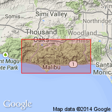
Vaqueros Formation in Santa Monica Mountains, Los Angeles Co, CA divided into (ascending): Danielson Member and San Nicholas Member (new). Vaqueros intertongues with Piuma Member (new) of Sespe Formation between Malibu and Las Flores Canyons. In western part of Point Dumes 7.5' quad, underlies Encinal member (new) of Topanga Canyon Formation (new). Both members contain TURRITELLA INEZANA fauna diagnostic of "Vaqueros" Stage. Foraminifers from interbedded silty shale in Encinal Canyon are assigned to Saucesian Stage. Age of Vaqueros in Santa Monica Mountains is early Miocene.
Source: GNU records (USGS DDS-6; Menlo GNULEX).
For more information, please contact Nancy Stamm, Geologic Names Committee Secretary.
Asterisk (*) indicates published by U.S. Geological Survey authors.
"No current usage" (†) implies that a name has been abandoned or has fallen into disuse. Former usage and, if known, replacement name given in parentheses ( ).
Slash (/) indicates name conflicts with nomenclatural guidelines (CSN, 1933; ACSN, 1961, 1970; NACSN, 1983, 2005, 2021). May be explained within brackets ([ ]).