

- Usage in publication:
-
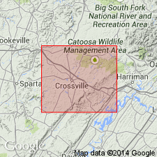
- Vandever shale
- Modifications:
-
- Named
- Dominant lithology:
-
- Shale
- Sandstone
- AAPG geologic province:
-
- Appalachian basin
Summary:
Named as a formation in Lee group. Named for Vandever, Cumberland Co., central TN. Consists of somewhat ferruginous sandy and clay shale with heavy sandstone beds in lower half. Thickness is 200 ft. Underlies Rockcastle sandstone; overlies Bonair sandstone. [Age is Pennsylvanian.]
Source: GNU records (USGS DDS-6; Reston GNULEX).

- Usage in publication:
-
- Vandever formation
- Modifications:
-
- Revised
- AAPG geologic province:
-
- Appalachian basin
Summary:
Included as a formation in Crab Orchard Mountains group (new). Name revised to Vandever formation because of large amount of sandstone in unit along eastern edge of Walden Ridge. Over most of Walden Ridge, consists of three units including a lower shaly part, prominent middle sandstone or conglomerate, and an upper shaly part. Thickness ranges from less than 100 ft to more than 400 ft. Near Vandever, where exposed along axis of anticline, thickness is 250 ft. Includes Lantana coal near base and Morgan Springs coal near top. Underlies Rockcastle conglomerate; overlies Newton sandstone. Equivalent to part of Fentress formation. Age is Pennsylvanian (Pottsville series). Report includes geologic maps, cross sections, stratigraphic sections, and correlation chart.
Source: GNU records (USGS DDS-6; Reston GNULEX).
- Usage in publication:
-
- Vandever Shale Member*
- Modifications:
-
- Revised
- AAPG geologic province:
-
- Appalachian basin
Summary:
New nomenclature defined for Early Pennsylvanian rocks of northwest GA. Johnson's (1946) nomenclature was based on miscorrelation with rock units of TN. For example, his Vandever Shale in GA is a lower bed than the Vandever Shale of TN. Vandever Shale of present report is classified as upper member of Crab Orchard Mountains Formation. Overlies Newton Sandstone Member. Thickness about 300 ft on Lookout Mountain.
Source: GNU records (USGS DDS-6; Reston GNULEX).
- Usage in publication:
-
- Vandever Formation
- Modifications:
-
- Revised
- AAPG geologic province:
-
- Appalachian basin
Summary:
Vandever Formation. Subdivided into (descending): unnamed upper shale member; Needleseye Conglomerate Member (new), 110 feet of thick-bedded, fine- to medium-grained, light-brownish-gray to light-brown conglomeratic sandstone, cross-bedded in part; and unnamed lower shale member. Age is Pennsylvanian.
Source: US geologic names lexicon (USGS Bull. 1350, Needleseye entry p. 522); GNU records (USGS DDS-6; Reston GNULEX).

- Usage in publication:
-
- Vandever Formation
- Modifications:
-
- Areal extent
- AAPG geologic province:
-
- Appalachian basin
Summary:
(East-central sheet; not separately mapped.) Vandever Formation of Crab Orchard Mountains Group. Mostly dark-gray to light-brown shale and siltstone; includes conglomerate or sandstone in middle to south. Lantana and Morgan Springs coals near base and top. Thickness as much as 450 feet; average about 300 feet. Lies below Rockcastle Conglomerate and above Newton Sandstone; both of Crab Orchard Mountains Group. Age is Pennsylvanian.
Source: Publication.

- Usage in publication:
-
- Vandever Formation
- Modifications:
-
- Overview
- AAPG geologic province:
-
- Appalachian basin
Summary:
Vandever Formation of Crab Orchard Mountains Group mapped in Roane Co., eastern TN. Unit consists of silty, medium dark-gray to olive-gray shale, persistent at top, middle, and base of formation; very fine to fine-grained, light-gray, sandstone flasered with irregular partings of medium dark-gray shale, persistent just above and below middle; shale and sandstone irregularly interlaminated with very fine to fine-grained, light-gray sandstone and medium- to medium dark gray shale, ripple, flasered, and burrowed. Contains thin Morgan Springs coal locally at or near top, with #12 coal in upper sandstone unit and Lantana coal near base, which is commonly split into several thin seams. Overlies Newton Sandstone and underlies Rockcastle Conglomerate, both of Crab Orchard Mountains Group. Thickness ranges from 210 to 410 ft. Age is Early Pennsylvanian.
Source: GNU records (USGS DDS-6; Reston GNULEX).

- Usage in publication:
-
- Vandever Formation*, Shale*
- Modifications:
-
- Revised
- Areal extent
- AAPG geologic province:
-
- Appalachian basin
Summary:
Used as either Vandever Formation Shale or Vandever Formation of Crab Orchard Mountains Group in TN. Previously assigned to Lee Group between Bon Air (Newton) Sandstone and Rockcastle Sandstone. [Restricted from GA, as is use of Crab Orchard Mountains Formation. No longer considered part of Lee Group as Lee is restricted from TN.]
Source: GNU records (USGS DDS-6; Reston GNULEX).
For more information, please contact Nancy Stamm, Geologic Names Committee Secretary.
Asterisk (*) indicates published by U.S. Geological Survey authors.
"No current usage" (†) implies that a name has been abandoned or has fallen into disuse. Former usage and, if known, replacement name given in parentheses ( ).
Slash (/) indicates name conflicts with nomenclatural guidelines (CSN, 1933; ACSN, 1961, 1970; NACSN, 1983, 2005, 2021). May be explained within brackets ([ ]).