

- Usage in publication:
-
- Ute
- Modifications:
-
- Original reference
- Dominant lithology:
-
- Limestone
- Shale
- AAPG geologic province:
-
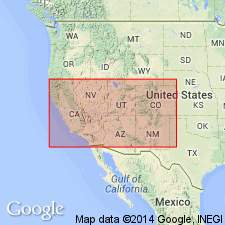
- Central Western Overthrust
- Wasatch uplift
Summary:
Mapped the Ute as Silurian.
Source: US geologic names lexicon (USGS Bull. 896, 2223-2224).
- Usage in publication:
-
- Ute limestone*
- Modifications:
-
- Original reference
- Dominant lithology:
-
- Limestone
- Shale
- AAPG geologic province:
-
- Central Western Overthrust
- Wasatch uplift
Summary:
Pg. 477. Ute limestone, 2,000 feet thick in Wahsatch [Wasatch] Mountains, contains fossils which show it to be chiefly or wholly of Quebec [Ordovician] age, although no fossils have been obtained from its immediate summit or base. Next younger formation is Ogden quartzite.
Source: US geologic names lexicon (USGS Bull. 896, 2223-2224).
- Usage in publication:
-
- Ute limestone*
- Modifications:
-
- Original reference
- Dominant lithology:
-
- Limestone
- Shale
- AAPG geologic province:
-
- Central Western Overthrust
- Wasatch uplift
Summary:
Pg. 340-392. Ute limestone (Silurian). Dark, almost black compact siliceous limestone, with calcareous shales and argillites toward base, carrying Quebec [Ordovician] fossils at top and bottom. Thickness 1,000 to 1,500 feet in Wahsatch [Wasatch] Mountains. Underlies Ogden quartzite and overlies Cambrian slate.
Source: US geologic names lexicon (USGS Bull. 896, 2223-2224).
- Usage in publication:
-
- Ute limestone*
- Modifications:
-
- Original reference
- Dominant lithology:
-
- Limestone
- Shale
- AAPG geologic province:
-
- Central Western Overthrust
- Wasatch uplift
Summary:
Pg. 393-419. Ute limestone (Silurian) is 1,200 to 1,500 feet thick in northern Wahsatch [Wasatch] region. Consists chiefly of limestones but includes some calcareous and argillaceous shale.
Named from Ute Peak, UT.
Source: US geologic names lexicon (USGS Bull. 896, 2223-2224).
- Usage in publication:
-
- Ute limestone*
- Modifications:
-
- Original reference
- Dominant lithology:
-
- Limestone
- Shale
- AAPG geologic province:
-
- Central Western Overthrust
- Wasatch uplift
Summary:
Pg. 127-248. Ute limestone (Silurian). Dark compact fine-grained rock, 1,000 to 2,000 feet thick in Wahsatch [Wasatch] Range, Utah. Toward base the limestone becomes shaly for several hundred feet. Conformably underlies Ogden quartzite and conformably overlies Cambrian shales.
Source: US geologic names lexicon (USGS Bull. 896, 2223-2224).
- Usage in publication:
-
- Ute formation*
- Modifications:
-
- Revised
- Dominant lithology:
-
- Limestone
- Shale
- Conglomerate
- AAPG geologic province:
-
- Wasatch uplift
Summary:
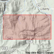
Ute formation. Blue to bluish-gray thin-bedded fine-grained limestones and shales, with some oolitic concretionary, and intraformational conglomerate layers. Thickness in Blacksmith Fork 759 feet; in section west of Liberty 731 feet. Abundant Middle Cambrian fossils. Type locality, slopes of Ute Peak, near forks of East Fork, east of Paradise, Cache County, Utah. Underlies Blacksmith formation and overlies Langston formation, all Middle Cambrian. This formation was named Ute limestone by 40th Parallel Survey, but aside from fact it was stated to overlie Cambrian quartzites and to be composed of 2,000 feet of limestones containing Cambrian fossils, it was not defined or limited. The beds here referred to Ute formation contain the fossils mentioned by 40th Parallel Survey as characterizing lower part of Ute limestone.
[GNC remark (ca. 1938, US geologic names lexicon, USGS Bull. 896, p. 2224): As defined by Walcott the name Ute is restricted to a lower part of Ute limestone of 40th Parallel Survey. Age is Middle Cambrian. Recognized in northeastern Utah and southeastern Idaho. This is present accepted definition. The Ute limestone of King appears to have included all the limestones (Ordovician and Upper and Middle Cambrian) beneath the Ordovician Swan Peak quartzite, which he apparently mistook for the quartzite in Ogden Canyon, which is of Middle and Lower Cambrian age.]
Source: US geologic names lexicon (USGS Bull. 896, 2223-2224).

- Usage in publication:
-
- Ute limestone
- Modifications:
-
- Revised
- AAPG geologic province:
-
- Wasatch uplift
Summary:
Pg. 1113-1114, 1116, 1117 (fig. 4), 1120-1121. Ute limestone. Walcott's 1908 (Smithsonian Misc. Colln., v. 53, no. 1804) Blacksmith Fork section emended. Thickness 685 feet. Shale at base of formation cannot be correlated with Spence shale of Idaho. Overlies Langston limestone; underlies Blacksmith dolomite (emended). [Age is Middle Cambrian.]
Source: US geologic names lexicon (USGS Bull. 1200, p. 4035).
- Usage in publication:
-
- Ute limestone*
- Modifications:
-
- Revised
- AAPG geologic province:
-
- Wasatch uplift
Summary:
Pg. 9-10, pls. 1, 6. Ute limestone. Described in Handolph quadrangle, Utah, where His 480 to 585 feet thick and considered to include Spence shale member. Overlies Langston limestone and underlies Blacksmith limestone. [Age is Middle Cambrian.]
Source: US geologic names lexicon (USGS Bull. 1200, p. 4035).
- Usage in publication:
-
- Ute limestone
- Modifications:
-
- Revised
- AAPG geologic province:
-
- Wasatch uplift
Summary:
Pg. 280, 281; J.S. Williams, 1948, GSA Bull., v. 59, no. 11, p. 1133. Ute limestone. Restricted to exclude Spence shale member, which is herein reallocated to Langston formation. [Age is Middle Cambrian.]
Source: US geologic names lexicon (USGS Bull. 1200, p. 4035).
- Usage in publication:
-
- Ute limestone*
- Modifications:
-
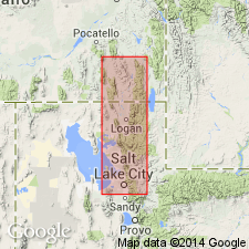
- Areal extent
- AAPG geologic province:
-
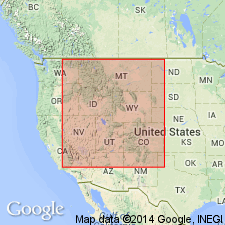
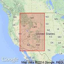
- Wasatch uplift
- Great Basin province
Summary:
Pg. 653-654, 670 (fig. 2), 671-672, 673 (fig. 3). Ute limestone. Maximum thickness is 745 feet at High Creek, [Cache County], Utah; estimated thickness 700 feet at Promontory Point, [Box Elder County], Utah. [Age is Middle Cambrian.]
Source: US geologic names lexicon (USGS Bull. 1200, p. 4035).
- Usage in publication:
-
- Ute Limestone*
- Modifications:
-
- Revised
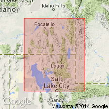
- Areal extent
- AAPG geologic province:
-
- Central Western Overthrust
- Great Basin province
- Wasatch uplift
Summary:
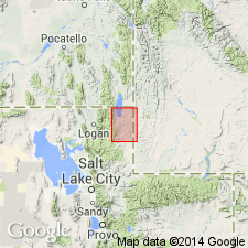
Ute Limestone. Idaho exposures geographically restricted to southeastern part of state [notably Bear River Range area, in Nounan, Midnight Mountain, Paris, and Mapleton 7.5-min quadrangles, Bear Lake and Franklin Cos.]; to the west in Portneuf Range area, rocks are reallocated to Bancroft Limestone (new). Ute Limestone redefined to exclude Spence Shale Member (now Spence Tongue of Lead Bell Shale, new). Cub Shale Member (new) adopted as basal unit of redefined Ute (is a tongue of Lead Bell to the west). Lies below Blacksmith Limestone and above Langston Formation (Langston Dolomite), or High Creek Limestone. Age is Middle Cambrian. BATHYURISCUS-ELRATHINA trilobite assemblage zone.
Loc. 8. Co-Op Creek, in sec. 20, T. 11 S., R. 43 E.
Loc. 10. Mill Creek, in sec. 2, T. 13 S., R. 42 E. (Maxey, 1958).
Loc. 12. Bloomington Canyon, in sec. 19, T. 14 S., R. 43 E. (Keller, 1963).
Loc. 13. Maple Creek, in sec. 4, T. 16 S., R. 41 E. (Coulter, 1956).
Loc. 15. Left Fork of Blacksmith Fork, in sec. 23, T. 11 N., R. 3 E. (Maxey, 1958).
Loc. 16. Blacksmith Fork, in sec. 17, T. 10 N., R. 3 E. (Deiss, 1938).
Source: Publication; Changes in stratigraphic nomenclature, 1972 (USGS Bull. 1394-A, p. A50-A51).
For more information, please contact Nancy Stamm, Geologic Names Committee Secretary.
Asterisk (*) indicates published by U.S. Geological Survey authors.
"No current usage" (†) implies that a name has been abandoned or has fallen into disuse. Former usage and, if known, replacement name given in parentheses ( ).
Slash (/) indicates name conflicts with nomenclatural guidelines (CSN, 1933; ACSN, 1961, 1970; NACSN, 1983, 2005, 2021). May be explained within brackets ([ ]).