The National Geologic Map Database is migrating to a new infrastructure. We apologize for any service disruptions during this process.
|
|---|


- Usage in publication:
-
- Two Medicine formation*
- Modifications:
-
- Original reference
- Dominant lithology:
-
- Shale
- AAPG geologic province:
-
- Sweetgrass arch
Summary:
Pg. 62-68. Two Medicine formation of Montana group. Forms badlands. Consists of gray to greenish-gray clay and soft irregular sandstone, which is most abundant in lower 250 feet; in places thin beds of red clay and nodular limestone. Thickness 1,950 feet. An abundant reptillan fauna of Judith River types; at many horizons a fresh-water fauna. Overlies Virgelle sandstone (new) and underlies Bearpaw shale. Corresponds to Judith River, Claggett, and upper part of Eagle of central Montana. Age is Late Cretaceous.
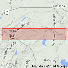
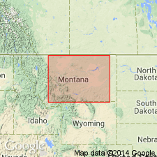
Exposed, together with underlying and overlying formations, on Two Medicine River between its mouth and Family Post Office, Blackfeet Indian Reservation, Pondera and Glacier Counties, Montana (Sweetgrass arch) [approx. from NW/4 NW/4 sec. 2, T. 31 N., R. 5 W., Abbott Lake 7.5-min quadrangle, to NW/4 NW/4 sec. 2, T. 31 N., R. 9 W., Piegan 7.5-min quadrangle; Lat. 48 deg. 28 min. 50 sec. N., Long. 112 deg. 13 min. 45 sec. W. to Lat. 48 deg. 28 min. 55 sec. N., Long. 112 deg. 44 min. 40 sec. W. (from USGS GNIS database and ACME Mapper 2.0, accessed February 22, 2009)].
[GNC remark (ca. 1938, US geologic names lexicon, USGS Bull. 896, p. 2204): Does not extend east as far as Sweetgrass Hills, where a different rock classification is now used.]
Source: US geologic names lexicon (USGS Bull. 896, p. 2204).
- Usage in publication:
-
- Two Medicine Formation
- Modifications:
-
- Revised
- Overview
- AAPG geologic province:
-
- Montana folded belt
Summary:
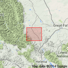
Is mapped as formation in Montana Group in Lewis and Clark Co, MT in Montana folded belt province. Revised along western margin of Disturbed Belt in that the Big Skunk Formation (new), comprised of 2,100 ft of volcanic-rich, arkosic sedimentary rock, occupies the upper two-thirds of the Two Medicine stratigraphic interval. Two Medicine-Big Skunk contact drops stratigraphically from northeast to southwest across the Dearborn River zone of the Disturbed Belt as the Big Skunk thickens at the expense of the Two Medicine. Is divided into three units: a lower sandy facies, a middle shale-mudstone facies, and an upper tongue. Only the lower sandy facies is present in the Dearborn River zone. Gradational lower contact with Virgelle Sandstone. Upper contact with the Big Skunk is a widespread disconformity in the Dearborn River zone with breccia-filled channels along the contact. Fossils include brackish- and fresh-water pelecypods and gastropods of early Montana age in the lower sandy facies. Age is Late Cretaceous.
Source: GNU records (USGS DDS-6; Denver GNULEX).
- Usage in publication:
-
- Two Medicine Formation*
- Modifications:
-
- Overview
- AAPG geologic province:
-
- Sweetgrass arch
- Montana folded belt
Summary:
Is formation differentiated into western and eastern facies in Lewis and Clark Co, MT (Montana folded belt province) and Cascade Co, MT (Sweetgrass arch). Overlies Virgelle Sandstone; underlies St. Mary River Formation. Western facies (divided into five map units) consists of a lower sedimentary member 340 ft thick and an upper volcanic member (equivalent to the Big Skunk Formation of Viele and Harris, 1965) about 1,525 ft thick. Volcanic member comprised of clastic volcanic rocks in lower part, 400 ft thick; latite flows, 550 ft thick; ash-flow tuffs, 475 ft thick; and clastic volcanic rocks in upper part, about 100 ft thick. Eastern facies consists of interbedded sandstone, siltstone, mudstone, and volcanic material and is mapped as single unit about 1,950 ft thick with tripartite division: lower part (equivalent to sedimentary member of western facies), about 400 ft thick; middle part, about 950 ft thick; and upper part, about 600 ft thick. Ash-fall tuff mapped locally in eastern facies 550 ft above base is probably equivalent to ash-flow tuff in western facies. Detailed lithologic descriptions given for all map units. Age is Late Cretaceous.
Source: GNU records (USGS DDS-6; Denver GNULEX).
- Usage in publication:
-
- Two Medicine Formation*
- Modifications:
-
- Overview
- AAPG geologic province:
-
- Montana folded belt
Summary:
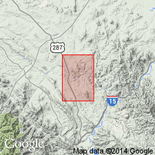
Is uppermost formation of Montana Group in Lewis and Clark Co, MT in vicinity of Dearborn River in Montana folded belt province. Overlies Virgelle Sandstone of Montana Group; underlies St. Mary River Formation. Consists of nonmarine volcanic-rich rocks as much as 2,500 ft thick locally interbedded with welded tuff, ash, or bentonite as thick as 200 ft. Estimated rate of deposition based on enclosing datable marine strata indicates a rate of 160 ft per million years. Facies relationships with equivalent rocks in MT as far east as Porcupine dome shown on fig. 9. Age is Campanian (Late Cretaceous) based on enclosing datable marine strata.
Source: GNU records (USGS DDS-6; Denver GNULEX).
- Usage in publication:
-
- Two Medicine Formation*
- Modifications:
-
- Overview
- AAPG geologic province:
-
- Sweetgrass arch
Summary:
Is formation [of Montana Group] in subsurface of Kevin-Sunburst dome, Glacier Co, MT on Sweetgrass arch. Overlies Virgelle Sandstone; underlies Bearpaw Shale. Is as much as 1,780 ft thick in dry and abandoned well, Montalban 1 Don Wilson, NW1/4 SW1/4 sec 27, T36N, R9W, Glacier CO, MT. Ardmore Bentonite Bed occurs about 290 ft above base of formation in this well and is assigned to Two Medicine Formation west of Sweetgrass arch in northwest MT. Using Ardmore as datum, stratigraphic sections show Two Medicine to be equivalent (in part) to Eagle Sandstone, Claggett Shale, Judith River Formation, and Bearpaw Shale as encountered in subsurface toward the east. Age is Late Cretaceous.
Source: GNU records (USGS DDS-6; Denver GNULEX).
For more information, please contact Nancy Stamm, Geologic Names Committee Secretary.
Asterisk (*) indicates published by U.S. Geological Survey authors.
"No current usage" (†) implies that a name has been abandoned or has fallen into disuse. Former usage and, if known, replacement name given in parentheses ( ).
Slash (/) indicates name conflicts with nomenclatural guidelines (CSN, 1933; ACSN, 1961, 1970; NACSN, 1983, 2005, 2021). May be explained within brackets ([ ]).