The National Geologic Map Database is migrating to a new infrastructure. We apologize for any service disruptions during this process.
|
|---|


- Usage in publication:
-
- Twin Knobs Formation*
- Modifications:
-
- Named
- Dominant lithology:
-
- Sandstone
- Limestone
- Quartzite
- Claystone
- AAPG geologic province:
-
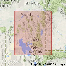
- Snake River basin
Summary:
Named for Twin Knobs, sec 12, T10S, R38E, Bannock Co, ID, Snake River basin. A belt of faulted exposures from crest to east slope of Portneuf Range from sec 1, T10S, R38E to sec 29, T10S, R39E is type area. Type section is in SW1/4 sec 7, T10S, R39E. Divisible into: 1) brown sandstone and limestone member (base) an interbedded sandstone (tan to buff, usually fine grained, ranging from very fine to medium, calcitic, moderately well sorted, dominantly quartz, locally muddy, some gentle crossbeds and ripple marks, some bedding surfaces argillaceous or micaceous), limestone (which may be sandy, oolitic, some layers cross-bedded, Girvanella-bearing, fine grained to medium to coarsely bioclastic, thin bedded medium to dark gray to black), and quartzite (mostly in lower part, is green, fine to very fine grained, in beds up to 1 ft thick, locally cross-bedded); 2) middle member a green, finely interlaminated to thinly interbedded claystone, sandstone, and limestone in equal proportions totals about 20 ft thick; and 3) upper member prominent ledges of Girvanella-bearing gray subaphanitic limestone, some layers oolitic, some pink, red and tan siltstone and sandstone beds. Is 590 ft thick at type section. Thins to southeast to about 40 ft thick. Overlies and intertongues with Sedgwick Peak Quartzite (new) of Brigham Quartzite; underlies Lead Bell Shale (new). Is of early Middle Cambrian age (stratigraphic position).
Source: GNU records (USGS DDS-6; Denver GNULEX).
For more information, please contact Nancy Stamm, Geologic Names Committee Secretary.
Asterisk (*) indicates published by U.S. Geological Survey authors.
"No current usage" (†) implies that a name has been abandoned or has fallen into disuse. Former usage and, if known, replacement name given in parentheses ( ).
Slash (/) indicates name conflicts with nomenclatural guidelines (CSN, 1933; ACSN, 1961, 1970; NACSN, 1983, 2005, 2021). May be explained within brackets ([ ]).