The National Geologic Map Database is migrating to a new infrastructure. We apologize for any service disruptions during this process.
|
|---|


- Usage in publication:
-
- Tutu Formation
- Modifications:
-
- Overview
- Revised
- Biostratigraphic dating
- AAPG geologic province:
-
- Caribbean region
Summary:
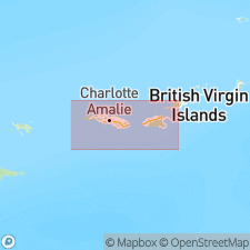
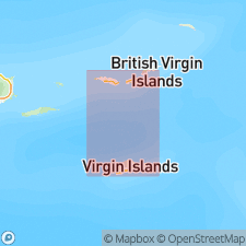
Tutu Formation consists of an interbedded sequence of fine- to coarse-grained volcanic wackes. Type locality is Tutu Bay, northeastern St. Thomas, VI, where excellent exposures are found along cliffs on northwest side and along new road cuts on east side. Occurs on Outer Brass Island (offshore northern St. Thomas), in northeastern St. Thomas from Picara Point to Coki Point, on Thatch Cay, Grass Cay, Mingo Cay, and Lovango Cay, and on St. John from Maho Bay to Leinster Point. Also occurs on island of Tortola, British VI. Contains the Coki Point Megabreccia lithofacies [informal] which consists of limestone, volcanic megabreccia, and submarine mudflow. Megabreccia consists of limestone blocks, porphyritic andesite boulders, and fragments of wacke. Occurs in spectacular outcrops from Coki Point westward to Spring Bay and may be seen elsewhere on both St. Thomas and St. John. Limestone in Coki Point unit contains neritic fauna of gastropods, pelecypods, echinoids, and corals, all representative of Late Cretaceous time. On basis of the pelecypod CAPRINULOIDEA, the assemblage is probably Albian. Congo Cay Limestone Member present only on Congo Cay, an island offshore northwest St. John (but also appears on Tortola). It is unclear as to its age and true assignment to Tutu. Exposed thickness of Tutu is 6,000 ft. Overlies Outer Brass Limestone; upper contact is not exposed in U.S. VI. Age of Tutu is Late Cretaceous.
Source: GNU records (USGS DDS-6; Reston GNULEX).
- Usage in publication:
-
- Tutu Formation*
- Modifications:
-
- Overview
- AAPG geologic province:
-
- Caribbean region
Summary:
Author follows usage of Donnelly (1959, 1966) for the rocks on St. Thomas and St. John, VI. They include (ascending) the Early Cretaceous Water Island Formation and the Late Cretaceous Louisenhoj Formation, Outer Brass Limestone, Tutu Formation (with its informal Coki Point Megabreccia lithofacies and Congo Cay Limestone Member of Donnelly, 1959), and Hans Lollik Formation. Five felsic rocks from Water Island Formation, dated by Michael Diggles (U.S. Geological Survey) using K-Ar whole rock techniques, yielded a range from 65.8+/-2.9 to 30.9+/-0.3 Ma. Two rocks from Louisenhoj Formation also were dated using K-Ar techniques by Diggles and yielded a range from 42.1+/-0.6 to 37.7+/-1.1 Ma. [Final version of this report incorrectly implies formal acceptance of the name Congo Cay in figures and some parts of text. It cannot be considered a formal member of the Tutu because it was named in Donnelly's unpublished Ph.D. thesis of 1959 and no naming paper has been published since then.--edk 95/03/07]
Source: GNU records (USGS DDS-6; Reston GNULEX).
For more information, please contact Nancy Stamm, Geologic Names Committee Secretary.
Asterisk (*) indicates published by U.S. Geological Survey authors.
"No current usage" (†) implies that a name has been abandoned or has fallen into disuse. Former usage and, if known, replacement name given in parentheses ( ).
Slash (/) indicates name conflicts with nomenclatural guidelines (CSN, 1933; ACSN, 1961, 1970; NACSN, 1983, 2005, 2021). May be explained within brackets ([ ]).