

- Usage in publication:
-
- Tuscaloosa formation*
- Modifications:
-
- Named
- Dominant lithology:
-
- Sand
- Clay
- Gravel
- AAPG geologic province:
-
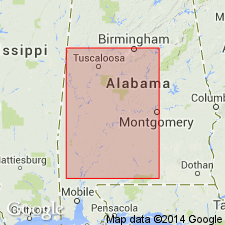
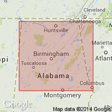
- Black Warrior basin
- Mid-Gulf Coast basin
Summary:
Tuscaloosa formation is here described as irregularly or obscurely bedded quartzitic and micaceous sands, of yellowish, gray, pink, and light-purple colors, often cross-stratified; interbedded with heterogeneous clays, of mottled, purple, and gray colors, sometimes carbonaceous or lignitiferous; also lenticular pebble beds (pebbles commonly of chert) and discontinuous lignitic layers. No fossils except lignite and leaf impressions. Thickness probably 1,000 ft. Rests unconformably on eroded surface of Carboniferous or other Paleozoic rocks. Underlies Eutaw formation. Of undetermined age, but probably Cretaceous.
Source: GNU records (USGS DDS-6; Reston GNULEX).

- Usage in publication:
-
- Tuscaloosa formation*
- Modifications:
-
- Overview
- Areal extent
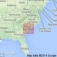
- AAPG geologic province:
-
- Atlantic Coast basin
Summary:
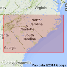
In eastern SC and in NC, the Tuscaloosa is overlain by Black Creek formation (Late Cretaceous). It is possible (according to L.W. Stephenson and C.W. Cooke, oral commun.) that in these States, beds older than the Tuscaloosa may in the future be differentiated from the deposits now called by that name. In SC, the Tuscaloosa replaces the Middendorf formation (abandoned) and in NC it replaces the Cape Fear formation (abandoned).
Source: GNU records (USGS DDS-6; Reston GNULEX).
- Usage in publication:
-
- Tuscaloosa formation*
- Modifications:
-
- Overview
- AAPG geologic province:
-
- Atlantic Coast basin
Summary:
Tuscaloosa formation is now thought to include all strata of Late Cretaceous age exposed at surface in SC below Black Creek formation, but it is possible that beds older than the Tuscaloosa may some day be differentiated from these deposits in NC and SC. Term Tuscaloosa is herein substituted for name Middendorf formation as used by Cooke (1926, USGS Prof. Paper 140-E). Sand and gravel like those of Tuscaloosa formation and doubtless of same age make up at least the greater part of Cape Fear formation of NC, which is now designated "Tuscaloosa," although it is possible that beds older than typical Tuscaloosa may be included in it. In SC, the Tuscaloosa rests directly on crystalline rocks of the Piedmont without interposition of older Cretaceous deposits. Time interval represented by this unconformity includes all of Triassic, Jurassic, and Early Cretaceous time, probably much of Paleozoic time, and perhaps the early part of the Late Cretaceous.
Source: GNU records (USGS DDS-6; Reston GNULEX).

- Usage in publication:
-
- Tuscaloosa formation
- Modifications:
-
- Revised
- AAPG geologic province:
-
- Black Warrior basin
Summary:
Series of beds now called "Tuscaloosa formation" can be subdivided into two formations. In this report these beds are referred to as lower Tuscaloosa and upper Tuscaloosa. There appears to be a major unconformity between the two with the lower wedging out updip and being overlapped by upper. It would probably be logical to restrict term "Tuscaloosa" to those beds that are here assigned to upper Tuscaloosa, and give new name to lower beds, but name is not proposed in this report.
Source: GNU records (USGS DDS-6; Reston GNULEX).
- Usage in publication:
-
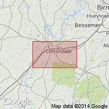
- Tuscaloosa group*
- Modifications:
-
- Revised
- AAPG geologic province:
-
- Black Warrior basin
Summary:
Tuscaloosa raised in rank to Tuscaloosa Group and subdivided into (ascending) Cottondale, Eoline, Coker, and Gordo formations (all new names). Overlies undifferentiated Paleozoic rocks; underlies McShan formation.
Source: GNU records (USGS DDS-6; Reston GNULEX).
- Usage in publication:
-
- Tuscaloosa formation
- Modifications:
-
- Areal extent
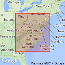
- AAPG geologic province:
-
- Atlantic Coast basin
Summary:
In SC, plant-bearing beds of upper part of Cooke's (1936) Tuscaloosa formation are reassigned to Middendorf member of Black Creek formation, and are shown to be equivalent in age to lower Black Creek formation of NC. Name "Tuscaloosa" is abandoned for beds in both NC and SC, which are here referred to "Lower Cretaceous? (undifferentiated)."
Source: GNU records (USGS DDS-6; Reston GNULEX).
- Usage in publication:
-
- Tuscaloosa group*
- Modifications:
-
- Revised
- AAPG geologic province:
-
- Black Warrior basin
Summary:
Group contains only two units of formational rank--lower unit, Coker formation, which is redefined to include all beds of pre-Gordo Tuscaloosa age, and upper unit, Gordo formation. Name Cottondale is abandoned. Eoline is reduced in rank to member of Coker formation.
Source: GNU records (USGS DDS-6; Reston GNULEX).
- Usage in publication:
-
- Tuscaloosa formation*
- Modifications:
-
- Areal extent
- AAPG geologic province:
-
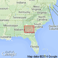
- South GA-North FL sedimentary province
Summary:
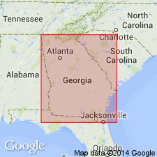
Tuscaloosa formation in GA consists generally of coarse to gravelly and arkosic sand, and of subordinate beds of mottled clay and silt. Average thickness 250 ft. Overlies crystalline rocks; underlies Eutaw formation. Formation crops out in gradually narrowing east-northeastward-trending belt from Chattahoochee River near Columbus to Ocmulgee River near Macon. Belt is about 11 mi wide in Chattahoochee River valley, 6 mi wide in Flint River valley, and 5 mi wide at Ocmulgee River.
Source: GNU records (USGS DDS-6; Reston GNULEX).
- Usage in publication:
-
- Tuscaloosa formation
- Modifications:
-
- Areal extent
- Overview
- AAPG geologic province:
-
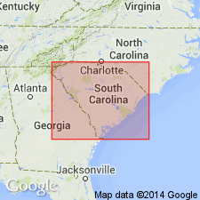
- Atlantic Coast basin
Summary:
Tuscaloosa formation in SC consists typically of light-gray, white, or buff arkosic sand gravel interbedded with white, pink, brown, or purple clay. Formation broken by many local unconformities. Thickness ranges from 0 to 800 ft. Crops out in belt gradually widening from 10 to 40 miles, extending in northeasterly direction from Aiken Co. to Marlboro Co. Map shows Tuscaloosa underlies Black Creek formation.
Source: GNU records (USGS DDS-6; Reston GNULEX).
- Usage in publication:
-
- Tuscaloosa formation
- Modifications:
-
- Areal extent
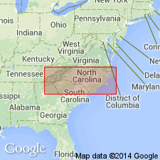
- Overview
- AAPG geologic province:
-
- Atlantic Coast basin
Summary:
Unit described and mapped in NC where it is oldest recognized formation exposed at surface in Coastal Plain. Underlies Black Creek formation. In some areas, covered by younger sediments of unknown age. Main outcrop lies along western part of Coastal Plain and extends southwestward from Neuse River.
Source: GNU records (USGS DDS-6; Reston GNULEX).
- Usage in publication:
-
- Tuscaloosa Formation*
- Modifications:
-
- Areal extent
- AAPG geologic province:
-
- Atlantic Coast basin
Summary:
Tuscaloosa Formation no longer used in updip areas of NC and SC. Its rocks are now assigned to the Cape Fear Formation (reinstated here) and the unconformably overlying Middendorf Formation. [It follows that the Tuscaloosa is also restricted from VA.]
Source: GNU records (USGS DDS-6; Reston GNULEX).
- Usage in publication:
-
- Tuscaloosa Group
- Modifications:
-
- Overview
- AAPG geologic province:
-
- Black Warrior basin
Summary:
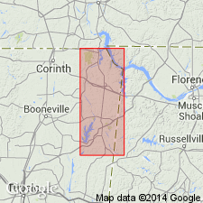
All Cretaceous strata above the Paleozoic rocks and below the Eutaw Group are mapped and described in this report as the Tuscaloosa Group. Tuscaloosa that underlies Tishomingo Co. is primarily composed of chert gravel, sand, and clay lithologies equivalent to the western lithofacies as defined by Marcher and Stearns (1962). Exposures of the Gordo Formation equivalent gravels are limited to areas along the eastern county boundary south of U.S. Rte 72. Coker Formation does not occur in Tishomingo Co. The thickest of Tuscaloosa exposures in the study area occurs in a gravel pit 1.5 mi south of Rte 72. Here 20 ft of quartz-bearing gravels in a quartz sand matrix are overlain by 185 ft of sand, clay, and chert gravel. Group attains 418 ft in the subsurface of west-central Tishomingo Co.
Source: GNU records (USGS DDS-6; Reston GNULEX).

- Usage in publication:
-
- Tuscaloosa Group
- Modifications:
-
- Overview
- AAPG geologic province:
-
- Mid-Gulf Coast basin
- Black Warrior basin
Summary:
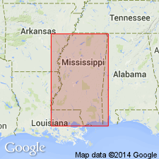
Tuscaloosa Group is composed primarily of clay, sand, and gravel. In easternmost AL, the Tuscaloosa undifferentiated is composed of poorly sorted kaolinitic, arkosic sand and gravel and interbedded yellowish-orange to reddish-green mottled kaolinitic clay. The unit is present in the subsurface of south AL and crops out along the northern limit of the Coastal Plain. Updip, the group is composed of the Coker and Gordo Formations. Downdip the Tuscaloosa is informally divided into lower, middle (marine), and upper units. In outcrop, the Tuscaloosa Group is from 600 to 900 ft thick in western AL and thins to 300 ft or less in eastern AL. From east to west in the subsurface, thickness ranges form 600 to 1,210 ft. Unconformably underlies Eutaw Formation; unconformably overlies Washita and Fredericksburg Groups. Age is Late Cretaceous (Cenomanian, Turonian, and Coniacian?)
Source: GNU records (USGS DDS-6; Reston GNULEX).
- Usage in publication:
-
- Tuscaloosa Formation
- Modifications:
-
- Overview
- AAPG geologic province:
-
- Black Warrior basin
Summary:
Gravels mapped as Tuscaloosa in Tishomingo Co., MS, southwestern TN, and northwestern AL are actually two distinct lithic units of different age. Lower gravels are chert gravel in a quartz sand matrix that can be traced southeast into the Gordo Formation. Upper chert gravel, with rare lenses of chert sand and kaolinitic clay unconformably overlies the lower unit and is best developed to the north in Tishomingo Co. This upper gravel is probably equivalent to the McShan Formation.
Source: GNU records (USGS DDS-6; Reston GNULEX).
- Usage in publication:
-
- "Tuscaloosa Formation"
- Modifications:
-
- Revised
- AAPG geologic province:
-
- South Georgia sedimentary province
Summary:
The "Tuscaloosa Formation" of western GA is included at the base of the newly named Oconee Group. According to authors, the "Tuscaloosa" has traditionally been correlated with the Tuscaloosa Group of AL (which does not crop out in GA) and is considered to be late Cenomanian in age in this report. The type Tuscaloosa is not a component of the Oconee, a massive sand apron that encompasses all of the pre-Upper Eocene, or pre-Barnwell Group kaolin and kaolinitic sand deposits of fluvial origin in the Fort Valley Plateau and the Fall Line Hills districts of the Coastal Plain of GA. The "Tuscaloosa" unconformably underlies the Pio Nono Formation (new).
Source: GNU records (USGS DDS-6; Reston GNULEX).
- Usage in publication:
-
- Tuscaloosa(?) Formation
- Modifications:
-
- Overview
- AAPG geologic province:
-
- Illinois basin
Summary:
Unit in the study area is a chert gravel that is partly silica-cemented and contains predominantly rounded chert clasts derived from the Clear Creek Chert. Unconformably overlies the Clear Creek Chert and the Dutch Creek Sandstone Member of the Grand Tower Limestone in the area west of Elco.
Source: GNU records (USGS DDS-6; Reston GNULEX).
For more information, please contact Nancy Stamm, Geologic Names Committee Secretary.
Asterisk (*) indicates published by U.S. Geological Survey authors.
"No current usage" (†) implies that a name has been abandoned or has fallen into disuse. Former usage and, if known, replacement name given in parentheses ( ).
Slash (/) indicates name conflicts with nomenclatural guidelines (CSN, 1933; ACSN, 1961, 1970; NACSN, 1983, 2005, 2021). May be explained within brackets ([ ]).