

- Usage in publication:
-
- Tuna Canyon Formation*
- Modifications:
-
- Named
- Dominant lithology:
-
- Sandstone
- AAPG geologic province:
-
- Transverse Ranges province
Summary:
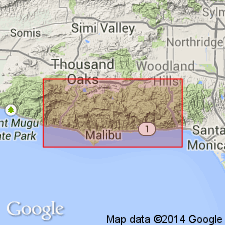
Type locality designated as Tuna Canyon sec.30 T1S R16W, Santa Monica Mountains, west-central Topanga quad, Los Angeles Co, CA. Replaces Chico Formation (now geographically restricted from coastal southern California). Tuna Canyon Formation is geographically restricted to area north of Malibu Coast fault. Consists of arkosic sandstone 800 m thick. Described as fossiliferous, thick-bedded, graded, laminated, coarse-grained turbidite. Base is not exposed in mapped area; inferred from exposures to northeast to overlie Santa Monica Slate or Late Cretaceous conglomerates. Disconformably(?) underlies Coal Canyon Formation, or locally, intervening Simi(?) Conglomerate. Is Late Cretaceous age.
Source: GNU records (USGS DDS-6; Menlo GNULEX).
For more information, please contact Nancy Stamm, Geologic Names Committee Secretary.
Asterisk (*) indicates published by U.S. Geological Survey authors.
"No current usage" (†) implies that a name has been abandoned or has fallen into disuse. Former usage and, if known, replacement name given in parentheses ( ).
Slash (/) indicates name conflicts with nomenclatural guidelines (CSN, 1933; ACSN, 1961, 1970; NACSN, 1983, 2005, 2021). May be explained within brackets ([ ]).