- Usage in publication:
-
- Trujillo formation*
- Modifications:
-
- Named
- Dominant lithology:
-
- Sandstone
- Conglomerate
- AAPG geologic province:
-
- Amarillo arch
- Palo Duro basin
Summary:
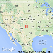
Named as upper formation of Dockum group from Trujillo Creek in Oldham Co, TX. No type locality designated. Occurs in the Panhandle of TX in Palo Duro Canyon and on Canadian River, as well as on the creeks tributary to both streams, Amarillo arch and Palo Duro basin. Lower member of the Trujillo is a persistent ledge of massive sandstone which in most places is fine grained and massive, but in a few places becomes cross-bedded and conglomeratic; is mostly gray or brown; has maximum thickness of 60-75 ft in Palo Duro Canyon and on Canyon Cita Creek; well exposed as a precipitous cliff. Middle sandstone, which is a very persistent ledge of sandstone and conglomerate, consists either or coarse, heavy, cross-bedded, red or gray sandstone, or cross-bedded lenticular conglomerate with pockets and lenses of clay; averages 10-60 ft thick. Upper sandstone is brown to gray, coarse, cross-bedded sandstone or conglomerate with pockets and lenses of clay; averages 30 ft thick. Formation ranges from 45 ft thick at mouth of Trujillo Creek to 210 ft thick on North Branch of North Canyon of Cita Creek. Overlies Tecovas formation (new) of Dockum group; unconformably underlies the Tertiary. Geologic map; measured sections; cross sections. Dockum mapped as an undivided unit. Because of fossils found characteristic of the Triassic period, this formation considered of Triassic age.
Source: GNU records (USGS DDS-6; Denver GNULEX).
- Usage in publication:
-
- Trujillo Formation
- Modifications:
-
- Areal extent
- Mapped 1:250k
- Dominant lithology:
-
- Conglomerate
- Sandstone
- Shale
- AAPG geologic province:
-
- Palo Duro basin
- Amarillo arch
Summary:
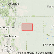
Is Upper Triassic formation in Dockum Group, mapped east of vicinity of Logan, Quay Co, NM along Canadian River drainage in Quay Co, NM and Oldham and southeastern Hartley Cos, TX (Palo Duro basin) and western Potter and southwesternmost Moore Cos, TX (Amarillo arch). Overlies Tecovas Formation of Dockum Group; overlain by Chinle Formation of Dockum Group. Map unit described as conglomerate, sandstone, and shale. Conglomerate, sandy, composed of granules and pebbles of quartz, limestone, sandstone, siltstone, minor chert, and fragments of petrified wood, massive, gray, brown. Sandstone, conglomeratic, fine to coarse grains of quartz and limestone, micaceous, calcareous locally, cross-bedded to massive, gray, greenish-gray, brown. Shale, micaceous, occurs as thin interbeds, gray and red. Forms scarp. Thickness 75 ft, truncated locally.
Source: GNU records (USGS DDS-6; Denver GNULEX).
- Usage in publication:
-
- Trujillo Member
- Modifications:
-
- Revised
- AAPG geologic province:
-
- Permian basin
Summary:
Rank reduced in Permian basin; assigned as the lower member of Dockum Formation in Garza and Crosby Cos, TX in the Permian basin. Upper contact revised in that Trujillo underlies the newly named Cooper Member of Chinle. New name replaces application of Chinle Formation to rocks above Trujillo. Term Chinle not used for a part of Dockum because it is thought to be equivalent to the entire Dockum. Late Triassic, Carnian age.
Source: GNU records (USGS DDS-6; Denver GNULEX).
- Usage in publication:
-
- Trujillo Formation
- Modifications:
-
- Revised
- Areal extent
- AAPG geologic province:
-
- Palo Duro basin
Summary:
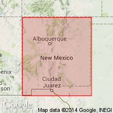
Name applied to rocks conformably above the newly named Garita Creek Formation and below the Bull Canyon Formation in east-central NM, Palo Duro basin. Upper contact with Bull Canyon. Is part of a sequence that was assigned to the Chinle Formation in many earlier reports. Name also applied to rocks named Cuervo Member by Kelley, 1972, but name Cuervo not perpetuated because it is a much later name than the Trujillo (Gould, 1907). Term Chinle considered to be a Colorado Plateau name applied to rocks deposited in a different basin than the Upper Triassic rocks of east-central NM; name Chinle not used in east-central NM. Nomenclature chart. Late Triassic age.
Source: GNU records (USGS DDS-6; Denver GNULEX).
- Usage in publication:
-
- Trujillo Formation
- Modifications:
-
- Areal extent
- AAPG geologic province:
-
- Palo Duro basin
- Las Vegas-Raton basin
Summary:
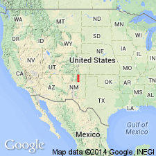
Is the most pervasive and easily recognized Triassic unit in the Sangre de Cristo Mountains. Is recognized from Montezuma Gap, San Miguel Co, Palo Duro basin north to Ricardo Creek in northern Colfax Co, Las Vegas-Raton basin. Varies from 11.9 to 58.0 m thick. Characterized by olive, yellow, or gray, trough cross-bedded or laminar quartzose sandstone, and limestone- or siltstone-pebble conglomerate. Forms prominent hogbacks. Easily distinguished from underlying Garita Creek Formation and from overlying Bull Canyon Formation, both of which are dominated by red mudstone. Nomenclature chart. Cross sections. Of Norian, Late Triassic age in this report. Rocks assigned to Trujillo by these authors have been assigned to all or parts of the Chinle, Santa Rosa, and Johnson Gap Formations by previous authors. Identified in measured sections at La Cueva in Mora Co and at Rayado, Uracca, and Ricardo Creeks in Colfax Co.
Source: GNU records (USGS DDS-6; Denver GNULEX).
For more information, please contact Nancy Stamm, Geologic Names Committee Secretary.
Asterisk (*) indicates published by U.S. Geological Survey authors.
"No current usage" (†) implies that a name has been abandoned or has fallen into disuse. Former usage and, if known, replacement name given in parentheses ( ).
Slash (/) indicates name conflicts with nomenclatural guidelines (CSN, 1933; ACSN, 1961, 1970; NACSN, 1983, 2005, 2021). May be explained within brackets ([ ]).

