The National Geologic Map Database is migrating to a new infrastructure. We apologize for any service disruptions during this process.
|
|---|


- Usage in publication:
-
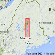
- Trout Valley Formation
- Modifications:
-
- Named
- Dominant lithology:
-
- Shale
- Siltstone
- Sandstone
- Conglomerate
- AAPG geologic province:
-
- New England province
Summary:
Probably named for Trout Brook valley. Crops out over an area about 1.5 by 8 mi. Consists of predominantly clastic rocks, mainly a heterogeneous assemblage of light-bluish-gray to black shale, siltstone, sandstone, and conglomerate; includes small amount of black sideritic ironstone and sandstone. Maximum exposed thickness of 1000 ft. To the north and west, abuts high-angle normal fault and is on downthrown side of fault. To the south and east, unconformably overlies series of felsite lavas, tuffs, and welded tuff called Traveller rhyolite by Toppan (1932). Plant fossils described. Age is Early Devonian.
Source: GNU records (USGS DDS-6; Reston GNULEX).
- Usage in publication:
-
- Trout Valley Formation*
- Modifications:
-
- Overview
- AAPG geologic province:
-
- New England province
Summary:
Used as Trout Valley Formation of Devonian (Emsian and Eifelian) age on stratigraphic section (fig. 2) only.
Source: GNU records (USGS DDS-6; Reston GNULEX).
For more information, please contact Nancy Stamm, Geologic Names Committee Secretary.
Asterisk (*) indicates published by U.S. Geological Survey authors.
"No current usage" (†) implies that a name has been abandoned or has fallen into disuse. Former usage and, if known, replacement name given in parentheses ( ).
Slash (/) indicates name conflicts with nomenclatural guidelines (CSN, 1933; ACSN, 1961, 1970; NACSN, 1983, 2005, 2021). May be explained within brackets ([ ]).