

- Usage in publication:
-
- Trenton gravel
- Modifications:
-
- Original reference
- Dominant lithology:
-
- Gravel
- AAPG geologic province:
-
- Piedmont-Blue Ridge province
Summary:
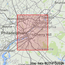
Pg. 296-309. Trenton gravel. The last and newest of all the gravels. Is an alluvial gravel, 0 to 100 feet thick. At Philadelphia lies close along the river and rises a few feet above it. Covers flat ground of Camden and lower part of Philadelphia and forms islands in the river. From its great development farther up the river is now called Trenton gravel. Age is Pleistocene.
Source: US geologic names lexicon (USGS Bull. 896, p. 2180).

- Usage in publication:
-
- Trenton gravel†
- Modifications:
-
- Abandoned
- AAPG geologic province:
-
- Atlantic Coast basin
Summary:
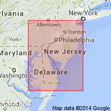
†Trenton gravel. Is a local development of Cape May formation, which name replaces it. Part of city of Trenton, New Jersey, is built on terrace covered with this gravel.
Source: US geologic names lexicon (USGS Bull. 896, p. 2180).
- Usage in publication:
-
- "Trenton Gravel"
- Modifications:
-
- Revised
- AAPG geologic province:
-
- Atlantic Coast basin
Summary:
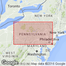
"Trenton Gravel" described as a very gravelly sand that crops out in a large area in the present Delaware River valley, particularly near Trenton. It is below the level of the Beacon Hill, the Bridgeton, and the Pensauken. Sand is distinct from all the previously described units, as it is an overall gray or pale reddish brown rather than the yellow or dark reddish brown of the Beacon Hill, the Bridgeton, and the Pensauken. The Trenton is subdivided into the Spring Lake beds and Van Sciver Lake beds. Spring Lake beds (graywacke 2 of Owens and Minard, 1975) have surface altitudes of 10.4-21 m and are present in the upper reaches of the lowland subprovince between Trenton, NJ, and Philadelphia, PA. Most of these deposits are within the Delaware River valley. Exposures of this unit within the Assunpink Valley are far and widely scattered. Typically, this formation consists of two lithologies--a lower yellow-brown gravelly sand, and an upper pale-reddish-gray to pale-gray gravelly sand. Salisbury and Knapp (1917) and MacClintock and Johnson (1956) considered the upper bed to be the Cape May Formation and the lower bed, the Pensauken Formation. Authors do not agree with these interpretations. Biostratigraphic dating of the beds yields a Sangamonian age. Exposures of the Van Sciver Lake beds (Graywacke 1 of Owens and Minard, 1975) are few because most of the unit is deeply buried. The best outcrops are in excavations in the upper Delaware River valley, particularly at Van Sciver Lake. The coarse gravel and sand within this unit are similar to those in the beds at Spring Lake. Downvalley the gravel content declines and the unit is mostly interbedded, thick-bedded clay-silt and cross-bedded sand. Biostratigraphic dating and the crosscutting relationship with the Spring Lake beds suggests a late Sangamonian age. Fig. 40 shows beds extending to DE along the Delaware Bay.
Source: GNU records (USGS DDS-6; Reston GNULEX).
- Usage in publication:
-
- Trenton Gravel
- Modifications:
-
- Reinstated
- Reference
- Dominant lithology:
-
- Sand
- AAPG geologic province:
-
- Piedmont-Blue Ridge province
Summary:
Trenton Gravel (reinstated) replaces Cape May Formation of earlier workers in PA. Reference section is pit at Penn Valley, Bucks Co., PA. Consists gray to pale-reddish-brown, very gravelly sand. Interbedded, cross-bedded sand and clay-silt layers. Deeply weathered; good aquifer; good sand for construction materials.
Source: GNU records (USGS DDS-6; Reston GNULEX).
For more information, please contact Nancy Stamm, Geologic Names Committee Secretary.
Asterisk (*) indicates published by U.S. Geological Survey authors.
"No current usage" (†) implies that a name has been abandoned or has fallen into disuse. Former usage and, if known, replacement name given in parentheses ( ).
Slash (/) indicates name conflicts with nomenclatural guidelines (CSN, 1933; ACSN, 1961, 1970; NACSN, 1983, 2005, 2021). May be explained within brackets ([ ]).