

- Usage in publication:
-
- Treasure Mountain latite
- Modifications:
-
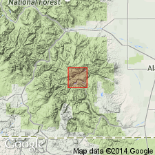
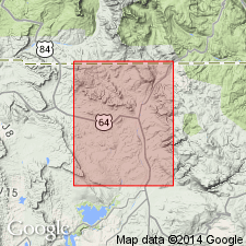
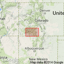
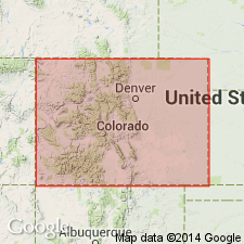
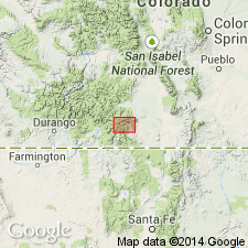
- Areal extent
- Dominant lithology:
-
- Latite
- AAPG geologic province:
-
- San Juan basin
- San Juan Mountains province
- San Luis basin
Summary:
(E.S. Larsen's 1917 provisional and field names for Summitville quadrangle), p. 20, 33-35. Treasure Mountain latite. Biotite latite, differing in several material respects from the other latites of Platoro-Summitville district, southern Colorado. Color varies from light- to dark-gray, but locally may be light- to dark-brown. Name Treasure Mountain not altogether satisfactory, and study of this formation to east may make change necessary. The name was used by Dr. E.S. Larsen in his field notes. Included in Potosi volcanic series. [Age is Miocene.]
Source: US geologic names lexicon (USGS Bull. 896, p. 2178).
- Usage in publication:
-
- Treasure Mountain latite*
- Modifications:
-
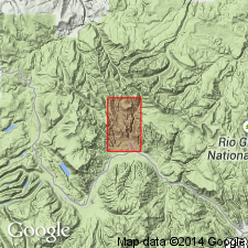
- Areal extent
- Dominant lithology:
-
- Latite
- AAPG geologic province:
-
- San Juan Mountains province
Summary:
Tbl. opp. p. 12. Treasure Mountain latite of Platoro-Summitville district is 1,000+ feet thick. [Age is Miocene.]
Named from exposures on Treasure Mountain, in northwest part of Summitville quadrangle, Summitville region, southern CO.
Source: US geologic names lexicon (USGS Bull. 896, p. 2178).
- Usage in publication:
-
- Treasure Mountain quartz latite*
- Modifications:
-
- Redefined
- Dominant lithology:
-
- Quartz latite
- AAPG geologic province:
-
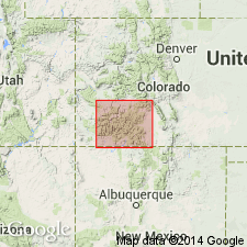
- San Juan basin
Summary:
[Credited to Larsen.] Changed name to Treasure Mountain quartz latite. [Age is Miocene.]
Source: US geologic names lexicon (USGS Bull. 896, p. 2178).

- Usage in publication:
-
- Treasure Mountain rhyolite
- Modifications:
-
- Redescribed
- Dominant lithology:
-
- Rhyolite
- AAPG geologic province:
-
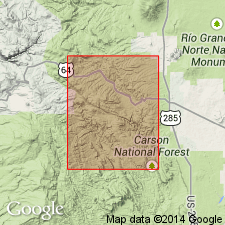
- San Juan Mountains province
Summary:
Pg. 13, 93 (table 18), 117-124. Described in San Juan region as Treasure Mountain rhyolite. Made up in most places of a series of alternating flows, welded tuffs, and tuff beds of rhyolite and rhyolitic quartz latite. Generally, flows and welded tuffs are 100 feet or less in thickness, but some are as much as 200 or 300 feet, and tuff layers are locally somewhat thicker. Present in three domes; thickness in central part of domes are: Conejos quadrangle, 1,500 feet; San Cristobal quadrangle, 1,200 feet; and Saguache quadrangle, 300 feet. Underlies Sheep Mountain quartz latite; overlies Conejos quartz latite; locally underlies Alboroto rhyolite or later formations of Potosi series; where directly overlain by Hinsdale formation, the two are separated by interval long enough to develop San Juan peneplain.
Source: US geologic names lexicon (USGS Bull. 1200, p. 3944-3945).
- Usage in publication:
-
- Treasure Mountain welded tuff
- Modifications:
-
- Redescribed
- Dominant lithology:
-
- Tuff
- AAPG geologic province:
-
- San Juan basin
Summary:
Pg. 38-42, pl. 1. Treasure Mountain welded tuff. A.P. Butler (1946, unpub. thesis) extended Treasure Mountain formation southward from Colorado into the upper Tusas Valley, Rio Arriba County, New Mexico (San Juan basin). Only mappable unit of this formation in Las Tablas quadrangle is the bipartite layer of welded tuff; hence in this report it is termed Treasure Mountain welded tuff. The lower welded tuff is dark-gray to black, mostly vitreous; both lithic and crystal fragments are faintly to markedly parallel to gross layering. The upper layer is pink to brick-red or olive-brown, dense, homogeneous, and fractures with a conchoidal pattern. Thickness 3 to 15 feet. Butler reported 100 feet. Is younger than the Conejos(?) formation and older than Biscara member of the Los Pinos formation. Age is Miocene.
Source: US geologic names lexicon (USGS Bull. 1200, p. 3944-3945); supplemental information from GNU records (USGS DDS-6; Denver GNULEX).

- Usage in publication:
-
- Treasure Mountain rhyolite*
- Modifications:
-
- Overview
- AAPG geologic province:
-
- San Juan Mountains province
Summary:
USGS currently [ca. 1960] designates the age of the Treasure Mountain rhyolite as middle or late Tertiary on the basis of an age change of Potosi volcanic group.
Source: US geologic names lexicon (USGS Bull. 1200, p. 3945).
- Usage in publication:
-
- Treasure Mountain rhyolite
- Modifications:
-
- Revised
- AAPG geologic province:
-
- San Juan basin
Summary:
Pg. 100-101. Trice (1957, unpub. thesis) subdivided Treasure Mountain rhyolite in Brazos Peak quadrangle into (ascending) Toltec andesite, Lagunitas clastic member, and Osier Mountain welded tuff. Upper two members crop out in Chamo quadrangle [this report].
Source: US geologic names lexicon (USGS Bull. 1200, p. 3944-3945).
- Usage in publication:
-
- Treasure Mountain Tuff*
- Modifications:
-
- Revised
- Redescribed
- AAPG geologic province:
-
- San Luis basin
Summary:
Name changed from Treasure Mountain Rhyolite to Treasure Mountain Tuff. Redescribed to include only those units at Treasure Mountain plus additional intertonguing tuffs farther south. Three large ash-flow sheets, mapped over nearly 5,000 km, are formally named in this report. Includes (in ascending order): unnamed lower tuff, La Jara Canyon Member (new), unnamed middle tuff, Ojito Creek Member (new), Ra Jadero Member (new), and unnamed upper tuff. Unconformably overlies Conejos Formation; unconformably underlies the tuff of Masonic Park. Age of La Jara Canyon Member is 29.8 m.y (Oligocene).
Source: Modified from GNU records (USGS DDS-6; Denver GNULEX); Changes in stratigraphic nomenclature, 1970 (USGS Bull. 1354-A, p. A26-A27).
- Usage in publication:
-
- Treasure Mountain Tuff*
- Modifications:
-
- Age modified
- AAPG geologic province:
-
- San Juan Mountains province
Summary:
Age changed from Oligocene --to-- late Oligocene. Considered part of /Potosi Volcanic Group† [Potosi Volcanic Group abandoned; see entry under Lipman and others (1973).]
Source: Changes in stratigraphic nomenclature, 1974 (USGS Bull. 1405-A, p. A22-A23).
- Usage in publication:
-
- Treasure Mountain Tuff*
- Modifications:
-
- Overview
- Revised
- AAPG geologic province:
-
- San Luis basin
- San Juan basin
- San Juan Mountains province
Summary:
Treasure Mountain Tuff. Treasure Mountain Tuff restricted; two quartz latite sheets previously included at the top of Treasure Mountain, now thought to be derived from the Mount Hope caldera, are reallocated to Masonic Park Tuff. Treasure Mountain Tuff includes La Jara Canyon, Ojito Creek, and Ra Jadero Members. Areal extent of the Treasure Mountain members in southwestern Colorado shown on distribution map; present in Archuleta County (San Juan basin), Conejos and Rio Grande Counties (San Luis basin), and Mineral County (San Juan Mountain province). Ash-flow activity began 30 to 29 m.y. ago when La Jara Canyon Member erupted from the Platoro caldera; caldera collapse began before eruptions were complete. Ojito Creek and Ra Jadero Members were erupted after the Platoro caldera moat was filled by lavas of the Summitville Andesite; the Summitville caldera occupies the northern part of Platoro caldera. Ages of the three members range from less than 29.8 to greater than 29.1 m.y.
Source: GNU records (USGS DDS-6; Denver GNULEX).
- Usage in publication:
-
- Treasure Mountain Group*
- Modifications:
-
- Revised
- AAPG geologic province:
-
- San Juan Mountains province
- San Juan basin
- San Luis basin
Summary:
Treasure Mountain Tuff is raised to group rank and divided into eight units (ascending): unnamed lower rhyolite tuff, Black Mountain Tuff (new), La Jara Canyon Tuff (rank raised), unnamed middle tuff, Ojito Creek Tuff (rank raised), Ra Jadero Tuff (rank raised), South Fork Tuff (new), and Chiquito Peak Tuff (new). Study area is within southeastern San Juan volcanic field, Archuleta County (San Juan basin), Mineral County (San Juan Mountain province), and Rio Grande and Conejos Counties (San Luis basin), southwestern Colorado. La Jara Canyon, Ojito Creek, and Ra Jadero raised to formation rank because they are as voluminous as some tuff sheets designated as formations elsewhere in San Juan field. Component units are ash-flow sheets erupted from multicyclic Platoro caldera complex during interval of 29.5 to 28.4 Ma (Oligocene).
Source: Modified from GNU records (USGS DDS-6; Denver GNULEX).
For more information, please contact Nancy Stamm, Geologic Names Committee Secretary.
Asterisk (*) indicates published by U.S. Geological Survey authors.
"No current usage" (†) implies that a name has been abandoned or has fallen into disuse. Former usage and, if known, replacement name given in parentheses ( ).
Slash (/) indicates name conflicts with nomenclatural guidelines (CSN, 1933; ACSN, 1961, 1970; NACSN, 1983, 2005, 2021). May be explained within brackets ([ ]).