

- Usage in publication:
-
- Trail beds
- Modifications:
-
- First used
- AAPG geologic province:
-
- Sierra Nevada province
Summary:
Geologic column of Taylorville [Taylorsville] region shows Trail beds to be 2900 ft thick and Late(?) Triassic age. Characteristic fossils have not been found; on structural grounds regarded as Triassic and probably younger than Hosselkus limestone.
Source: GNU records (USGS DDS-6; Menlo GNULEX).
- Usage in publication:
-
- Trail formation*
- Modifications:
-
- Named
- Dominant lithology:
-
- Shale
- Sandstone
- Conglomerate
- AAPG geologic province:
-
- Sierra Nevada province
Summary:
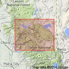
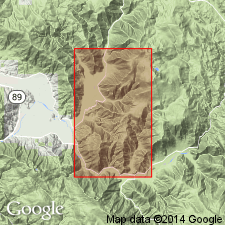
Well exposed along Hosselkus Creek on "the trail", Plumas Co, CA; hence the name. Occurs in two principal areas, one north of Genesee Valley and the other south. Consists largely of slaty shales with some interbedded sandstones and conglomerates. Shales are often purplish or red but more frequently gray with pencil structure locally developed; in places contain numerous cherty nodules of carbonate of lime. Sandstones are generally fine, often somewhat slaty, thin-bedded and gray to almost black. Unit contains fresh-water fossils. Thickness is 2900 ft. Unconformably overlies Swearinger slate, Hosselkus limestone, and Robinson formation. Is next older than marine Hardgrave sandstone with which it is assumed to be unconformable. Geologic column shows Jurassic age.
Source: GNU records (USGS DDS-6; Menlo GNULEX).
- Usage in publication:
-
- Trail formation
- Modifications:
-
- Revised
- AAPG geologic province:
-
- Sierra Nevada province
Summary:
[Author renamed basal Lower Jurassic "Trail formation" of Diller (1908) "Lilac sandstone"]. Trail formation (also referred to as Trail tuff and conglomerate) is next to youngest Jurassic formation in Taylorsville region. Occurs in Hosselkus Canyon, Forman Ravine, Cooks Canyon, and Evans Peak. Consists of alternating beds of conglomerate and fine tuff (100 ft or more thick). Tuff beds are chiefly gray in lower part of unit and red in upper part. Total thickness is over 2000 ft. Overlies Lucky S formation (new). Underlies Combe formation (new). Is late(?) Late Jurassic age.
Source: GNU records (USGS DDS-6; Menlo GNULEX).
- Usage in publication:
-
- Trail formation*
- Modifications:
-
- Age modified
- AAPG geologic province:
-
- Sierra Nevada province
Summary:
Shown on paleotectonic map as Early Jurassic age; underlies Hardgrave sandstone. [this is sequence of Diller, 1892, 1908]
Source: GNU records (USGS DDS-6; Menlo GNULEX).

- Usage in publication:
-
- Trail formation*
- Modifications:
-
- Age modified
- AAPG geologic province:
-
- Sierra Nevada province
Summary:
Traces changes in stratigraphic order and ages of units in Taylorsville region by Diller (1892, 1908) and Silberling (IN Reeside and others, 1957). Sequence accepted for this folio is (ascending): Trail formation, Swearinger slate, and Hosselkus limestone. Footnote states that McMath (1958, unpub. thesis) now doubts validity of data given to Silberling. Age given as Triassic.
Source: GNU records (USGS DDS-6; Menlo GNULEX).

- Usage in publication:
-
- Trail Formation*
- Modifications:
-
- Age modified
- AAPG geologic province:
-
- Sierra Nevada province
Summary:
Trail Formation provisionally assigned to Middle Jurassic (Callovian) on basis of stratigraphic relations. Unit could be in part younger than Callovian. Geologic column of Taylorsville area shows Trail Formation (2000 to 4000 ft of conglomerate and sandstone) overlies Lucky S Argillite [this is sequence of McMath (1966) based on Crickmay (1933)].
Source: GNU records (USGS DDS-6; Menlo GNULEX).
For more information, please contact Nancy Stamm, Geologic Names Committee Secretary.
Asterisk (*) indicates published by U.S. Geological Survey authors.
"No current usage" (†) implies that a name has been abandoned or has fallen into disuse. Former usage and, if known, replacement name given in parentheses ( ).
Slash (/) indicates name conflicts with nomenclatural guidelines (CSN, 1933; ACSN, 1961, 1970; NACSN, 1983, 2005, 2021). May be explained within brackets ([ ]).