The National Geologic Map Database is migrating to a new infrastructure. We apologize for any service disruptions during this process.
|
|---|


- Usage in publication:
-
- Tomhegan formation*
- Modifications:
-
- Named
- Biostratigraphic dating
- Dominant lithology:
-
- Sandstone
- Slate
- Quartzite
- Tuff
- Breccia
- AAPG geologic province:
-
- New England province
Summary:
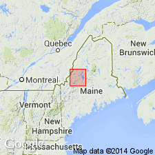
Named as formation in Moose River group after Tomhegan Cove on Moosehead Lake. Type section of upper main part is on west shore of Moosehead Lake between Blue Ridge on the south and Tomhegan Cove. Type section of lower Kineo volcanic member is on northeast side of Mount Kineo in northwest 1/4 of Moosehead Lake 15-min quad. Occurs in Somerset Co. and adjacent parts of Piscataquis Co., west-central ME. Upper main part consists of blue-gray, gray-weathering sandstone that contains scattered shell lenses; dark-blue, gray-weathering slate; blue-gray, rusty, dark-gray-weathering, argillaceous sandstone, and fine- to medium-grained quartzite. Thickness estimated to be about 6,000 ft. Lower part is Kineo volcanic member which consists of massive, conchoidally fracturing felsite; massive, irregularly fracturing felsite containing abundant garnet phenocrysts; and dark tuff, light tuff, volcanic conglomerate, and flow breccia. Thickness ranges from 0 to 4,000 ft. Lower contact of main part of Tomhegan with Kineo is not well exposed; overlies Tarratine formation where Kineo is absent; upper contact not described. Report includes geologic map and correlation chart. Age is Devonian (Onondaga and possibly Oriskany age) based on AMPHIGENIA and EODEVONARIA (both Onondaga) and GLOBOTHYRIS (Oriskany to early Onondaga).
Source: GNU records (USGS DDS-6; Reston GNULEX).

- Usage in publication:
-
- Tomhegan Formation*
- Modifications:
-
- Age modified
- Biostratigraphic dating
- AAPG geologic province:
-
- New England province
Summary:
Age of Tomhegan Formation refined to Emsian (early Schoharian) based on complex shelly fauna at one locality in Long Pond 15-min quad, and at 45 other localities in the Moose River synclinorium outside the map area to the east as shown by Boucot and Heath (1969). Includes separately mapped intrusive garnet rhyolite previously mapped either as unnamed garnet rhyolite or part of Kineo Volcanic Member by Boucot and Heath (1969); now considered to be equivalent to Kineo.
Source: GNU records (USGS DDS-6; Reston GNULEX).
For more information, please contact Nancy Stamm, Geologic Names Committee Secretary.
Asterisk (*) indicates published by U.S. Geological Survey authors.
"No current usage" (†) implies that a name has been abandoned or has fallen into disuse. Former usage and, if known, replacement name given in parentheses ( ).
Slash (/) indicates name conflicts with nomenclatural guidelines (CSN, 1933; ACSN, 1961, 1970; NACSN, 1983, 2005, 2021). May be explained within brackets ([ ]).