

- Usage in publication:
-
- Toano Limestone*
- Modifications:
-
- Named
- Biostratigraphic dating
- Dominant lithology:
-
- Limestone
- Mudstone
- AAPG geologic province:
-
- Great Basin province
Summary:
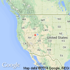
Named for Toano Range, Elko Co, NV. Type section designated as exposures about 4 km north of Silver Zone Pass, sec.4 T35N R68E, Silver Zone Pass 7.5' quad, west side of Toano Range, Elko Co, NV. Present in Toano Range, Pilot Range and southern Silver Island Mountains (Leppy Range), NV and UT. Predominant lithology is uniform-appearing, thin- to medium-bedded silty limestone and mudstone with color contrast between grayish-orange silty layers and medium-dark-gray lime mudstone. Is 850 m thick at type section. Contains Middle Cambrian fossils at type section from 300 m above base to uppermost 10 m (identified by A.R. Palmer, 1983, written commun.). Lower one-third of unit in Toano Range appears to be barren. Age is Middle Cambrian based on faunal evidence and presumed Middle Cambrian age of upper part of underlying Killian Springs Formation (new). Underlies Clifside Limestone (new) in Toano Range.
Source: GNU records (USGS DDS-6; Menlo GNULEX).
- Usage in publication:
-
- Toano Limestone*
- Modifications:
-
- Areal extent
- AAPG geologic province:
-
- Great Basin province
Summary:
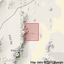
Toano Limestone geographically extended into report area [northern Pilot Range, Crater Island NW 7.5' quad, Box Elder Co, UT]. Age shown as Cambrian.
Source: GNU records (USGS DDS-6; Menlo GNULEX).
- Usage in publication:
-
- Toano Limestone*
- Modifications:
-
- Areal extent
- AAPG geologic province:
-
- Great Basin province
Summary:
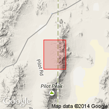
Toano Limestone geographically extended into report area [Pilot Range, Patterson Pass 7.5' quad]. Age given as Cambrian.
Source: GNU records (USGS DDS-6; Menlo GNULEX).
- Usage in publication:
-
- Toano Limestone*
- Modifications:
-
- Areal extent
- AAPG geologic province:
-
- Great Basin province
Summary:
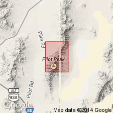
Toano Limestone geographically extended into report area [south Pilot Range]. Age given as Cambrian.
Source: GNU records (USGS DDS-6; Menlo GNULEX).
For more information, please contact Nancy Stamm, Geologic Names Committee Secretary.
Asterisk (*) indicates published by U.S. Geological Survey authors.
"No current usage" (†) implies that a name has been abandoned or has fallen into disuse. Former usage and, if known, replacement name given in parentheses ( ).
Slash (/) indicates name conflicts with nomenclatural guidelines (CSN, 1933; ACSN, 1961, 1970; NACSN, 1983, 2005, 2021). May be explained within brackets ([ ]).