

- Usage in publication:
-
- Tipton shale member*
- Modifications:
-
- Original reference
- Dominant lithology:
-
- Conglomerate
- Sandstone
- Shale
- Clay
- Limestone
- AAPG geologic province:
-
- Green River basin
Summary:
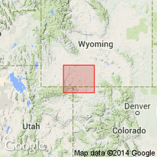
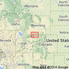
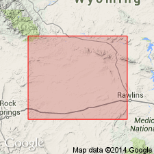
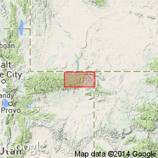
Tipton shale member of Green River formation. Thin fissile shale and sandstone; pronounced oolitic limestone (in places 20 to 50 feet thick) near base; also other oolitic and concretionary beds locally resembling huge oyster shells scattered on surface. Thickness 100 to 325 feet. Underlies Cathedral Bluffs red beds member of Green River formation and overlies Wasatch formation. Named for exposures in vicinity of Tipton, a station on Union Pacific RR [in NE/4 sec. 18, T. 19 N., R. 96 W., southeastern corner Tipton 7.5-min quadrangle], Sweetwater County, southwestern Wyoming. To north of Tipton station the Tipton shale has been removed by erosion over greater part of Great Divide basin. [Age is Eocene.]
Source: US geologic names lexicon (USGS Bull. 896, p. 2155).
- Usage in publication:
-
- Tipton tongue*
- Modifications:
-
- Revised
- AAPG geologic province:
-
- Green River basin
Summary:
Tipton tongue of Green River formation. In basin of Vermilion Creek, in northwestern Moffat County, northwestern Colorado, and southern Sweetwater County, southwestern Wyoming, the upper and lower parts of Wasatch formation are separated by Tipton tongue of Green River formation. This tongue, which is characterized by gray fissile shale and oil shale, wedges out southward, and the main part of the Wasatch and the upper part (here called Cathedral Bluffs tongue) merge into a continuous formation comparable to that east of Godiva Ridge. According to Schultz the Cathedral Bluffs tongue (which he called a member of Green River formation) passes northwestward by lateral variation into typical Green River shales. [Age is Eocene.]
Source: US geologic names lexicon (USGS Bull. 896, p. 2155).
- Usage in publication:
-
- Tipton tongue*
- Modifications:
-
- Areal extent
- AAPG geologic province:
-
- Green River basin
Summary:
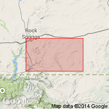
Pg. 101, 102. Tipton tongue of Green River formation. In its type area Tipton tongue separates Niland (new) and Cathedral Bluffs tongues of Wasatch formation. Thickness about 250 feet at type locality. Lower part of Tipton is probably early Eocene; age of upper part uncertain.
Source: US geologic names lexicon (USGS Bull. 1200, p. 3900-3901).
- Usage in publication:
-
- Tipton shale member*
- Modifications:
-
- Areal extent
- AAPG geologic province:
-
- Green River basin
Summary:
Pg. 1073-1074. Tipton shale member of Green River formation. Underlies Wilkins Peak member (new). [Age is early Eocene.]
Source: US geologic names lexicon (USGS Bull. 1200, p. 3900-3901).
- Usage in publication:
-
- Tipton tongue*
- Modifications:
-
- Areal extent
- AAPG geologic province:
-
- Uinta basin
Summary:
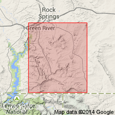
Pg. 40 (fig. 4), 41-42. Tipton tongue of Green River formation. Geographically extended into Daggett County, northeastern Utah. Here Green River formation is broken by unconformity. Beds below unconformity are here considered Tipton tongue, and beds above unconformity as main body of Green River equivalent to Cathedral Bluffs member of Wasatch and Laney shale of Green River as mapped farther east. [Age is early Eocene.]
Source: US geologic names lexicon (USGS Bull. 1200, p. 3900-3901).
- Usage in publication:
-
- Tipton Shale Member*, Tongue*
- Modifications:
-
- Overview
- AAPG geologic province:
-
- Green River basin
Summary:
As a part of Green River Formation in the Greater Green River basin in WY, Tipton is given the stratigraphic rank of tongue where it is overlain by the Cathedral Bluffs Tongue of Wasatch Formation, and as member elsewhere. A 1-10 ft thick coquina (chiefly the gastropod OXYTREMA and the clam UNIO), called the GONIOBASIS marker bed, is a widespread marker that occurs at the base of the Tipton. A tough, very hard gray clayey marlstone is near the top. Tipton includes gray to brownish-black oil shale and gray paper shale, local lenses of oolite, coal, and sandstone, as well as several analcitized tuff beds that range from 1/2 inch to more than 2 inches thick and can be traced for many miles on the surface and in the subsurface. Near the southern margin of the basin, the oil shales intertongue with red claystone and then farther south with sandstone and conglomerate. Oil shale in the Tipton thins northward. Deposited in Lake Gosiute in a 12,000+ sq mi area. Source areas were Uinta and Wind River Mountains. Conformably overlies Niland Tongue of Wasatch. Contains vertebrate fossils of late early Eocene, Lost Cabin age. Stratigraphic figures.
Source: GNU records (USGS DDS-6; Denver GNULEX).
- Usage in publication:
-
- Tipton Shale Member*
- Modifications:
-
- Principal reference
- Revised
- Dominant lithology:
-
- Shale
- Limestone
- AAPG geologic province:
-
- Green River basin
Summary:
Revised as a member of Green River Formation to exclude strata that more appropriately belong and are thus reassigned to the overlying Wilkins Peak Member of the Green River Formation. The strata are present southwest of Canyon Creek in T12N, R102W in Sweetwater Co. They were thought by Schultz (1920) to represent a facies change in the Tipton from shale to conglomerate. The conglomerate facies (coarse limestone, sandstone, and chert) are a remnant of an alluvial fan and are placed in the Wilkins Peak. Principal reference section for Tipton designated in sec 19, T18N, R97W, 6 mi east of Tipton Station, Carbon Co, WY in the Washakie basin part of the Greater Green River basin. Wilkins Peak divisible at principal reference section into: 1) a lower part of brown papery low-grade oil shale with a brown, finely crystalline dolomite near middle, and a basal fossiliferous, gray, very fine grained, calcareous sandstone and brown shale unit; and 2) an upper part of brown, low-grade oil shale with a few interbeds of algal limestone. Shown as about 170 ft thick on graphic section. Overlies Niland Tongue of Green River. Underlies Wilkins Peak Member of Green River. Fossil gastropods (GONIOBASIS and VIVIPARUS) and pelecypod (LAMPSILIS) found in basal unit. The Tipton-Wilkins Peak contact is marked by an abrupt color change from brown (Tipton) to green (Wilkins Peak). Eocene age.
Source: GNU records (USGS DDS-6; Denver GNULEX).
- Usage in publication:
-
- Tipton Tongue*, Shale Member*
- Modifications:
-
- Overview
- AAPG geologic province:
-
- Green River basin
Summary:
Term Tipton Shale Member of Green River Formation used in the Washakie basin of the Greater Green River basin where Tipton is overlain by Wilkins Peak Member of Green River. Where Wilkins Peak has tongued out into the Cathedral Bluffs Tongue of Wasatch, the underlying Tipton is assigned the rank of tongue--Tipton Tongue of Green River. Columnar section. Cross section. Is of Lost Cabin, early Eocene age.
Source: GNU records (USGS DDS-6; Denver GNULEX).
- Usage in publication:
-
- Tipton Shale Member
- Modifications:
-
- Overview
- Areal extent
- AAPG geologic province:
-
- Green River basin
- Uinta uplift
Summary:
Occurs as a member of Green River Formation over a large part of southwest WY in eastern Lincoln and Uinta, southern Sublette, Sweetwater, western Carbon Cos, and adjoining northern Moffat Co, CO, all in Greater Green River basin, and into Daggett and Summit Cos, UT on Uinta uplift. Is more than 400 ft thick in the center of the Wasahie basin. Isopach map. Is of generally uniform (100-200 ft) thickness. Basal bed is a prominent marker rich in GONIOBASIS, other mollusks, and ostracods. Upper part has several beds of stromatolites interbedded with oil shale. Grades at basin margin into carbonate facies on west and east, and sandstone-mudstone facies on north and south. Is thought to be equivalent to Fontenelle Tongue of Green River. Author believes Fontenelle should be discarded. Overlies Niland Tongue of Wasatch Formation. Underlies Wilkins Peak Member of Green River Formation. Of early Eocene, Lostcabinian age.
Source: GNU records (USGS DDS-6; Denver GNULEX).
- Usage in publication:
-
- Tipton Shale Member*
- Modifications:
-
- Revised
- Areal extent
- AAPG geologic province:
-
- Green River basin
Summary:
Recognized throughout most of the WY and CO parts of the Greater Green River basin as a unit of late early Eocene age. Revised to include two newly named beds, the Scheggs Bed, at base and Rife Bed, at top. The Scheggs, formerly designated as the lower part of Tipton, is drab-brown weathering oil-shale that has some algal limestones and abundant mollusks, and is of freshwater origin. The Rife, formerly designated as the upper part of Tipton, is light-gray weathering oil shale with some algal limestones and rare mollusks, and is of saltwater origin. Scheggs and Rife are conformable across the south and east parts of the basin; they are never in contact in the central part of the basin or on the northwest flank of the Rock Springs uplift. On the northwest flank the newly named Farson Sandstone Member (chiefly tan sandstone) separates Rife from Scheggs. The Scheggs, Farson, and Rife were assigned to the Tipton by Schultz (1920) and Bradley (1959). The Scheggs and Rife were assigned to the Tipton by Culbertson (1980) but his New Fork Tongue is the Farson of this report. Stratigraphic diagrams. Areal extent maps of Rife and Scheggs. Stratigraphic rank term tongue applied where Tipton underlies Cathedral Bluffs Tongue of Wasatch Formation; at those localities, Scheggs and Rife are beds of Tipton Tongue.
Source: GNU records (USGS DDS-6; Denver GNULEX).
- Usage in publication:
-
- Tipton Tongue*
- Modifications:
-
- Mapped 1:24k
- Dominant lithology:
-
- Sandstone
- Shale
- AAPG geologic province:
-
- Green River basin
Summary:
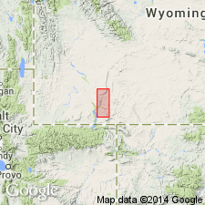
Tipton Tongue of Green River Formation. Descriptions and interpretations of Tipton lithofacies in southern part of Peach Orchard Flat quadrangle have been published by Roehler (1988, USGS Bull. 1669-A) and Hanley (1988, USGS Bull. 1669-A); their studies showed the Tipton Tongue includes gray or tan sandstone, brown and gray oil shale, and minor gray mudstone, siltstone, and shale. Sandstone is fine- to coarse-grained and commonly cross-bedded, and locally contains chert pebbles and concentrations of fossil nonmarine mollusks. Less than 1 mile north of Peach Orchard Flat quadrangle, in sec. 22, T. 15 N., R. 92 W., Blue Gap 7.5-min quadrangle, the Tipton Tongue is predominantly fine- to coarse-grained sandstone with a basal 9-feet-thick paper shale. Individual sandstones coarsen upward, are mainly horizontally stratified, and contain mollusk shell fragments in their lower parts (Hettinger and others, 1991, USGS Misc. Inv. Ser. Map I-2151). Thickness ranges from 20 to 120 feet in Peach Orchard Flat quadrangle. Age is Eocene. Report includes geologic map, measured sections, correlation chart, cross sections.
Source: Publication.
For more information, please contact Nancy Stamm, Geologic Names Committee Secretary.
Asterisk (*) indicates published by U.S. Geological Survey authors.
"No current usage" (†) implies that a name has been abandoned or has fallen into disuse. Former usage and, if known, replacement name given in parentheses ( ).
Slash (/) indicates name conflicts with nomenclatural guidelines (CSN, 1933; ACSN, 1961, 1970; NACSN, 1983, 2005, 2021). May be explained within brackets ([ ]).