The National Geologic Map Database is migrating to a new infrastructure. We apologize for any service disruptions during this process.
|
|---|


- Usage in publication:
-
- Timberlake Fanglomerate
- Modifications:
-
- Named
- Dominant lithology:
-
- Conglomerate
- Fanglomerate
- AAPG geologic province:
-
- Pedregosa basin
Summary:
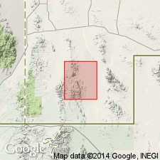
No type locality designated. Named after Timberlake Ranch vicinity of Cowboy Spring, sec 13, T31S, R18W, Walnut Wells quad, Hidalgo Co, NM, Pedregosa basin, near where exposures are found. Geologic map. Scattered exposures from near mouth of Bennett Creek, sec 10, T31S, R18W, southward to southern border of quad near mouth of Walnut Creek. Consists largely of limestone-cobble conglomerate; east of Cowboy Spring also contains masses of fanglomerate composed of limestone conglomerate boulders 200+ ft in diameter derived from detritus of underlying Cowboy Spring Formation (new). Matrix varies from red, argillaceous sandstone to limestone conglomerate of all grain sizes. Varies in thickness from 0-500 ft. Abrupt thickness changes due to erosion of fanglomerate after deposition on the irregular pre-Timberlake surface. Top eroded in some places. Lies with sharp angular unconformity, disconformity, and conformity above extrusive rocks; overlies Cretaceous rocks. Difficult to distinguish from underlying Cowboy Spring where in contact. Overlies sandstone of Mojado Formation where Cowboy Spring is absent. Overlain locally by Basin Creek Tuff, Horse Hill Breccia, and Bluff Creek Formation (all new). Is at base of Tertiary extrusive rocks, but no fossils found; age determined from indirect evidence. More closely related to overlying Tertiary rocks than underlying Cretaceous rocks, so considered of Tertiary age.
Source: GNU records (USGS DDS-6; Denver GNULEX).
For more information, please contact Nancy Stamm, Geologic Names Committee Secretary.
Asterisk (*) indicates published by U.S. Geological Survey authors.
"No current usage" (†) implies that a name has been abandoned or has fallen into disuse. Former usage and, if known, replacement name given in parentheses ( ).
Slash (/) indicates name conflicts with nomenclatural guidelines (CSN, 1933; ACSN, 1961, 1970; NACSN, 1983, 2005, 2021). May be explained within brackets ([ ]).