The National Geologic Map Database is migrating to a new infrastructure. We apologize for any service disruptions during this process.
|
|---|


- Usage in publication:
-
- Tibble formation*
- Modifications:
-
- Named
- Dominant lithology:
-
- Conglomerate
- Limestone
- AAPG geologic province:
-
- Wasatch uplift
Summary:
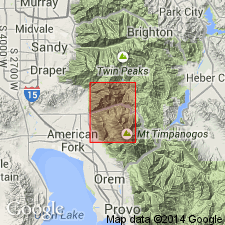
Named for Tibble Fork southeast of American Fork Canyon. Type section is in secs 7 and 8, T4S, R3E, between Tibble Fork and Mill Canyon, Utah Co, UT on the Wasatch uplift. Occurs in northeast part of quad. Consists of pebble to boulder conglomerate, sandy to shaly greenish-gray to reddish-brown tuffaceous sediments, thin lenticular white freshwater algal? limestone. Larger boulders are well-rounded, several ft in diameter, gray to red andesite or latite. Smaller fragments 1 to 6 inches in diameter are angular sedimentary rocks (quartzite, limestone, sandstone). Is topographically below Little Cottonwood stock. Has no fragments from the stock and thus must be younger. Is about 2,500 ft thick. Basal beds rest on erosion surface beneath which the rocks are stained with iron oxide to depths of several hundred ft. Such staining is in Great Blue limestone and the Bridal Veil limestone member of the Oquirrh formation. Is a fluvial deposit, chiefly of nonvolcanic origin. May be contemporaneous with Norwood tuff. Assigned to the Tertiary. Geologic map. Cross sections.
Source: GNU records (USGS DDS-6; Denver GNULEX).
- Usage in publication:
-
- Tibble Formation*
- Modifications:
-
- Overview
- AAPG geologic province:
-
- Wasatch uplift
Summary:
Volcanic and clastic sediments of the Tibble Formation are thought to be closely related in origin to the volcanic rocks of the Traverse Range which have yielded a K-Ar date of 37.3 +/-1.1 m.y., date near the basal Oligocene. Report area near Draper, UT is in Utah Co on the Wasatch uplift. Is related to the earliest phase (37-41 m.y. ago) of intrusive activity in the Bingham, Cottonwood and Park City districts.
Source: GNU records (USGS DDS-6; Denver GNULEX).
- Usage in publication:
-
- Tibble Formation
- Modifications:
-
- Overview
- Age modified
- AAPG geologic province:
-
- Wasatch uplift
Summary:
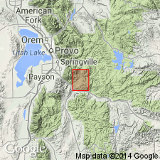
Located in north-central part of geologic map area, Utah Co, UT on the Wasatch uplift where it conformably overlies Uinta Formation. Appears to be overlain by volcanic ash deposits. Measured section 518 ft (incomplete?) thick at SE1/4 NW1/4 NE1/4 sec 35 to NE1/4 SE1/4 SE1/4 sec 26, T8S, R4E described. Consists of pebble to boulder conglomerate composed of 70 percent Paleozoic rocks and 30 percent red to gray andesite interbedded with minor amounts of gray ash, light green volcanic arenite, greenish subgraywacke, and coarse-grained sand. The arenite is medium to coarse grained, calcareous, contains fragments mainly of pumice, chert, and quartzite. Forms low foothills with rounded cliffs. Assigned to the early Oligocene because of 1) its position above Uinta Formation, 2) first appearance of andesite cobbles, 3) amount of lithification, and 4) predated later faulting. May correlate with Bishop Conglomerate.
Source: GNU records (USGS DDS-6; Denver GNULEX).
For more information, please contact Nancy Stamm, Geologic Names Committee Secretary.
Asterisk (*) indicates published by U.S. Geological Survey authors.
"No current usage" (†) implies that a name has been abandoned or has fallen into disuse. Former usage and, if known, replacement name given in parentheses ( ).
Slash (/) indicates name conflicts with nomenclatural guidelines (CSN, 1933; ACSN, 1961, 1970; NACSN, 1983, 2005, 2021). May be explained within brackets ([ ]).