- Usage in publication:
-
- Thurman sandstone*
- Modifications:
-
- Original reference
- Dominant lithology:
-
- Conglomerate
- Sandstone
- Shale
- AAPG geologic province:
-
- Arkoma basin
Summary:
Pg. 439. Thurman sandstone. Brown sandstone and shaly beds with, at base, 50 feet or more of conglomerate composed of angular or little-rounded chert fragments in a brown sandstone matrix. Thickness 200 feet. Top formation of Coal Measures. Overlies Boggy shale; underlies Guertie sand. [Mapped (pl. 64) as Shawnee sandstone, but Shawnee being preoccupied, Thurman sandstone is adopted in text.] Age is Pennsylvanian (Allegheny). Report includes geologic map.
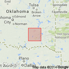
Named from former village of Thurman, McAlester coal district, McAlester quadrangle, northern part of Pittsburg Co., (about 6 mi west of Indianola), which is near if not on outcrops of the formation. [According to GNU records (USGS DDS-6; Denver GNULEX, Aug. 1, 1988), type locality not designated.]
Source: US geologic names lexicon (USGS Bull. 896, p. 1935); supplemental information from GNU records (USGS DDS-6; Denver GNULEX).
For more information, please contact Nancy Stamm, Geologic Names Committee Secretary.
Asterisk (*) indicates published by U.S. Geological Survey authors.
"No current usage" (†) implies that a name has been abandoned or has fallen into disuse. Former usage and, if known, replacement name given in parentheses ( ).
Slash (/) indicates name conflicts with nomenclatural guidelines (CSN, 1933; ACSN, 1961, 1970; NACSN, 1983, 2005, 2021). May be explained within brackets ([ ]).

