The National Geologic Map Database is migrating to a new infrastructure. We apologize for any service disruptions during this process.
|
|---|


- Usage in publication:
-
- Threadgill member*
- Modifications:
-
- First used
- Dominant lithology:
-
- Limestone
- Dolomite
- AAPG geologic province:
-
- Llano uplift
Summary:
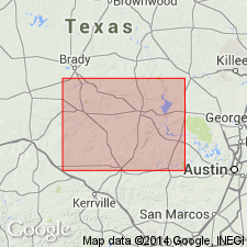
Assigned as basal member, Tanyard formation (new), Ellenburger group (revised). First published description. Type section is on Threadgill and Mormon creeks, south of Lange's Mill, northwest Gillespie Co., TX on the Llano uplift where it is 280 ft thick. Ranges between 91 ft thick in the east part Llano area to 313 ft thick in west area. Principally limestone in west; grades east to dolomite. Is thinner bedded on west side and thicker bedded on east. The dolomites have vuggy or spongy masses of chert. The limestones are generally non-cherty. Overlies Pedernales or San Saba Members of Wilberns Formation. Underlies Staendebach Member (new) of Tanyard cross sections. Geologic maps of parts of Blanco and San Saba Cos. Of Early Ordovician age.
Source: GNU records (USGS DDS-6; Denver GNULEX).
For more information, please contact Nancy Stamm, Geologic Names Committee Secretary.
Asterisk (*) indicates published by U.S. Geological Survey authors.
"No current usage" (†) implies that a name has been abandoned or has fallen into disuse. Former usage and, if known, replacement name given in parentheses ( ).
Slash (/) indicates name conflicts with nomenclatural guidelines (CSN, 1933; ACSN, 1961, 1970; NACSN, 1983, 2005, 2021). May be explained within brackets ([ ]).