The National Geologic Map Database is migrating to a new infrastructure. We apologize for any service disruptions during this process.
|
|---|


- Usage in publication:
-
- Thirsty Canyon Tuff*
- Modifications:
-
- Named
- Dominant lithology:
-
- Tuff
- AAPG geologic province:
-
- Great Basin province
Summary:
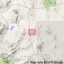
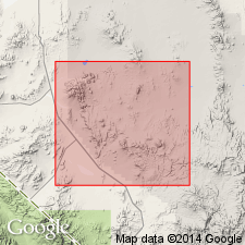
Named for exposures of rhyolitic ash-flow and air-fall tuffs (chemically soda rhyolite and pantellerite) in headward part of Thirsty Canyon (its type area), north and east of Beatty, Nye Co, NV, Great Basin province. Complete section nowhere exposed. Present known extent in 12 7 1/2 min and 7 15 min quads. Divided into (ascending): Spearhead (reduced in rank), composite sheet; Trail Ridge (new), multiple ash-flow cooling unit; Dry Lake (new), simple cooling unit; Gold Flat (new), compound cooling unit; Labyrinth Canyon (new), single ash-flow simple cooling unit; and upper member, two 1-8 ft thick white to gray pumice-rich air fall tuffs. Welding and cooling characteristics indicate each member deposited during restricted time interval, and cooled as single unit. Members thicken and thin; are generally conformable; locally separated by lenses of conglomerate and sandstone and by intertongued lava flows (these interbedded rocks not included in Thirsty Canyon); have varied degrees of welding and amount of devitrification and crystallization; similar mineralogic and chemical composition; lateral and vertical variation in phenocryst, lithic-fragment, and pumice content. Phenocrysts comprise 5-30% of rock, include soda-rich sanidine, pigeonite, green clinopyroxene, fayalite, brown amphibole, zircon. Unconformably overlies Rainier Mesa Member of Piapi Canyon Formation. Dated Pliocene. K-Ar age of 7.5 m.y. from Spearhead. Distribution map of some of members.
Source: GNU records (USGS DDS-6; Denver GNULEX).
- Usage in publication:
-
- Thirsty Canyon Tuff*
- Modifications:
-
- Mapped
- AAPG geologic province:
-
- Great Basin province
Summary:
Mapped in Buckboard Mesa 7.5' quad, Nye Co, NV where Trail Ridge Member and upper ash-flow tuff of Spearhead Member are also shown. Is up to 250ft thick. Underlies Quaternary alluvium and talus deposits. Interlayers with and underlies Tertiary fan gravel and tuffaceous deposits. Assigned Pliocene age.
Source: GNU records (USGS DDS-6; Menlo GNULEX).
- Usage in publication:
-
- Thirsty Canyon Tuff*
- Modifications:
-
- Mapped
- AAPG geologic province:
-
- Great Basin province
Summary:
Mapped in Timber Mountain 7.5' quad, Nye Co, NV where Trail Ridge and Spearhead Members are exposed. Underlies Quaternary alluvium overlies Timber Mountain Tuff. Interlayered with Tertiary gravels and tuffaceous sediments. Assigned Pliocene age.
Source: GNU records (USGS DDS-6; Menlo GNULEX).
- Usage in publication:
-
- Thirsty Canyon Tuff*
- Modifications:
-
- Mapped
- AAPG geologic province:
-
- Great Basin province
Summary:
Mapped in Silent Butte 7.5' quad, Nye Co, NV, where it consists of Spearhead and Trail Ridge Members and is up to 475 ft thick. Overlies Pliocene rhyolite (unconformably overlies Timber Mountain Tuff); underlies Pliocene basalt. Assigned to Pliocene.
Source: GNU records (USGS DDS-6; Menlo GNULEX).
- Usage in publication:
-
- Thirsty Canyon Tuff*
- Modifications:
-
- Mapped
- AAPG geologic province:
-
- Great Basin province
Summary:
Mapped in Thirsty Canyon SE 7.5' quad, Nye Co, NV, where it consists of (ascending) Spearhead and Trail Ridge Members, and is as much as 360 ft thick. Unconformably overlies and conformably underlies basalt. Assigned to Pliocene.
Source: GNU records (USGS DDS-6; Menlo GNULEX).
- Usage in publication:
-
- Thirsty Canyon Tuff*
- Modifications:
-
- Mapped
- AAPG geologic province:
-
- Great Basin province
Summary:
Mapped in Thirsty Canyon 7.5' quad, Nye Co, NV, where it consists of (ascending) Spearhead, Trail Ridge, and Gold Flat Members and is as much as l250 ft thick. Overlies trachyandesite (unconformably overlies Timber Mountain Tuff); underlies rhyolitic rocks. Assigned to Pliocene.
Source: GNU records (USGS DDS-6; Menlo GNULEX).
- Usage in publication:
-
- Thirsty Canyon Tuff*
- Modifications:
-
- Mapped
- AAPG geologic province:
-
- Great Basin province
Summary:
Thirsty Canyon Tuff. Mapped in Scrugham Peak 7.5-min quadrangle, Nye County, Nevada. Consists of (ascending) Spearhead and Trail Ridge Members. Thickness as much as 775 feet [770 feet according to US geologic names lexicon (USGS Bull. 1350, p. 755)]. Underlies volcanic fan gravel. Separated from underlying Timber Mountain Tuff by air-fall and ash-flow tuff as much as 175 feet thick. Age is Pliocene.
Source: GNU records (USGS DDS-6; Menlo GNULEX).
- Usage in publication:
-
- Thirsty Canyon Tuff*
- Modifications:
-
- Mapped
- AAPG geologic province:
-
- Great Basin province
Summary:
Mapped in Ammonia Tanks 7.5' quad, Nye Co, NV, where it consists of (ascending) Spearhead and Trail Ridge Members, and is up to 150 ft thick. Unconformably overlies Timber Mountain Tuff; underlies surficial deposits. Assigned to Pliocene.
Source: GNU records (USGS DDS-6; Menlo GNULEX).
- Usage in publication:
-
- Thirsty Canyon Tuff*
- Modifications:
-
- Mapped
- AAPG geologic province:
-
- Great Basin province
Summary:
Mapped in Dead Horse Flat 7.5' quad, Nye Co, NV, where it consists of (ascending) Spearhead and Trail Ridge Members, and is up to 140 ft thick. Unconformably overlies Timber Mountain Tuff: underlies Quaternary surficial deposits. Assigned to Pliocene.
Source: GNU records (USGS DDS-6; Menlo GNULEX).
- Usage in publication:
-
- Thirsty Canyon Tuff*
- Modifications:
-
- Mapped
- AAPG geologic province:
-
- Great Basin province
Summary:
Mapped in Trail Ridge 7 1/2' quad, Nye Co., NV where it consists of (ascending) Rocket Wash, Spearhead, Trail Ridge, Gold Flat, and Labyrinth Canyon Members plus an uppermost informal member and is up to about 800 ft. thick. Overlies Pliocene lavas (unconformably overlies Timber Mountain Tuff); underlies Quaternary surficial deposits.
Source: GNU records (USGS DDS-6; Menlo GNULEX).
- Usage in publication:
-
- Thirsty Canyon Tuff*
- Modifications:
-
- Geochronologic dating
- AAPG geologic province:
-
- Great Basin province
Summary:
K-Ar ages of 6.2-7.5 Ma (on sanidine) from samples of Labyrinth Canyon Member near Black Mountain (lat 37deg 18'N, long 116 deg 35"W) and Spearhead Member near Timber Mountain (lat 37 deg 08'N, long 116 deg 26'W) respectively, Nye Co, NV. Assigned to Pliocene (Hemphillian North American provincial age).
Source: GNU records (USGS DDS-6; Menlo GNULEX).
- Usage in publication:
-
- Thirsty Canyon Tuff*
- Modifications:
-
- Revised
- AAPG geologic province:
-
- Great Basin province
Summary:
The two parts of the Spearhead Member of Thirsty Canyon Tuff, designated the upper and lower parts, are thought to be distinct ash-flow sheets rather than a single composite sheet as originally thought. The lower sheet is reversely polarized with the remanent vector having high inclination. The upper sheet has a subhorizontal south-directed stable thermoremanent magnetization. Lower part is removed from the Spearhead and named Rocket Wash Member of Thirsty Canyon Tuff. Spearhead is restricted to the former upper part of Spearhead. Of mid-Pliocene age.
Source: GNU records (USGS DDS-6; Denver GNULEX).
- Usage in publication:
-
- Thirsty Canyon Tuff*
- Modifications:
-
- Mapped
- AAPG geologic province:
-
- Great Basin province
Summary:
Mapped in southwest quarter of Black Mountain 15' quad, Nye Co, NV, where it consists of (ascending) Rocket Wash, Spearhead, Trail Ridge, Gold Flat, and Labyrinth Canyon Members, and an upper unnamed member. Is about 730 ft thick. Overlies Pliocene lavas and unconformably overlies Grouse Canyon Member of Belted Range Tuff; underlies basalt. Assigned to Pliocene.
Source: GNU records (USGS DDS-6; Menlo GNULEX).
- Usage in publication:
-
- Thirsty Canyon Tuff*
- Modifications:
-
- Mapped
- AAPG geologic province:
-
- Great Basin province
Summary:
Mapped in northern half of Black Mountain 15-min quadrangle, Nye County, Nevada. Includes (ascending) tuff of Rocket Wash, Spearhead Member, Trail Ridge Member, Gold Flat Member, Labyrinth Canyon Member, and an upper unnamed member. Is about 500 feet thick. Overlies fanglomerate and unconformably overlies Timber Mountain Tuff; underlies Pliocene basalt. Age is Pliocene.
Source: Modified from GNU records (USGS DDS-6; Menlo GNULEX).
- Usage in publication:
-
- Thirsty Canyon Tuff*
- Modifications:
-
- Areal extent
- AAPG geologic province:
-
- Great Basin province
Summary:
Geographically extended into Slate Ridge area, southern Esmeralda Co, NV, its farthest westward extent, where it consists of (ascending) Spearhead and possibly Trail Ridge Members. Overlies Miocene tuff and ash flows. Underlies Pliocene or Pleistocene gravel and sand. Assigned Pliocene age.
Source: GNU records (USGS DDS-6; Menlo GNULEX).
- Usage in publication:
-
- Thirsty Canyon Tuff*
- Modifications:
-
- Geochronologic dating
- AAPG geologic province:
-
- Great Basin province
Summary:
[Thirsty Canyon Tuff.] Samples from type Spearhead "Rhyolite," near Rabbit Spring at foot of Malpais Mesa, just south of Spearhead Point, Lat. 37 deg. 41 min. 40 sec. N., Long. 117 deg. 14 min. 20 sec. W., Esmeralda County, Nevada, yielded K-Ar ages (sanidine and whole rock) of 6.7 +/-0.1 and 6.8 +/-0.14 Ma.
Source: Modified from GNU records (USGS DDS-6; Menlo GNULEX).
- Usage in publication:
-
- Thirsty Canyon Tuff*
- Modifications:
-
- Age modified
- AAPG geologic province:
-
- Great Basin province
Summary:
Consists of (ascending) Spearhead and Trail Ridge Members in Goldfield area; Spearhead assigned a Miocene or Pliocene age based on isotopic age in Goldfield area [overall age of Thirsty Canyon Tuff is thus Miocene? and Pliocene].
Source: GNU records (USGS DDS-6; Menlo GNULEX).
- Usage in publication:
-
- Thirsty Canyon Tuff*
- Modifications:
-
- Revised
- AAPG geologic province:
-
- Great Basin province
Summary:
Thirsty Canyon Tuff. Includes (ascending): Rocket Wash Member, Pahute Mesa Member (new), Trail Ridge Member, Gold Flat Member, and unnamed upper member. Spearhead Member is revised to include rocks of †Labyrinth Canyon Member (abandoned) and is reassigned to Stonewall Flat Tuff (new). Tuffs of the Thirsty Canyon emanated from the Black Mountain volcanic center, Nye County, Nevada. These tuffs have higher concentrations of Hf, Th, Rb, Be, and REE, than those from nearby Stonewall Mountain volcanic center. Age is late Miocene. Report includes stratigraphic chart.
Source: Modified from GNU records (USGS DDS-6; Denver GNULEX).
- Usage in publication:
-
- Thirsty Canyon Group*
- Modifications:
-
- Revised
- AAPG geologic province:
-
- Great Basin province
Summary:
Within southwest Nevada volcanic field, Nye Co, NV, Great Basin province, units previously of formation rank are raised to group rank to allow for combining petrographically, geochemically, and temporally related lava flows and nonwelded tuffs with the principal correlative welded ash-flow tuff sheets (formerly members of the previous formation-rank tuffs). The ash-flow sheets are raised to formation rank and designated as "Tuff." Thirsty Canyon Group consists of (ascending) Rocket Wash, Pahute Mesa, Trail Ridge, and Gold Flat Tuffs (all ranks raised). Source is Black Mountain caldera. Younger than Beatty Wash Formation (new); older than Stonewall Flat Tuff. Nomenclature chart. Assigned Miocene age.
Source: GNU records (USGS DDS-6; Denver GNULEX).
For more information, please contact Nancy Stamm, Geologic Names Committee Secretary.
Asterisk (*) indicates published by U.S. Geological Survey authors.
"No current usage" (†) implies that a name has been abandoned or has fallen into disuse. Former usage and, if known, replacement name given in parentheses ( ).
Slash (/) indicates name conflicts with nomenclatural guidelines (CSN, 1933; ACSN, 1961, 1970; NACSN, 1983, 2005, 2021). May be explained within brackets ([ ]).