

- Usage in publication:
-
- Thaynes formation*
- Modifications:
-
- Original reference
- Dominant lithology:
-
- Limestone
- Sandstone
- Shale
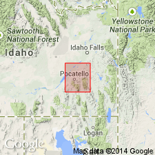
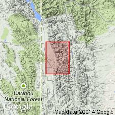
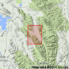
- AAPG geologic province:
-
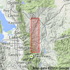
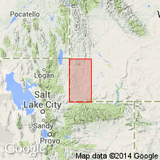
- Uinta uplift
Summary:
Thaynes limestone (also Thaynes formation). Essentially a calcareous formation. Comprises two parts separated by a red shale member, each made up of limestone, calcareous sandstone, normal sandstone, and shale. Most ot true limestones are in upper part, and sandstones predominate in lower part, though each type is found throughout. A very characteristic rock occurring at many horizons is a dense, homogeneous blue-gray calcareous sandstone, which appears superficially to be a limestone but on exposure loses its low calcareous content and becomes a medium fine-grained brown sandstone. [Detailed section in Park City district, Utah, given; fossils listed.] Thickness 1,190 feet. Underlies Ankareh shale (red) and overlies Woodside shale (red). [Age is Early Triassic.]
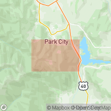
Named from Thaynes Canyon, whose deep and extended incision affords best exposures of the formation in Park City district, UT.
Source: US geologic names lexicon (USGS Bull. 896, p. 2135-2136).
- Usage in publication:
-
- Thaynes formation*
- Modifications:
-
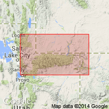
- Areal extent
- AAPG geologic province:
-
- Green River basin
Summary:
Pg. 50+, chart opp. p. 50, map, pl. 3, etc. Thaynes formation. In southwestern Wyoming consists of very fossiliferous gray limestones and thin-bedded yellow sandstones, containing abundant fauna. Thickness in southwestern Wyoming 2,400 to 2,600+ feet. Conformably underlies Nugget formation and conformably overlies Woodside formation. [Fossils listed, identified by G.H. Girty, USGS, see p. 50-53, pl. 6; fauna includes mollusks AVICULOPECTEN CURTOCARDINALIS, AVICULOPECTEN OCCIDANEUS, AVICULOPECTEN PARVULUS, AVICULOPECTEN WEBERENSIS, MYALINA PERMIANA, MYACITES INCONSPICUUS, SEDGWICKIA CONCAVA. Age is considered Carboniferous.]
Source: US geologic names lexicon (USGS Bull. 896, p. 2135-2136).
- Usage in publication:
-
- Thaynes formation*
- Modifications:
-
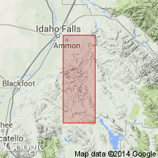
- Areal extent
- AAPG geologic province:
-
- Uinta uplift
Summary:
Pg. 55, pls. 2, 5. Thaynes formation. Essentially calcareous. Comprises two parts separated by a red shale member, each made up of limestone, calcareous sandstone, normal sandstone, and shale. Most of true limestones are in upper part and sandstones predominate in lower part. A characteristic rock at many horizons is a very fossiliferous dense, homogeneous blue-gray calcareous sandstones, which appears superficially to be a limestone. Thickness of formation in Park City district, Utah, 1,290+/- feet; the upper part 630+/- feet; the middle red shale member 115+/- feet; and lower part 445+/- feet. Conformably underlies Ankareh shale (red) and overlies Woodside shale (dark red). [Fossils listed.] Extends into Idaho. [Age is Early Triassic.]
Source: US geologic names lexicon (USGS Bull. 896, p. 2135-2136).

- Usage in publication:
-
- Thaynes group*
- Modifications:
-
- Revised
- AAPG geologic province:
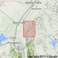
-
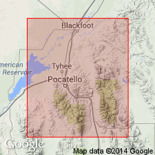
- Snake River basin
Summary:
Pg. 492. Thaynes group. Thaynes deposits in Fort Hall Indian Reservation, southeastern Idaho, become a group, divisible into 3 formations, here named (descending) Portneuf limestone, 1,500+/- feet thick; Fort Hall formation, 800+/- feet thick; and Ross [Ross Fork now] limestone, 1,350+/- feet thick. [Age is Early Triassic.]
Source: US geologic names lexicon (USGS Bull. 896, p. 2135-2136).
- Usage in publication:
-
- Thaynes group*
- Modifications:
-
- Revised
- AAPG geologic province:
-
- Snake River basin
Summary:
Pg. 32, 35. Thaynes group (including Portneuf limestone, Fort Hall formation, and Ross limestone) underlies Ankareh sandstone and overlies Woodside shale in Fort Hall Indian Reservation, southeastern Idaho. [Age is Early Triassic.]
Source: US geologic names lexicon (USGS Bull. 896, p. 2135-2136).
- Usage in publication:
-
- Thaynes group*
- Modifications:
-
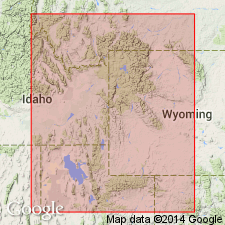
- Areal extent
- AAPG geologic province:
-
- Snake River basin
Summary:
Replaced Ankareh sandstone, as used by him in previous reports, with Timothy sandstone, and explained that the lithologic unit called by him Thaynes group in southeastern Idaho, corresponds to Thaynes formation as used by Veatch in southwestern Wyoming, and also corresponds to Thaynes limestone of Boutwell in Park City district, Utah, but includes at top limestones that are equivalent in time to basal part of Boutwell's Ankareh shale of Park City district, Utah.
Source: US geologic names lexicon (USGS Bull. 896, p. 2135-2136).
- Usage in publication:
-
- Thaynes limestone
- Modifications:
-
- Overview
- Revised
- AAPG geologic province:
-
- Wasatch uplift
Summary:
Lower part of Triassic sequence divisible between Fort Douglas, Salt Lake Co, UT on the Wasatch uplift, and Whiterocks Canyon, Duchesne Co, UT in the Uinta basin, where the Thaynes limestone is present. East of Whiterocks Canyon to Skull Creek in Uintah Co, UT in the Uinta basin, the name Woodside shale is applied to the undivided Triassic section above Park City formation, or locally the Weber sandstone, and below Gartra grit member (new name) of Stanaker formation (new name).
Source: GNU records (USGS DDS-6; Denver GNULEX).
- Usage in publication:
-
- Thaynes group*
- Modifications:
-
- Overview
- AAPG geologic province:
-
- Snake River basin
- Wasatch uplift
Summary:
Present (geologic map, cross sections) in Bingham Co., ID in the Snake River basin, and for a short distance south into Caribou Co., ID on the Wasatch uplift as a unit with three mapped formations (ascending): Ross Fork limestone, Fort Hall formation, and Portneuf limestone. The Thaynes itself was not mapped. Overlies Woodside shale. Unconformably underlies Timothy sandstone. All formations of the Thaynes assigned to the Lower Triassic. Author recognizes the work of Kummel (1943) in which the Thaynes was divided into 5 parts and by Matthews (1929, 1931) in which Thaynes was divided into a Pinecrest formation 600 ft thick and Emigrant formation 1,000 ft thick. Evaluation of these two stratigraphic schemes would have required more field work. Present report by author is consistent with his previous work in the Fort Hall area.
Source: GNU records (USGS DDS-6; Denver GNULEX).
- Usage in publication:
-
- Thaynes formation*
- Modifications:
-
- Overview
- AAPG geologic province:
-
- Green River basin
- Snake River basin
- Wasatch uplift
- Uinta basin
Summary:
Divided into 6 lithologic units (ascending order): 1.) lower limestone, 2.) lower black limestone, 3.) tan silty limestone, 4.) upper black limestone, sandstone, and limestone, 5.) Portneuf limestone member, and 6.) Timothy sandstone member. The Portneuf is divided into an upper and lower part by the newly named Lanes tongue of the Ankareh formation. The new tongue is a 440 ft thick redbed. Thaynes overlies Dinwoody formation (west) and Woodside formation (east). Underlies Higham grit. Is 5,525 ft thick at Fort Hall, Bingham Co., ID, (Snake River basin) and 3,550 ft thick along Sheep Creek, Caribou Co., ID (Wasatch uplift). Is found over a wide area in northern UT, eastern ID, western WY, and southwest MT. Eastward thinning of Thaynes results from intertonguing redbeds of the Woodside and Ankareh. Recognized in northern UT as far east as Whiterocks Canyon, Uintah Co. (Uinta basin). East of Gros Ventre Canyon and Hoback Mountains, the Alcova limestone member of the Chugwater formation represents an equivalent of the upper part of the Thaynes. A prominent limestone at base contains an abundant ammonite fauna characterized by MEEKOCERAS. Other younger ammonite zones represented. Cross sections. Block diagram. Assigned to the Lower and Upper Triassic. The Lower-Upper boundary falls within the Timothy member. Correlation chart.
Source: GNU records (USGS DDS-6; Denver GNULEX).
- Usage in publication:
-
- Thaynes limestone*
- Modifications:
-
- Overview
- AAPG geologic province:
-
- Green River basin
Summary:
Name applied to a resistant conspicuous unit that overlies Woodside redbeds and underlies Ankareh redbeds. Consists of alternating layers of gray, sandy limestone, green-gray, calcareous siltstone, and some green shale. The lower third has few thick limestone beds and the rock weathers dark brown and has numerous manganese stains. The upper two-thirds contains a larger portion of limestone, and the rocks weather yellow-gray. Ranges between 1,000 and 1,400 ft thick. Two parts mapped (geologic map) in central southern and central west part of quad. in Lincoln Co., WY in the Greater Green River basin. Assigned to the Lower Triassic.
Source: GNU records (USGS DDS-6; Denver GNULEX).
- Usage in publication:
-
- Thaynes Formation
- Modifications:
-
- Areal extent
- AAPG geologic province:
-
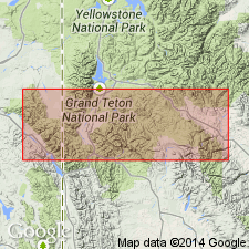
- Snake River basin
- Yellowstone province
Summary:
All but upper part extended eastward from Bonneville and Teton Cos, ID, eastern Snake River basin to Munger Mountain (sec 21, T39N, R116W) and Red Mountain (sec 7, T42N, R113W), both in Teton Co, WY, Yellowstone province. In Munger Mountain-Red Mountain area, Thaynes intertongues with Red Peak and Crow Mountain Formations, both of Chugwater Group. Thaynes subdivided into, in ascending order: lower limestone, lower black limestone, tan silty limestone, upper black limestone, and sandstone and limestone units and Portneuf Limestone and Timothy Sandstone [Members] following Kummel (1954, U.S. Geological Survey, Professional Paper 254). Portneuf and Timothy pinchout in eastern ID. Thaynes (below Portneuf) correlates with about upper three fourths of Red Peak and lower part of Crow Mountain. Triassic age.
Source: GNU records (USGS DDS-6; Denver GNULEX).
- Usage in publication:
-
- Thaynes Formation*
- Modifications:
-
- Overview
- AAPG geologic province:
-
- Wasatch uplift
Summary:
Mapped in large areas of northeast, northwest, and southwest parts of quad., Caribou Co., ID on the Wasatch uplift. Overlies Dinwoody Formation. Underlies Higham Grit. Divided into (ascending): black limestone member, platy siltstone member, black shale member, nodular siltstone member, lower and upper parts of Portneuf Limestone Member, and, at top, Timothy Sandstone Member. The two parts of the Portneuf are separated by 500 ft of red to red-brown sandstone assigned to the Lanes Tongue of the Ankareh Formation. The black limestone member is very resistant, is 550 ft thick, and has a MEEKOCERAS fauna at base. The platy limestone member is about 650 to 750 ft thick, is yellow-brown to gray, calcareous, and platy. The black shale member is about 280 ft thick. The nodular siltstone member is about 400 ft thick; it has small dark gray limestone nodules. The lower part of the Portneuf is massive, cliff-forming, gray limestone 300 to 400 ft. thick. The upper part of the Portneuf is about 250 to 290 ft thick and includes gray and brown sandstone, siltstone, and shale at base that are overlain by gray limestone interbedded with the three lithologies. The Timothy is buff to gray, glauconitic sandstone about 230 ft thick. All the members have interbeds of other lithologies. Of Early Triassic age.
Source: GNU records (USGS DDS-6; Denver GNULEX).
- Usage in publication:
-
- Thaynes Formation*
- Modifications:
-
- Revised
- Overview
- AAPG geologic province:
-
- Snake River basin
Summary:
Lower Triassic Thaynes Formation divided into 3 mapped units (ascending): Ross Fork Limestone Member, Fort Hall Member, and Portneuf Limestone Member. These members mapped extensively in the eastern central and southern parts of the quad. in Bannock and Bingham Cos., ID in the Snake River basin. Thaynes overlies Dinwoody Formation and unconformably underlies Timothy Sandstone. Usage in this quad. constitutes a revision of the Thaynes in that the Timothy is removed from it and that the Ross Fork, Fort Hall, and Portneuf are assigned member rank in it. Reason given for removal of Timothy from Thaynes is "its marine origin".
Footnote, Triassic units shown on this map are the formational units of Mansfield (1920), except that the Ross Fork, Fort Hall, and Portneuf Limestone are considered members of the marine Thaynes Formation, which was redefined by Kummel (1954) [included Portneuf Member; names Ross Fork and Fort Hall not applied to the rocks]. The Timothy Sandstone, which was considered a member of the Thaynes by Kummel, is here considered of formational rank because of its nonmarine origin.) [Adopted by the USGS May 9, 1981.]
Source: GNU records (USGS DDS-6; Denver GNULEX).
For more information, please contact Nancy Stamm, Geologic Names Committee Secretary.
Asterisk (*) indicates published by U.S. Geological Survey authors.
"No current usage" (†) implies that a name has been abandoned or has fallen into disuse. Former usage and, if known, replacement name given in parentheses ( ).
Slash (/) indicates name conflicts with nomenclatural guidelines (CSN, 1933; ACSN, 1961, 1970; NACSN, 1983, 2005, 2021). May be explained within brackets ([ ]).