- Usage in publication:
-
- Terryville Sandstone
- Modifications:
-
- Named
- Dominant lithology:
-
- Sandstone
- Shale
- AAPG geologic province:
-
- Arkla basin
Summary:
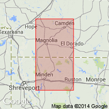
Name applied to 1 of 4 formations of the Upper Jurassic Cotton Valley Group in LA. Overlies Bossier Formation (restricted) of Cotton Valley. Underlies and intertongues with Hico Shale (new) of Cotton Valley. Named for the Terryville Field, Lincoln Parish, LA, Arkla basin. Type section designated as interval between 9,620 and 10,390 ft in Arkansas-Louisiana Gas Co., Harriet Lewis No. 1 in NW NW sec 27, T19N, R4W. Consists of massive, white quartzose sandstone and a few thin dark-gray shales. Base and top defined by sandstone. Has a maximum thickness of 1,400 ft in a belt 6 to 10 mi wide that extends from southern Ouachita Parish through southern Caddo Parish, LA and west into TX. Descends stratigraphically northward; both the base and top of Terryville are older in northern area. Pinches out near LA-AR boundary. Five blanket sandstones in the upper part of the Terryville that average 50 ft thick named. These are (descending order): Cadeville, Bodcaw, Vaughn, McFearin, and Justiss. Cross sections. Known only in the subsurface. Accumulated as an offshore barrier island or longshore bar deposit. [Authors do not identify the nomenclature that was applied to these rocks in papers published prior to 1964.] Grades northward into Schuler Formation, a name restricted to the updip red bed facies, of the Cotton Valley.
Source: GNU records (USGS DDS-6; Denver GNULEX).
For more information, please contact Nancy Stamm, Geologic Names Committee Secretary.
Asterisk (*) indicates published by U.S. Geological Survey authors.
"No current usage" (†) implies that a name has been abandoned or has fallen into disuse. Former usage and, if known, replacement name given in parentheses ( ).
Slash (/) indicates name conflicts with nomenclatural guidelines (CSN, 1933; ACSN, 1961, 1970; NACSN, 1983, 2005, 2021). May be explained within brackets ([ ]).

