The National Geologic Map Database is migrating to a new infrastructure. We apologize for any service disruptions during this process.
|
|---|


- Usage in publication:
-
- Tensleep sandstone*
- Modifications:
-
- Named
- Dominant lithology:
-
- Sandstone
- AAPG geologic province:
-
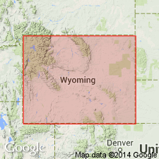
- Powder River basin
Summary:
Named for extensive exposures in walls of lower canyon of Tensleep Creek in Bighorn and Powder River basins, Big Horn Co, WY. Extends along flanks of Bighorn Range. Is a white ledge-forming sandstone whose average thickness is 200 ft. Thins to 50 ft near the MT State line. Is unfossiliferous, but is thought to be Upper Carboniferous and probably equivalent to the upper part of Minnelusa formation of the Black Hills. No fossils found. Overlies Amsden formation (new) and underlies Chugwater formation (new) [the nature of the contacts not described]. Also recognized in Casper Range as a massive, coarse-grained, porous, gray and brown sandstone [Casper sandstone] 50+ ft thick, and in Iron Mountain on Chugwater Creek, Platte Co, WY in the Denver basin as a unit of two brownish-red, soft sandstones separated by two thin beds of limestone. Correlation diagram.
Source: GNU records (USGS DDS-6; Denver GNULEX).
- Usage in publication:
-
- Tensleep sandstone
- Modifications:
-
- Revised
- AAPG geologic province:
-
- Wind River basin
Summary:
Pg. 1199-1226. Tensleep sandstone of Darton is only locally recognizable as lithologic unit in central Wyoming and is not true stratigraphic unit. No boundary can be drawn to separate it from Amsden formation, and fauna of upper part of Amsden is indistinguishable from that of Tensleep sandstone. Name Tensleep is here retained as name of formation which includes entire Pennsylvanian sequence in central Wyoming; that is, Tensleep beds above Tensleep sandstone. Marine fossils indicate Des Moines age for entire formation. Measured sections show thickness varies from 180 to 535 feet. Underlies Phosphoria or Chugwater formation; overlies Sacajawea formation; in some areas, separated from the Sacajawea by unnamed limestone interval referred to as beds of Chester(?) age.
Source: US geologic names lexicon (USGS Bull. 1200, p. 3854-3856).
- Usage in publication:
-
- Tensleep formation
- Modifications:
-
- Revised
- AAPG geologic province:
-
- Wind River basin
Summary:
Pg. 126 (fig. 2), 131-132. Discussion of Wind River Mountain area. Tensleep formation, 398 to 535 feet thick, overlies Sacajawea formation and disconformably underlies the Phosphoria. Tensleep, as herein defined, includes upper part of Amsden formation of Darton and that name is dropped. On Bull Lake Creek, 60 feet of laminated limestone without fossils lies with irregular contact on the Sacajawea and is overlain disconformably by Tensleep formation. This sequence of laminated limestones may constitute another formation, possibly of Chester age.
Source: US geologic names lexicon (USGS Bull. 1200, p. 3854-3856).
- Usage in publication:
-
- Tensleep sandstone
- Modifications:
-
- Biostratigraphic dating
- Age modified
- AAPG geologic province:
-
- Powder River basin
Summary:
Lower Wolfcampian (Lower Permian) fusulinids SCHWAGERINA and TRITICITES found in uppermost Tensleep along eastern flank of southern Big Horn Mountains in sec. 8, T44N, R83W, Johnson Co, WY, about four miles southwest of Mayoworth, Powder River basin. Desmoinesian fusulinids WEDEKINDELLINA and FUSULINA are also present occurring from 300-400 ft below top of Tensleep. Tensleep in southern Big Horn Mountains ranges from Desmoinesian (Cherokee) to lower Wolfcampian and is correlative with almost all of the Casper formation exposed in Laramie Range (unfossiliferous part of uppermost part of Casper may be slightly younger than Tensleep). Tensleep is also correlative with Divisions I, II, III, and upper part of combined Divisions IV and V, of Hartville formation of southeast WY. Descriptions of fusulinids.
Source: GNU records (USGS DDS-6; Denver GNULEX).
- Usage in publication:
-
- Tensleep Sandstone*
- Modifications:
-
- Revised
- AAPG geologic province:
-
- Powder River basin
Summary:
Overlies Ranchester Limestone Member (new) of Amsden Formation at the type section of the Amsden on Amsden Creek, Sheridan Co, WY, Powder River basin and at the reference section of the Amsden, Washakie Co, WY in Bighorn basin. Is of Des Moines and locally of very latest Atoka age, Middle Pennsylvanian.
Source: GNU records (USGS DDS-6; Denver GNULEX).
- Usage in publication:
-
- Tensleep Sandstone*
- Modifications:
-
- Overview
- AAPG geologic province:
-
- Wind River basin
- Green River basin
Summary:
One of several units in study area long regarded as being entirely Pennsylvanian age but is now known to be partly Early Permian age. [Author discusses Permian part; Pennsylvanian part discussed in Mallory (1975, USGS P.P. 853-N)]. Other units of Pennsylvanian and Permian age are Minnelusa, Hartville, and Casper Formations. Permian-Pennsylvanian parts of these units separated by a red-marker unit or its equivalent. Permian part of Tensleep occurs in central and south-central WY, Wind River and Greater Green River basins. Correlates with Casper Formation in Laramie Range (fig. 48). In south-central WY, sandstone of Permian part of Tensleep and Casper is difficult to separate from sandstone of underlying Pennsylvanian part of units. At its type section [not actually designated] in north-central WY, Tensleep is entirely Pennsylvanian age. Probably deposited mostly as dunes in south-central WY; wedges out westward where deposition was probably fluvial; eastward, unit intertongues with sandstones deposited in beach environment. Stratigraphic columns (table 1); distribution of Pennsylvanian part of unit shown in fig. 45. Overlies Amsden Formation; conformably underlies Satanka Shale or Owl Canyon Formation (southeastern and south-central WY) or unconformably underlies Goose Egg Formation (central WY) or Park City Formation at type area. Assigned Pennsylvanian and Early Permian (Wolfcamp) age.
Source: GNU records (USGS DDS-6; Denver GNULEX).
- Usage in publication:
-
- Tensleep Sandstone*
- Modifications:
-
- Areal extent
- AAPG geologic province:
-
- Green River basin
- Wind River basin
- Yellowstone province
- Bighorn basin
Summary:
Tensleep Sandstone is the name applied to rocks above Amsden Formation throughout area of report--from Bighorn Mountains on northeast to Rawlins area on southeast, west to WY-ID state line and within the Bighorn, Wind River, and Greater Green River basins, and the Yellowstone province. Amsden-Tensleep boundary discussed as difficult to place at many localities. Authors follow Wilson (1962) and Todd (1964) in placing boundary at point where dominant Tensleep aspect gives way to dominant Amsden aspect, usually a sandstone (Tensleep) above carbonate and shale (Amsden). Shown as Atokan age at base [upper age not stated]. Section B-B', Plate 11 shows Tensleep as far west as sta 20 in Teton Co and Wells Formation in ID (sta 17, Bannock Co) [but two intervening stas (18 and 19) in Lincoln and Teton Cos, WY not clearly shown as Wells or Amsden]. Tensleep is clearly shown in Lincoln and Teton Cos as unit overlying Amsden on Plate 9.
Source: GNU records (USGS DDS-6; Denver GNULEX).
- Usage in publication:
-
- Tensleep Sandstone*
- Modifications:
-
- Areal extent
- AAPG geologic province:
-
- Green River basin
- Bighorn basin
- Yellowstone province
- Wind River basin
Summary:
Names applied to Pennsylvanian sequence in thrust belt of southwest WY, Greater Green River basin shown differently on two correlation charts in this chapter. Figure 3 (ascending): upper part of Ranchester Limestone Member (Morrowan) of Amsden Formation and Tensleep Sandstone (Atokan and younger Pennsylvanian). In contrast, figure 10 shows (ascending): Round Valley Limestone (Morrowan and Atokan) [a name not previously used in thrust belt; name Amsden used by most geologists for these rocks] and lower member of Wells Formation (Atokan to Virgilian). Pennsylvanian sequence Chesterfield Range, ID Snake River basin represented only by post-Atokan Pennsylvanian Wells Formation. Tensleep described as including a dolomitic member at base in central and northwest WY that some have assigned to Amsden. Upper part is mostly fine- and medium-grained, well-sorted quartz sandstone. [Reason for presentation of two different sequences in same area not stated].
Source: GNU records (USGS DDS-6; Denver GNULEX).
- Usage in publication:
-
- Tensleep Formation
- Modifications:
-
- Revised
- AAPG geologic province:
-
- Bighorn basin
Summary:
Two mappable units in the Tensleep Formation named. The lower unit is the Medicine Lodge Creek member; the upper unit is the Hyatt Ranch member; [the initial letter of word member not capitalized]. Tensleep overlies the Amsden Formation. The two members are separated by an unconformity. Phosphoria overlies Tensleep. Cross sections. Correlation chart. Medicine Lodge Creek is Des Moines age. Hyatt Ranch is assigned to the Missouri and Virgil. Relief on upper surface of Tensleep may be as much as 250 ft. [Areal limits where Tensleep can be divided into members not stated.]
Source: GNU records (USGS DDS-6; Denver GNULEX).
For more information, please contact Nancy Stamm, Geologic Names Committee Secretary.
Asterisk (*) indicates published by U.S. Geological Survey authors.
"No current usage" (†) implies that a name has been abandoned or has fallen into disuse. Former usage and, if known, replacement name given in parentheses ( ).
Slash (/) indicates name conflicts with nomenclatural guidelines (CSN, 1933; ACSN, 1961, 1970; NACSN, 1983, 2005, 2021). May be explained within brackets ([ ]).