

- Usage in publication:
-
- Temple Butte Limestone*
- Modifications:
-
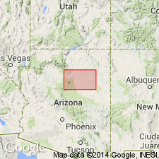
- Areal extent
- AAPG geologic province:
-
- Black Mesa basin
Summary:
Temple Butte Limestone of Middle? and Late Devonian age mapped along Little Colorado River in Black Mesa basin in northwest part of map (term Martin Formation should be used for nearly equivalent rocks to south and southwest of quad).
Source: GNU records (USGS DDS-6; Denver GNULEX).
For more information, please contact Nancy Stamm, Geologic Names Committee Secretary.
Asterisk (*) indicates published by U.S. Geological Survey authors.
"No current usage" (†) implies that a name has been abandoned or has fallen into disuse. Former usage and, if known, replacement name given in parentheses ( ).
Slash (/) indicates name conflicts with nomenclatural guidelines (CSN, 1933; ACSN, 1961, 1970; NACSN, 1983, 2005, 2021). May be explained within brackets ([ ]).