The National Geologic Map Database is migrating to a new infrastructure. We apologize for any service disruptions during this process.
|
|---|


- Usage in publication:
-
- Telegraph Pass Granite
- Modifications:
-
- Named
- Reference
- Dominant lithology:
-
- Granite
- AAPG geologic province:
-
- Basin-and-Range province
Summary:
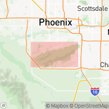
Named for Telegraph Pass, main ridge, South Mountains, Maricopa Co, AZ, Basin-and-Range province. Type locality is along Summit road, 300 m north-northwest of Telegraph Pass. Two reference localities designated: 1) cuts along Summit road, NW1/4 sec 20, T1S, R3E; 2) outcrops in center sec 17, T1S, R3E. Occurs as a south-dipping tabular body. Forms bold spheroidal outcrops where undeformed. Easily eroded forming a light-colored grus where hydrothermally altered. Is medium grained, composed of crystals 0.5 and 4 mm in diameter. Contains 30 to 40 percent quartz, 30 to 40 percent plagioclase, 20 to 30 percent potassium feldspar, and 2 to 3 percent biotite, or near the boundary with granodiorite. Also contains small amounts of sericite, fine-grained muscovite magnetite, apatite, and zircon. Grades into and has been intruded over South Mountains Granodiorite (new); intrudes Estrella Gneiss (new). Of middle Tertiary (25 m.y.) age. Geologic map. Is part of (along with Dobbins Alaskite (new) and South Mountains Granodiorite) a composite pluton.
Source: GNU records (USGS DDS-6; Denver GNULEX).
- Usage in publication:
-
- Telegraph Pass Granite*
- AAPG geologic province:
-
- Basin-and-Range province
Summary:
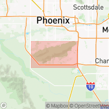
Is a middle Tertiary unit in the South Mountains of Maricopa Co, AZ in the Basin-and-Range province. Is the second phase (of three) in order of intrusion of a composite pluton. Has a maximum age of 27.6 +/-11.9 Ma, or Oligocene. Age of emplacement of pluton thought to be 22.0 +/-4.1 or during Miocene time.
Source: GNU records (USGS DDS-6; Denver GNULEX).
For more information, please contact Nancy Stamm, Geologic Names Committee Secretary.
Asterisk (*) indicates published by U.S. Geological Survey authors.
"No current usage" (†) implies that a name has been abandoned or has fallen into disuse. Former usage and, if known, replacement name given in parentheses ( ).
Slash (/) indicates name conflicts with nomenclatural guidelines (CSN, 1933; ACSN, 1961, 1970; NACSN, 1983, 2005, 2021). May be explained within brackets ([ ]).