The National Geologic Map Database is migrating to a new infrastructure. We apologize for any service disruptions during this process.
|
|---|


- Usage in publication:
-
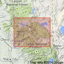
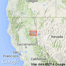
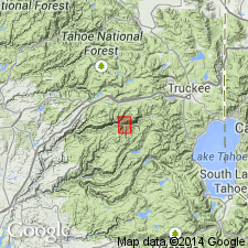
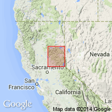
- Taylorville slates
- Modifications:
-
- First used
- Dominant lithology:
-
- Slate
- AAPG geologic province:
-
- Sierra Nevada province
Summary:
Geologic column of Taylorville [Taylorsville] region shows Taylorville slates as 1800 ft thick and of Silurian(?) age. Underlies Arlington beds and overlies Montgomery limestone or Grizzly quartzite.
Source: GNU records (USGS DDS-6; Menlo GNULEX).
- Usage in publication:
-
- Taylorsville formation*
- Modifications:
-
- Named
- Dominant lithology:
-
- Slate
- Sandstone
- Chert
- Conglomerate
- Quartzite
- AAPG geologic province:
-
- Sierra Nevada province
Summary:
Taylorville slates (Diller, 1892) is named Taylorsville formation [for exposures on east face of spur above limestone about 1 mi south of Taylorsville, Plumas Co, CA]. Consists chiefly of slates and thin-bedded sandstones, among which there are numerous small layers of fine black chert or occasional less regular masses of red chert, but at base there is locally fine greenish-gray conglomerate with indistinct pebbles and near middle well-defined bed of light-colored quartzite. Thickness is 1800 ft. Rests with probable unconformity on Montgomery limestone and in places Grizzly formation. Is older than Arlington formation, from which it is separated by granites. Fossils are not distinctive but formation is believed to be Devonian(?).
Source: GNU records (USGS DDS-6; Menlo GNULEX).
- Usage in publication:
-
- Taylorsville Formation*
- Modifications:
-
- Age modified
- AAPG geologic province:
-
- Sierra Nevada province
Summary:
Age of fossiliferous Taylorsville Formation is Silurian [no basis given].
Source: GNU records (USGS DDS-6; Menlo GNULEX).
- Usage in publication:
-
- Taylorsville Formation†
- Modifications:
-
- Abandoned
- AAPG geologic province:
-
- Sierra Nevada province
Summary:
Unit abandoned as its rocks are considered equivalent to the more recently designated Sierra City melange (of Shoo Fly Complex). [Shoo Fly Complex is a more recent interpretation of these rocks' tectonic history.]
Source: GNU records (USGS DDS-6; Menlo GNULEX).
For more information, please contact Nancy Stamm, Geologic Names Committee Secretary.
Asterisk (*) indicates published by U.S. Geological Survey authors.
"No current usage" (†) implies that a name has been abandoned or has fallen into disuse. Former usage and, if known, replacement name given in parentheses ( ).
Slash (/) indicates name conflicts with nomenclatural guidelines (CSN, 1933; ACSN, 1961, 1970; NACSN, 1983, 2005, 2021). May be explained within brackets ([ ]).