- Usage in publication:
-
- Tatow limestone
- Modifications:
-
- Named
- Dominant lithology:
-
- Limestone
- Sandstone
- AAPG geologic province:
-
- Great Basin province
Summary:
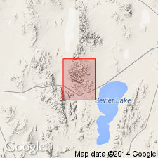
Named for exposures measured 1 1/2 mi north of Marjum Canyon in the House Range, Millard Co, UT in the Great Basin province. These exposures are designated the type locality. Named for Tatow Knob. Same rocks assigned to Langston? limestone by Walcott. Is 165 ft thick in Marjum Canyon where it forms red-brown cliffs and steep slopes above the Pioche shale and below the Howell limestone. Lower 40 ft is gray, fine-grained limestone with tan clay flakes and nodules, calcareous platy sandstone, and micaceous shale partings. Upper 125 ft is steel-, tan-, and blue-gray, oolitic and arenaceous limestone; gray, argillaceous, calcareous, thin-bedded sandstone; partings of fissile to chunky arenaceous and micaceous shale. Fossils--brachiopods, trilobites. Early Cambrian age. May be equivalent to the restricted Pioche shale of the Highland Range, NV. Diagram shows comparison of nomenclature used in this report with that used by Walcott.
Source: GNU records (USGS DDS-6; Denver GNULEX).

- Usage in publication:
-
- Tatow Formation*
- Modifications:
-
- Adopted
- AAPG geologic province:
-
- Great Basin province
Summary:
Tatow limestone of Deiss (1938) is adopted as the Tatow Formation. Age is Cambrian.
Source: GNU records (USGS DDS-6; Menlo GNULEX).

- Usage in publication:
-
- Tatow Member
- Modifications:
-
- Revised
- AAPG geologic province:
-
- Great Basin province
Summary:
Reduced in stratigraphic rank from Tatow Limestone to Tatow Member, upper member of Pioche Formation. Present authors state that only 6 m of its 55 m thick section is limestone. The rest is mostly quartzite with interbeds of phyllitic shale. However Tatow has the lowest appearance of carbonate rock in the House Range. Lower boundary placed at base of lowest limestone; overlies lower member of Pioche. Upper boundary placed at base of massive cliff-forming limestone of Millard Member of Howell Limestone. Correlation chart. Has the ALBERTELLA Zone fauna in upper 10 m of member. Recognized in the Fish Springs, House, Wah Wah, and Cricket Ranges of western UT, Great Basin province. Of early Middle Cambrian age.
Source: GNU records (USGS DDS-6; Denver GNULEX).

- Usage in publication:
-
- Tatow Member*
- Modifications:
-
- Age modified
- Revised
- AAPG geologic province:
-
- Great Basin province
Summary:
Tatow Formation (Hintze, 1974) is revised to the Tatow Member of the Pioche Formation. Age is Middle Cambrian.
Source: GNU records (USGS DDS-6; Menlo GNULEX).
For more information, please contact Nancy Stamm, Geologic Names Committee Secretary.
Asterisk (*) indicates published by U.S. Geological Survey authors.
"No current usage" (†) implies that a name has been abandoned or has fallen into disuse. Former usage and, if known, replacement name given in parentheses ( ).
Slash (/) indicates name conflicts with nomenclatural guidelines (CSN, 1933; ACSN, 1961, 1970; NACSN, 1983, 2005, 2021). May be explained within brackets ([ ]).

