- Usage in publication:
-
- Tanyard formation*
- Modifications:
-
- Named
- Dominant lithology:
-
- Dolomite
- Limestone
- AAPG geologic province:
-
- Llano uplift
Summary:
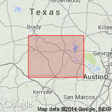
Name given to rocks at base of Ellenburger group (rank raised) exposed at the Tanyard, the type section, on east bank of Buchanan Lake opposite mouth of Jim John Creek and Cedar Hollow, and 2-3 mi north of mouth of Fall Creek, northwest Burnet Co., TX on the Llano uplift. Consists of 518 to 658 ft of dolomite and limestone. Is thickest at the western side of uplift and thinnest on the eastern side of the uplift. The dolomite is gray, irregularly bedded, fine- to coarse-grained, vuggy to porous. The limestone is gray, sublithographic, thick-to thin-bedded. Weathers rough or smoothly irregular to pitted, craggy. Limestone occurs mostly in upper and lower parts, whereas dolomite occurs mostly in middle. Divisible into Threadgill member (first published description), and Staendebach member (new). Overlies Pedernales or San Saba Members (depending on locality) of Wilberns Formation. Underlies Gorman Formation, middle formation of Ellenburger group. Cross section. Geologic maps of areas in Gillespie, Blanco, and San Saba Cos., on the Llano uplift. Of Early Ordovician age. Fossils locally abundant. May be equivalent to Gasconade dolomite of MO and Chepultepec dolomite of Appalachians.
Source: GNU records (USGS DDS-6; Denver GNULEX).
For more information, please contact Nancy Stamm, Geologic Names Committee Secretary.
Asterisk (*) indicates published by U.S. Geological Survey authors.
"No current usage" (†) implies that a name has been abandoned or has fallen into disuse. Former usage and, if known, replacement name given in parentheses ( ).
Slash (/) indicates name conflicts with nomenclatural guidelines (CSN, 1933; ACSN, 1961, 1970; NACSN, 1983, 2005, 2021). May be explained within brackets ([ ]).

