

- Usage in publication:
-
- Tanyard Branch member*
- Modifications:
-
- Named
- Dominant lithology:
-
- Sandstone
- Shale
- AAPG geologic province:
-
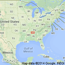
- Black Warrior basin
Summary:
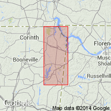
Pride Mountain formation named and subdivided into seven members (ascending): Alsobrook, Tanyard Branch (new), Wagnon (new), Southward Spring sandstone, Sandfall (new), Mynot sandstone (new), and Green Hill (new). Tanyard Branch consists of 15 ft of light-olive-gray to buff very fine to fine-grained thin to medium uneven bedded sandstone at its base. Sandstone is overlain by 5 ft of olive-gray shale and 10 ft of light-olive-gray to buff, very fine to fine-grained sandstone rubble. Maximum thickness about 35 ft near AL-MS State line. Thins eastward to an average of about 20 ft through most of Colbert Co, AL.
Source: GNU records (USGS DDS-6; Reston GNULEX).
- Usage in publication:
-
- Tanyard Branch Member
- Modifications:
-
- Overview
- AAPG geologic province:
-
- Black Warrior basin
Summary:
Tanyard Branch Member consists of a sequence of sandstones, interbedded with thin shale units. Lower portions of the sandstone sequence consist of a thinly bedded, sparingly petroliferous sandstone of variable thicknesses (averaging about 40 ft). This interval previously called Cripple Deer sandstone member of Alsobrook formation by Morse (1928). This sandstone interval is separated from an overlying sandstone interval by a very thin interval of shale. The overlying sandstone was previously referred to as the Allsboro sandstone by Morse (1928). The Tanyard Branch is equivalent to the Bethel Sandstone as described in northern AL by Butts (1926) and the Lewis sand of the petroleum industry. The Member has a maximum thickness of about 35 ft in western Colbert Co., AL, and eastern Tishomingo Co., MS. Grades eastward across northern AL into a sequence of shale and limestone. Overlies the shales and limestones of the Alsobrook Member and underlies the limestones and shales of the Wagnon Member. Age is Late Mississippian (Chesterian).
Source: GNU records (USGS DDS-6; Reston GNULEX).
For more information, please contact Nancy Stamm, Geologic Names Committee Secretary.
Asterisk (*) indicates published by U.S. Geological Survey authors.
"No current usage" (†) implies that a name has been abandoned or has fallen into disuse. Former usage and, if known, replacement name given in parentheses ( ).
Slash (/) indicates name conflicts with nomenclatural guidelines (CSN, 1933; ACSN, 1961, 1970; NACSN, 1983, 2005, 2021). May be explained within brackets ([ ]).