The National Geologic Map Database is migrating to a new infrastructure. We apologize for any service disruptions during this process.
|
|---|


- Usage in publication:
-
- Tanana Formation*
- Modifications:
-
- Named
- Dominant lithology:
-
- Clay
- Silt
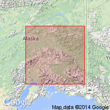
- AAPG geologic province:
-
- Alaska East-Central region
Summary:
Named for a widespread inactive solifluction layer in Yukon-Tanana Upland of central AK. Type locality designated as exposures in borrow pit on south valley wall of Pedro Creek at its junction with Twin Creek in SE/4 sec.11 T2N R1E, Livengood D-3 quad, AK. Composed of poorly stratified, unsorted and angular fractured, weathered bedrock fragments in a silty sandy matrix. Composition of fragments varies depending on local bedrock and may range from grus to greasy clay to the most common type, platy rock fragments in silty matrix. Minor amounts of gold are locally present. Thickness ranges 1 to 25 m. Overlies bedrock or Cripple Gravel (new). Underlies Chena Alluvium, Goldstream Formation, Gold Hill Loess (all new), or Fairbanks Loess. In valley bottom grades laterally into Fox Gravel (new). Age is early or middle Pleistocene.
Source: GNU records (USGS DDS-6; Menlo GNULEX).
For more information, please contact Nancy Stamm, Geologic Names Committee Secretary.
Asterisk (*) indicates published by U.S. Geological Survey authors.
"No current usage" (†) implies that a name has been abandoned or has fallen into disuse. Former usage and, if known, replacement name given in parentheses ( ).
Slash (/) indicates name conflicts with nomenclatural guidelines (CSN, 1933; ACSN, 1961, 1970; NACSN, 1983, 2005, 2021). May be explained within brackets ([ ]).