- Usage in publication:
-
- Tamiami limestone
- Modifications:
-
- Named
- Dominant lithology:
-
- Limestone
- AAPG geologic province:
-
- Florida platform
Summary:
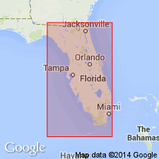
Name Tamiami proposed for a limestone penetrated in digging shallow ditches to form roadbed of Tamiami Trail over a distance of about 34 mi in Collier and Monroe Cos. Consists mainly of dirty-white to gray rather hard porous nonoolitic limestone with inclusions of clear quartz grains. Underlies Buckingham limestone (named). Tentatively placed at base of Pliocene below Caloosahatchee.
Source: GNU records (USGS DDS-6; Reston GNULEX).
- Usage in publication:
-
- Tamiami formation*
- Modifications:
-
- Revised
- AAPG geologic province:
-
- Florida platform
Summary:
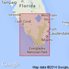
Tamiami formation was first noted by Sanford (1909) who named it Lostmans River limestone. Cooke and Mossom (1929, Florida Geol. Survey 20th Ann. Rept) rejected Lostmans River limestone as valid formation and divided its rocks between Miami oolite on the south and Caloosahatchee marl on the north. Mansfield's (1939) Tamiami limestone is same limestone that Cook and Mossom correlated with Caloosahatchee marl. Place name Tamiami is preferred to Lostmans River because exposures on Tamiami Trail are more accessible than those of Lostmans River area. Term limestone is not appropriate because formation generally contains too much sand. Formation is, in general, a wedge-shaped deposit that thickens toward southeast and east. Thickness about 15 ft on Tamiami Trail 40 mi west of Miami; about 100 ft near shore of Biscayne Bay at Silver Bluff.
Source: GNU records (USGS DDS-6; Reston GNULEX).
- Usage in publication:
-
- Tamiami formation*
- Modifications:
-
- Age modified
- Revised
- AAPG geologic province:
-
- Florida platform
Summary:
Tamiami formation is of upper Miocene age and, as here indicated, includes all deposits of that age in FL. As thus defined, includes Tamiami limestone and Buckingham limestone of Mansfield and part of Hawthorn formation of Parker and Cooke (1944).
Source: GNU records (USGS DDS-6; Reston GNULEX).
- Usage in publication:
-
- Tamiami formation
- Modifications:
-
- Revised
- AAPG geologic province:
-
- Florida platform
Summary:
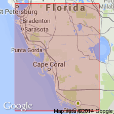
Upper Miocene Tamiami formation is subdivided into several new and revised members. Ascending, these are the Bayshore clay member (new), Murdock Station member (new), Buckingham limestone member (revised), Pinecrest sand member (revised), and Ochopee limestone member (new). [Though units are lower cased, author's intent interpreted as formal naming of members.]
Source: GNU records (USGS DDS-6; Reston GNULEX).
- Usage in publication:
-
- Tamiami Formation
- Modifications:
-
- Revised
- AAPG geologic province:
-
- Florida platform
Summary:
Tamiami stratigraphically restricted. La Belle Clay Member raised in rank to La Belle Formation and replaces lower part of Tamiami Formation.
Source: GNU records (USGS DDS-6; Reston GNULEX).
- Usage in publication:
-
- Tamiami Formation*
- Modifications:
-
- Age modified
- AAPG geologic province:
-
- Florida platform
Summary:
Age changed to early Pliocene on basis of correlation with Yorktown Formation of NC.
Source: GNU records (USGS DDS-6; Reston GNULEX).
- Usage in publication:
-
- Tamiami Formation
- Modifications:
-
- Overview
- AAPG geologic province:
-
- Florida platform
Summary:
"Both the top and the bottom of the Tamiami, as well as the age, have been in dispute for the past 40 years." The top of the unit can be any one of a number of different lithologies, including limestone, sandstone, quartz sand, marl, shell beds, or clay. It may underlie the Caloosahatchee or the Fort Thompson Formation. The definition of the Hawthorn is used to establish the base of the Tamiami. There are at least 9 facies that may be mapped on the basis of dominant lithology in southwest FL: the Pinecrest Sand Member, the unnamed limestone facies, the Golden Gate Reef Member (of Meeder, 1987), the Bonita Springs Marl Member (of Missimer, 1984), the HYOTISSA facies, the Ochopee Limestone Member, the sand facies, the Buckingham Limestone Member, and the tan clay and sand facies. Only 1 to 4 of these occur in a vertical stratigraphic section at any given locality. The Buckingham is the lowermost facies and is probably equivalent in age to the clay and sand facies.
Source: GNU records (USGS DDS-6; Reston GNULEX).
- Usage in publication:
-
- Tamiami Formation*
- Modifications:
-
- Biostratigraphic dating
- AAPG geologic province:
-
- South Florida province
Summary:
Pinecrest Beds of peninsular Florida were assigned a middle to late Pliocene age by DuBar (1974) (who referred to these rocks as the Pinecrest Sand Member of the Tamiami Formation). Hazel (1977 and personal commun., 1990) dated the uppermost beds of the Tamiami and the overlying Pinecrest Beds as early and middle Pliocene based on zone 20 planktonic foraminifers and ORIONINA VAUGHANI and PARACYTHERIDEA MUCRA ostracode assemblage zones. Correlation chart in report shows Tamiami as early Pliocene.
Source: GNU records (USGS DDS-6; Reston GNULEX).
- Usage in publication:
-
- Tamiami Group
- Modifications:
-
- Revised
- AAPG geologic province:
-
- Florida platform
Summary:
Pg. 598, 600. Tamiami Group of DuBar and others, 1989 [unpub. ms.]. Divided into (descending) Sarasota Formation and Murdock Station Formation. Unconformably overlies Miocene [Hawthorn] Group and unconformably underlies Pleistocene Port Charlotte Group. Age is medial or late Pliocene.
[Cited DuBar, J.R., DuBar, S.S., and Blackwelder, B.W., 1989, Revision of stratigraphic nomenclature of some Neogene/Pleistocene marine deposits of Florida: Inst. for Tertiary-Quaternary Stud., Ter-Qua Symp. Ser., v. 2, Nebraska Acad. Sci., in press (ca. 2009, manuscript remains unpublished).]
Source: Publication.
- Usage in publication:
-
- Tamiami Formation
- Modifications:
-
- Age modified
Summary:
Author follows interpretation of Hunter (1968) and DuBar (1974) who considered the Pinecrest beds and Buckingham limestone to be facies of the upper Tamiami. LATIRUS of middle Pliocene age reported from the Tamiami are then from the Pinecrest facies (3.5-3.0 m.y.). Author allows that more work is needed to accurately define the relationships among the Buckingham, Tamiami, and Pinecrest units.
Source: GNU records (USGS DDS-6; Reston GNULEX).
- Usage in publication:
-
- Tamiami Formation
- Modifications:
-
- Overview
- AAPG geologic province:
-
- Florida platform
Summary:
In this report there are four named formations included within Pliocene time in southern FL, including the lower parts of the Caloosahatchee and Anastasia Formations, the Tamiami Formation, and the Peace River Formation of the Hawthorn Group. All are separated from each other and from younger and older units by regional unconformities. Age of the Tamiami extends from 4.7 Ma to 2.8 Ma based on global sea level curve of Vail and others (1977), age dates of Jones and others (1991), and stratigraphic relationships. It is the primary Pliocene formation in southern FL. Correlation of the nine or more defined members of the Tamiami is a problem. There are some distinct disconformities observed between some of the members or facies. At several locations, the Buckingham Limestone Member is separated from overlying units by a disconformity. In southern Lee Co. and northern Collier Co., the Bonita Springs Marl Member (Missimer, in press(?)) separates the Pinecrest from the Ochopee. Fig. 3 illustrates the Bonita Springs below the Golden Gate Member(?) (Missimer, in press(?)).
Source: GNU records (USGS DDS-6; Reston GNULEX).
- Usage in publication:
-
- Tamiami Formation*
- Modifications:
-
- Biostratigraphic dating
- AAPG geologic province:
-
- Florida platform
Summary:
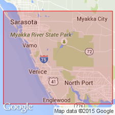
In the APAC Shell Pit (APAC) on the central-western coast of FL, Petuch (1982) delineated 12 informal units based on molluscan biofacies that are traceable throughout the area. Strata in this study are from Quality Aggregate Phase 6 Pit (QA6), APAC, and DeSoto No. 5 Pit, all of central-western coastal FL and range from early Pliocene to early Pleistocene age. Lowermost Pliocene unit, unit 11 of Petuch (1982), was collected at QA6; it is an ECPHORA and BALANUS biofacies and represents lower part of Tamiami Formation. It is equivalent in age to Sunken Meadow Member of Yorktown Formation of NC and VA. Tamiami also includes Pinecrest Beds. Unit 10, the lowest in Pinecrest Beds, is a MERCENARIA biofacies overlain unconformably by unit 8, which is a VERMICULARIA biofacies. Units 6 and 7 contain best-preserved and most diverse assemblages of fossils within Pinecrest Beds. Unit 7 is characterized by a mixed shell assemblage and unit 6 contains a mixture of HYOTISSA and other shells. Unit 3, a mytilid layer, unconformably overlies unit 6. Unit 2 is a HYOTISSA bed. All are part of Pinecrest Beds. Younger samples are tentatively assigned to the Caloosahatchee Formation.
Source: GNU records (USGS DDS-6; Reston GNULEX).
- Usage in publication:
-
- Tamiami Formation
- Modifications:
-
- Overview
- AAPG geologic province:
-
- Florida platform
Summary:
The nomenclature of the Pliocene Tamiami Formation applied in this report evolved from the stratigraphic revisions of Hunter (1968) and those of Petuch (1982). Formation is divided into lower and upper parts. The lower part includes units 11 and 10 of Petuch and is equivalent to the Murdock Station Member of Hunter. The upper Tamiami includes Petuch's units 9 through 2 and is essentially equivalent to Hunter's Pinecrest Member. The upper Tamiami is further subdivided into lower and upper Pinecrest beds at an unconformity that is observed between units 4 and 3 in quarry exposures in Sarasota Co. The lower Tamiami and lower Pinecrest beds of the upper Tamiami of southern FL correlate with the Jackson Bluff Formation of the FL panhandle, and are assigned to the Coastal Onlap Cycle TB3.6 (Zullo and Harris, 1992). This cycle spans the Zanclean-Piacenzian boundary. The upper Pinecrest beds are assigned to the TB3.7 cycle and are Piacenzian in age.
Source: GNU records (USGS DDS-6; Reston GNULEX).
For more information, please contact Nancy Stamm, Geologic Names Committee Secretary.
Asterisk (*) indicates published by U.S. Geological Survey authors.
"No current usage" (†) implies that a name has been abandoned or has fallen into disuse. Former usage and, if known, replacement name given in parentheses ( ).
Slash (/) indicates name conflicts with nomenclatural guidelines (CSN, 1933; ACSN, 1961, 1970; NACSN, 1983, 2005, 2021). May be explained within brackets ([ ]).

