- Usage in publication:
-
- Tallery sandstone [member]
- Modifications:
-
- Named
- Dominant lithology:
-
- Sandstone
- AAPG geologic province:
-
- Appalachian basin
Summary:
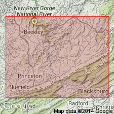
Named the Tallery sandstone member of the Hinton formation in WV and VA for Tallery Mountain, Summers Co., southeastern WV. Consists of green and shaly, but sometimes massive, sandstone. Thickness is 10 to 25 feet. Overlies Tallery limestone [member] and underlies the Lower Fivemile shale, both of the Hinton [formation]. The Tallery is of Mississippian age.
Source: GNU records (USGS DDS-6; Reston GNULEX).

- Usage in publication:
-
- Tallery Sandstone Member*
- Modifications:
-
- Overview
- AAPG geologic province:
-
- Appalachian basin
Summary:
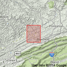
The Tallery Sandstone Member of the Hinton Formation consists of white to light gray, very fine- to medium-grained, thin- to thick-bedded sandstone. In places, it is thick-bedded to massive and quartzose, and splits locally into two or more beds that contain medium gray or greenish gray shale in between. Unit overlies the middle shale member of the Hinton and underlies the Pratter Shale Member of the Hinton. The Tallery is of Late Mississippian age.
Source: GNU records (USGS DDS-6; Reston GNULEX).

- Usage in publication:
-
- Tallery Sandstone Member
- Modifications:
-
- Overview
- AAPG geologic province:
-
- Appalachian basin
Summary:
Hinton Formation is divided into seven distinct lithologic members in the report area: the Stony Gap Sandstone Member at the base, the middle red member, the Little Stone Gap Member, the middle shale member of Englund (1968), the Tallery Sandstone Member, the Pratter Shale Member, and the upper shale member of Englund (1968). The Tallery is a very light gray and light-greenish-gray, fine- to medium-grained, arkosic sandstone. Contains conglomerate with rounded quartz pebbles. The Tallery ranges in thickness from about 30 ft to as much as 160 ft. In southwestern VA, the Tallery was commonly confused with the Princeton Sandstone. The Member occupies the middle part of the "Ravencliff sand" of drillers. Age is Late Mississippian (Chesterian).
Source: GNU records (USGS DDS-6; Reston GNULEX).
For more information, please contact Nancy Stamm, Geologic Names Committee Secretary.
Asterisk (*) indicates published by U.S. Geological Survey authors.
"No current usage" (†) implies that a name has been abandoned or has fallen into disuse. Former usage and, if known, replacement name given in parentheses ( ).
Slash (/) indicates name conflicts with nomenclatural guidelines (CSN, 1933; ACSN, 1961, 1970; NACSN, 1983, 2005, 2021). May be explained within brackets ([ ]).

