


- Usage in publication:
-
- Table Mountain Shoshonite*
- Modifications:
-
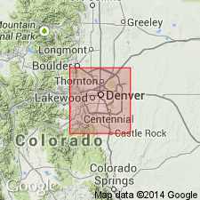
- Mapped 1:24k (Morrison quad, Jefferson Co, CO)
- Redescribed
- Geochronologic dating
- Dominant lithology:
-
- Shoshonite
- AAPG geologic province:
-
- Denver basin
Summary:
Is Paleocene formation mapped in north-central Jefferson Co, CO (Denver basin). On Correlation of Map Units is shown to correlate with middle part of Denver Formation (Paleocene and Upper Cretaceous). Divided into separately mapped upper flow and middle flow units. Exposures occur on South Table Mountain on north-central edge of quad. Two upper basalt flows recognized on Table Mountain by Cross (1896) and a third, lower, less extensive flow (Van Horn, 1972) collectively assigned to Table Mountain Shoshonite. Was designated "Table Mountain basalt" by Cross in 1896. Is a potassium-rich basalt or shoshonite (silica content avg 51.73%, potash content is 3.83-4.8%). Lower flow is 60 ft thick, middle flow is 90 ft thick, and upper flow is 60-90 ft thick. Source thought to be Ralston dike 4 mi to the north which has an age of 63 +/-2.5 m.y. K-Ar method. Middle flow yielded date of 58.7 m.y. from sample 10 ft above base. Total thickness is about 150 ft. Paleocene age on dike thought to be most accurate for the Table Mountain.
Source: GNU records (USGS DDS-6; Denver GNULEX).
- Usage in publication:
-
- Table Mountain Shoshonite*
- Modifications:
-
- Areal extent
- Geochronologic dating
- AAPG geologic province:
-
- Denver basin
Summary:
Mapped as part of a shoshonite unit of early Paleocene age in the Denver basin that includes not only the three dark-gray porphyritic lava flows on North and South Table Mountain, but also similar rocks in a dike near Ralston Reservoir, both in Jefferson Co., and a sill on Flagstaff Mountain near Boulder, Boulder Co. Total thickness of flows about 73 m. The middle flow of the Table Mountain dated as 63-64 m.y. and the Ralston Reservoir dike is 62 m.y.
Source: GNU records (USGS DDS-6; Denver GNULEX).
- Usage in publication:
-
- Table Mountain Shoshonite*
- Modifications:
-
- Areal extent
- AAPG geologic province:
-
- Denver basin
Summary:
Mapped with unit designated mafic latite of Paleocene age which occurs as lava flows in Denver Formation on North and South Table Mountains and on north side of Green Mountain, as well as plugs of similar material near Ralston Reservoir in Jefferson Co., CO in the Denver basin.
Source: GNU records (USGS DDS-6; Denver GNULEX).
For more information, please contact Nancy Stamm, Geologic Names Committee Secretary.
Asterisk (*) indicates published by U.S. Geological Survey authors.
"No current usage" (†) implies that a name has been abandoned or has fallen into disuse. Former usage and, if known, replacement name given in parentheses ( ).
Slash (/) indicates name conflicts with nomenclatural guidelines (CSN, 1933; ACSN, 1961, 1970; NACSN, 1983, 2005, 2021). May be explained within brackets ([ ]).