The National Geologic Map Database is migrating to a new infrastructure. We apologize for any service disruptions during this process.
|
|---|


- Usage in publication:
-
- Symonds formation*
- Modifications:
-
- Named
- Dominant lithology:
-
- Graywacke
- Slate
- Breccia
- Marble
- AAPG geologic province:
-
- Alaska Southeastern region
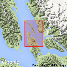
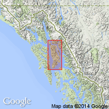
Summary:
Type locality designated as exposures at Symonds Point, Juneau (B-3) quad, southeastern AK. Crops out along eastern shore of Admiralty Island from Symonds Point to southern boundary of quad, on Horse, Colt, and Portland Islands, and on parts of Lincoln, Shelter, Hump, and Douglas Islands. Composed of interlayered gray to dark-gray graywacke, black slate, volcanic flow breccia, brown marble on Hump Island, and includes greenstone sills on Shelter Island. Is largely concealed by water; its thickness is at least 5000 ft and possibly 10,000 ft. Overlies Barlow Cove formation (new). Strata on Shelter Island may grade by facies change into Shelter formation (new); Symonds and Shelter formations may tentatively be classed as of same age. Age of Symonds formation given as Early Cretaceous(?).
Source: GNU records (USGS DDS-6; Menlo GNULEX).
- Usage in publication:
-
- Symonds formation†
- Modifications:
-
- Abandoned
- AAPG geologic province:
-
- Alaska Southeastern region
Summary:
Symonds Formation of Berker (1957) abandoned. Its rocks reassigned to Seymour Canal Formation as current mapping shows Symonds is northward continuation of Seymour Canal Formation.
Source: GNU records (USGS DDS-6; Menlo GNULEX).
For more information, please contact Nancy Stamm, Geologic Names Committee Secretary.
Asterisk (*) indicates published by U.S. Geological Survey authors.
"No current usage" (†) implies that a name has been abandoned or has fallen into disuse. Former usage and, if known, replacement name given in parentheses ( ).
Slash (/) indicates name conflicts with nomenclatural guidelines (CSN, 1933; ACSN, 1961, 1970; NACSN, 1983, 2005, 2021). May be explained within brackets ([ ]).