

- Usage in publication:
-
- Sycamore sands
- Modifications:
-
- Original reference
- Dominant lithology:
-
- Sand
- AAPG geologic province:
-
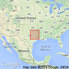
- Llano uplift
Summary:
Pg. 141, 142. Sycamore sands. At base conglomerate of well-rounded pebbles of Paleozoic limestone, quartz, chert, granite, and schist, embedded in ferruginous yellow and red gritty sand; passes upward into angular cross-bedded sand, which becomes finer toward top until it reaches condition known as "pack sand." Thickness 50 feet. Basal member of Travis Peak formation in Burnet County. Underlies Cow Creek beds and overlies Carboniferous. Age is Early Cretaceous (Comanche).
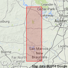
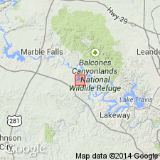
Named from exposures on Sycamore Creek, Burnet Co., central TX.
Source: US geologic names lexicon (USGS Bull. 896, p. 2102).
- Usage in publication:
-
- Sycamore member
- Modifications:
-
- Areal extent
- AAPG geologic province:
-
- Llano uplift
Summary:
Pg. 631-632. Sycamore member of Travis Peak formation. Member consists primarily of sands and conglomerates. Thickness 30 to 90 feet. Underlies Cow Creek member. Hill's Sycamore has priority over Taff's Sycamore limestone in Mississippian of Oklahoma. Age is Early Cretaceous (Comanche).
Source: US geologic names lexicon (USGS Bull. 1200, p. 3796-3797).
- Usage in publication:
-
- Sycamore sand member
- Modifications:
-
- Areal extent
- AAPG geologic province:
-
- Llano uplift
Summary:
Pg. 5, 6-7 (fig. 1), 8. Sycamore sand member of Travis Peak formation. Marble Falls limestone and Smithwick shale are truncated, and deposited across them is massive conglomerate of Cretaceous age belonging to Sycamore sand member of Travis Peak formation. Age is Early Cretaceous (Comanche).
Source: US geologic names lexicon (USGS Bull. 1200, p. 3796-3797).
- Usage in publication:
-
- Sycamore sand
- Modifications:
-
- Revised
- AAPG geologic province:
-
- Llano uplift
Summary:
Pg. 69, figs. Referred to as Sycamore sand. Cartographic rock unit ordinarily mapped with the Sycamore but originally included in Hill's definition of Cow Creek beds is distinct unit between Sycamore sands below and Cow Creek limestone above. It is here named Hammet shale. Age of Sycamore is Early Cretaceous (Comanche).
Source: US geologic names lexicon (USGS Bull. 1200, p. 3796-3797).
For more information, please contact Nancy Stamm, Geologic Names Committee Secretary.
Asterisk (*) indicates published by U.S. Geological Survey authors.
"No current usage" (†) implies that a name has been abandoned or has fallen into disuse. Former usage and, if known, replacement name given in parentheses ( ).
Slash (/) indicates name conflicts with nomenclatural guidelines (CSN, 1933; ACSN, 1961, 1970; NACSN, 1983, 2005, 2021). May be explained within brackets ([ ]).